River
River Dee
154 km from source to mouth · United Kingdom.
 United KingdomFlows into North Sea
In numbers
Length
154km
Average flow
44m³/s
Basin
2,100km²
Drop
373m
from 377 m to 4 m
Country
1
The journey
From source to mouth
154 km of river and 59 stops on the way: 8 towns and cities on its banks, dams, bridges and the tributaries that feed it.
- 0 kmSourceat 377 m
- 0 kmChest of Dee
- 3 kmMar, townships, enclosures, stills, kilns, Dubrach to E of Dalvorar
- 7 kmLinn of Dee Bridge
- 7 kmLinn of Dee
- 12 kmVictoria Bridge, Mar Lodge Estate
- 14 kmLinn of Quoich
- 25 kmInvercauld Bridge
- 27 kmFalls of Garbh Allt
- 27 kmGarbh Allt Suspension Bridge
- 36 kmdesigned landscape at Balmoral Castle
- 37 kmBalmoral Castle
- 39 kmCrathie Girder Bridge
- 40 kmCrathie Suspension Bridge
- 43 kmSuspension Bridge, Abergeldie Castle
- 52 kmSuspension Bridge, Polhollick
- 53 kmGirnock Burntributary
- 57 kmRoyal Bridge
- 57 kmBallater1,550 people
- 60 kmRiver Muicktributary
- 61 kmPananich Lodge
- 62 kmMonaltrie Monument
- 65 kmCambus O'May Hotel Including Terraced Garden Walls And Gatepiers
- 66 kmSuspension Bridge, Cambus O' May
- 66 kmCambus Cottage including Platform, Cambus O'May
- 71 kmLoch Kinord0.6 km²
- 71 kmDinnet House
- 73 kmDinnet Bridge
- 76 kmGlen Tanar Church
- 80 kmBalnacoil House Hotel, Rhu-Na-Haven Road, Aboyne
- 82 kmAboyne Bridge
- 83 kmAboyne2,650 people
- 83 kmWater of Tanartributary
- 98 kmBridge of Potarch
- 102 kmWoodend House
- 112 kmBridge of Dee
- 113 kmBanchory7,440 people
- 115 kmWater of Feughtributary
- 124 kmPark House
- 127 kmPark Bridge
- 127 kmKeith's Tower
- 135 kmMaryculter House
- 135 kmOld Parish Church, Maryculter
- 136 kmPeterculter4,560 people
- 137 kmMaryculter Bridge
- 137 kmRiver Dee Bridge
- 138 kmMilltimber2,660 people
- 144 kmShakkin' Briggie
- 144 kmCults3,500 people
- 145 kmPitfoddels Castle
- 145 kmbridge at Moat Hill
- 149 kmKing George VI Bridge
- 150 kmNigg16,400 people
- 150 kmDuthie Park
- 150 kmFerryhill Railway Viaduct
- 151 kmWellington Suspension Bridge
- 151 kmbridge at Ruthrieston, Aberdeen
- 151 kmQueen Elizabeth Bridge
- 152 kmQueen Victoria Bridge
- 152 kmAberdeen200,680 people
- 154 kmNorth Seaat 4 m
Water level along the river (RiverATLAS; the height is exaggerated). Towns: GeoNames and Wikidata; bridges, dams and tributaries: Wikidata.
River in Aberdeenshire, Scotland, UK, flows into the North Sea at Aberdeen
At the mouth it carries 44 m³/s on average: an Olympic pool every 57 seconds. It drops from 377 m to 4 m, 2.4 m per kilometre on average. Its basin covers 2,100 km², about the size of MU. 164,000 people live in it. Highest water: from November to January. No large dam holds it back: it is one of the world's free-flowing rivers.
Where to start
- AberdeenLargest city on its banks · 200,680 people
- Aberdeen International Airport (ABZ)Nearest airport with scheduled flights, 8 km from the cityCar hire at ABZ airport (Aberdeen)Discover Cars · Affiliate link↗
- On the water4 ferry piers, marinas, boat rentals and boat ramps along the river (OpenStreetMap)
- From June to AugustThe best months to visit
River Dee, month by month
Highest water: from November to January
Best months to visit: from June to August.
From about 21 m³/s in the lowest month to 63 m³/s in the highest. An estimate: the monthly flow is modelled from the lowest and highest months of WaterGAP (RiverATLAS, 1971–2000) and the rain and snow along the river (WorldClim). Dams change the real rhythm. The chip is the average air temperature; below it, the month's rain.
Plan the trip
Plan the trip: boat trips, a bed by the river, a car
Some links above are affiliate links: if you book through them we may earn a commission, at no extra cost to you. It never changes what the data on this page says.
The basin
River Dee: the basin in numbers
2,130 km² of land send their water to this river. This is what lives on it.
- 164,000people live in the basin
- 78/km²people per km²
- 405maverage altitude of the basin
- 949mmof rain a year (basin average)
- 6.1°Caverage air temperature
- 56%protected areas
- 0.2%covered by lakes
What covers the basin
- 10% Forest
- 6% Cropland
- 27% Pasture
- 3% Towns and cities
RiverATLAS (HydroATLAS v1.0, CC BY 4.0): land cover, people, protected areas, glaciers and dams over the whole basin upstream of the mouth.
Along the river
River Dee: what you find on the way
- 1Weirs
- 20WaterfallsChest of Dee, Linn of Dee, Falls of Allt Connie and 17 more
- 4Ferry piersAberdeen Ferry Terminal, Eurolink Berth, Aberdeen and 1 more
- 3River beachesAberdeen Beach, Aberdeen, Beach Ballroom Bathing Area
From OpenStreetMap, within 1.4 km of the river. Not mapped is not the same as not there.
Cross-checked with our atlases
River Dee in our other atlases
What our sister atlases know about the waterfalls on this river, the lakes it flows through, the beaches at its mouth, the mountains where it rises and the islands off its mouth.
 4waterfalls on the riverCascadyas
 1lake on its wayLakeyas
 6beaches at the mouth and on the banksCoastya
 90mountains at the sourcePeakyas
 2islands off the mouthIslandyas
Waterfalls (4)
On the river, by Cascadyas
- Chest of Deekm 0
- Linn of Deekm 6
- Linn of Quoichkm 12
- Falls of Garbh Alltkm 22
Cascadyas is coming soonOpen Cascadyas ↗
Lakes and reservoirs (1)
Lakes it flows through, by Lakeyas
- Loch Kinordkm 580.6km²
Lakeyas is coming soonOpen Lakeyas ↗
Beaches (6)
At the mouth (25 km) and on the banks, by Coastya
- Aberdeen Beachkm 12613.3°C
- Newburgh Seals Beach19 km away13.3°C
- Wine Cove25 km away · cove13.3°C
- Portlethen Bay10 km away · cove13.3°C
- Newtonhill Bay14 km away · cove13.3°C
- Hackley Bay22 km away · cove13.3°C
Mountains at the source (90)
Within 15 km of the source, by Peakyas
- Ben Macdui4.3 km away · prominence 950 m1,309m
- Braeriach1.4 km away · prominence 461 m1,296m
- Cairn Toul2.2 km away · prominence 166 m1,291m
- Cairn Gorm7.9 km away · prominence 146 m1,245m
- Sgòr an Lochain Uaine1.3 km away · prominence 118 m1,258m
- Beinn Mheadhoin8.4 km away · prominence 254 m1,183m
- Beinn Bhrotain6.4 km away · prominence 258 m1,157m
- Derry Cairngorm7.1 km away · prominence 141 m1,155m
82 more on PeakyasOpen Peakyas ↗
Islands off the mouth (2)
Within 30 km of the mouth, by Islandyas
- Craigmaroinn11 km away
- Craiglethy26 km away
Islandyas is coming soonOpen Islandyas ↗
From space
The source and the mouth, seen from orbit
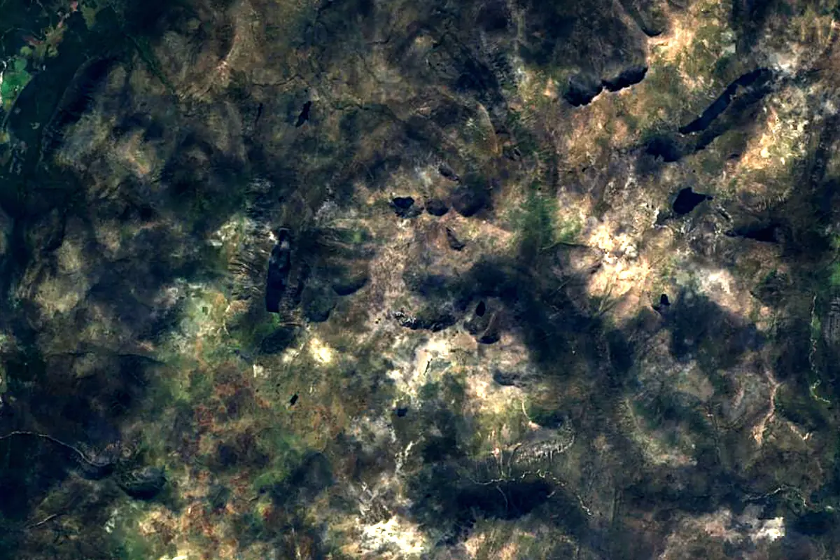
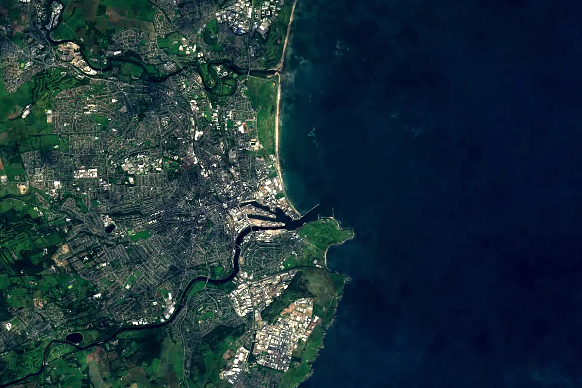
Sentinel-2 cloudless 2016 by EOX IT Services GmbH (contains modified Copernicus Sentinel data 2016), CC BY 4.0. The glowing line is the river as drawn by RiverATLAS.
Tributaries
Where it flows, and what flows into it
Tributaries (14)
Also: River Quoich, River Gairn, Water of Feugh, Water of Tanar, River Muick, Clunie Water, Girnock Burn, Leuchar Burn, Lui Water, Geldie Burn, Feardar Burn, Gelder Burn, Burn of Cattie, Ey Burn
Nearby
Rivers nearby
United Kingdom131 km21 m³/s3 km awayRiver SpeyUnited Kingdom172 km64 m³/s85 km awayRiver TayUnited Kingdom193 km170 m³/s116 km awayRiver TweedUnited Kingdom156 km89 m³/s154 km awayRiver ForthUnited Kingdom47 km61 m³/s158 km awayRiver ClydeUnited Kingdom176 km90 m³/s200 km awayRiver TyneUnited Kingdom100 km63 m³/s241 km awayRiver WearUnited Kingdom96 km21 m³/s251 km awayWhere these numbers come from
| Name, length, places | Wikidata (Q964949) · CC0 |
|---|---|
| Course, profile, basin | RiverATLAS v1.0 (HydroATLAS, Linke et al. 2019) · CC BY 4.0 — followed from the source to the mouth given by Wikidata |
| Flow | WaterGAP (RiverATLAS), 1971–2000 · CC BY 4.0 |
| Climate along the river | WorldClim (RiverATLAS), 1970–2000 · CC BY 4.0 |
| Towns, bridges, dams | Wikidata · CC0; GeoNames · CC BY 4.0 |
| Along the river | © OpenStreetMap contributors · ODbL |
| Images | EOX Sentinel-2 cloudless 2016 · CC BY 4.0; Wikimedia Commons |
| Our other atlases | Cascadyas, Lakeyas, Coastya, Peakyas, Islandyas — Wikidata · CC0; © OpenStreetMap contributors · ODbL; GeoNames · CC BY 4.0; HydroLAKES · CC BY 4.0; NOAA OISST |
Every source and licence is on the data sources page.
The family
Do you prefer beaches, lakes, mountains, waterfalls, islands, rivers or canyons?
Same idea, other landscapes: field atlases built on open data, month by month, in seven languages.
beaches Find your beach: sea temperature, sun and swimming month by month.Visit lakes
 Every lake on Earth: water temperature, ice, depth and the shore.Coming soonVisit mountains
 Every summit in 3D: summit weather, the 0 °C line, huts and trails.Visit waterfalls
 Every waterfall: height, flow month by month and when it roars.Coming soonVisit islands
 Every island from the sea up: size, sea temperature, ferries and 3D.Coming soonVisit
  rivers
 Every river from source to sea: the journey, the flow and the basin in numbers.You are here
 canyons
 Every canyon cut to scale: depth to the floor, rim and floor temperatures, trails and viewpoints.Coming soonVisit