River
Yellowstone River
1,114 km from source to mouth · United States.
 United StatesFlows into Missouri River
In numbers
Length
1,114km
Average flow
390m³/s
Basin
181,299km²
Drop
1,873m
from 2,438 m to 565 m
Country
1
The journey
From source to mouth
1,114 km of river and 37 stops on the way: 8 towns and cities on its banks, dams, bridges and the tributaries that feed it.
- 0 kmSourceat 2,438 m
- 19 kmBridger Lake0.3 km²
- 80 kmYellowstone Lake340 km²
- 80 kmFishing Bridge
- 102 kmChittenden Bridge
- 102 kmChittenden Memorial Bridge
- 103 kmYellowstone Falls
- 103 kmUpper Falls of the Yellowstone River
- 103 kmCrystal Falls
- 104 kmLower Falls of the Yellowstone River
- 107 kmSilver Cord Cascade
- 132 kmTower Fall40 m
- 136 kmLamar Rivertributary
- 142 kmTower Suspension Bridge
- 148 kmHellroaring Creektributary
- 173 kmGardner Rivertributary
- 196 kmCarbella Bridge
- 206 kmDailey Lake0.8 km²
- 254 kmCarter Bridge
- 261 kmLivingston8,040 people
- 276 kmShields Rivertributary
- 323 kmBoulder Rivertributary
- 342 kmGreycliff89 people
- 363 kmReed Point177 people
- 390 kmStillwater Rivertributary
- 392 kmColumbus1,857 people
- 442 kmClarks Fork Yellowstone Rivertributary
- 468 kmBillings117,116 people
- 488 kmHuntley Bridge
- 571 kmBighorn Rivertributary
- 659 kmForsyth1,647 people
- 681 kmRosebud Creektributary
- 743 kmTongue Rivertributary
- 745 kmMiles City8,354 people
- 801 kmPowder Rivertributary
- 818 kmTerry562 people
- 837 kmYellowstone River Bridge
- 887 kmBell Street Bridge
- 1,114 kmMissouri Riverat 565 m
Water level along the river (RiverATLAS; the height is exaggerated). Towns: GeoNames and Wikidata; bridges, dams and tributaries: Wikidata.
Tributary of the Missouri River in North Dakota, Montana, and Wyoming in the United States
At the mouth it carries 390 m³/s on average: an Olympic pool every 6.4 seconds. It drops from 2,438 m to 565 m, 1.7 m per kilometre on average. Its basin covers 181,299 km², about the size of KH. 387,000 people live in it. Highest water: from May to July; lowest: from December to March. Dams and reservoirs hold back a large share of its water (29% of a year's flow).
Where to start
- BillingsLargest city on its banks · 117,116 people
- Billings Logan International Airport (BIL)Nearest airport with scheduled flights, 4 km from the cityCar hire at BIL airport (Billings)Discover Cars · Affiliate link↗
- On the water34 ferry piers, marinas, boat rentals and boat ramps along the river (OpenStreetMap)
- Kayak and canoe9 put-ins and rapids mapped (OpenStreetMap)
- From June to SeptemberThe best months to visit
Yellowstone River, month by month
Highest water: from May to July
Lowest water: from December to March. Freezing months (average below −4 °C): from December to February. Best months to visit: from June to September.
From about 130 m³/s in the lowest month to 1,300 m³/s in the highest. An estimate: the monthly flow is modelled from the lowest and highest months of WaterGAP (RiverATLAS, 1971–2000) and the rain and snow along the river (WorldClim). Dams change the real rhythm. The chip is the average air temperature; below it, the month's rain.
Plan the trip
Plan the trip: boat trips, a bed by the river, a car
Some links above are affiliate links: if you book through them we may earn a commission, at no extra cost to you. It never changes what the data on this page says.
The basin
Yellowstone River: the basin in numbers
180,349 km² of land send their water to this river. This is what lives on it.
- 387,000people live in the basin
- 2/km²people per km²
- 1,510maverage altitude of the basin
- 386mmof rain a year (basin average)
- 5.4°Caverage air temperature
- 9%protected areas
- 0.4%covered by lakes
- 1%permafrost
- 4.2km³held in reservoirs
What covers the basin
- 20% Forest
- 9% Cropland
- 66% Pasture
RiverATLAS (HydroATLAS v1.0, CC BY 4.0): land cover, people, protected areas, glaciers and dams over the whole basin upstream of the mouth.
Along the river
Yellowstone River: what you find on the way
- 14WeirsHuntley Diversion Dam, Waco-Custer Diversion Dam, Ranchers Ditch Diversion and 11 more
- 6WaterfallsUpper Yellowstone Falls, Crystal Falls, Lower Yellowstone Falls and 3 more
- 9RapidsLeHardys Rapids, Trout Rapids, Buffalo Rapids and 6 more
- 34Boat rampsCarbella, Point of Rocks, Emigrant and 31 more
From OpenStreetMap, within 2.6 km of the river. Not mapped is not the same as not there.
Cross-checked with our atlases
Yellowstone River in our other atlases
What our sister atlases know about the waterfalls on this river, the lakes it flows through, the beaches at its mouth, the mountains where it rises and the islands off its mouth.
 6waterfalls on the riverCascadyas
 3lakes on its wayLakeyas
 9mountains at the sourcePeakyas
Waterfalls (6)
On the river, by Cascadyas
- Yellowstone Fallskm 98
- Upper Falls of the Yellowstone Riverkm 98
- Crystal Fallskm 99
- Lower Falls of the Yellowstone Riverkm 99
- Silver Cord Cascadekm 103
- Tower Fallkm 12640m
Cascadyas is coming soonOpen Cascadyas ↗
Lakes and reservoirs (3)
Lakes it flows through, by Lakeyas
- Bridger Lakekm 180.3km²
- Yellowstone Lakekm 76 · 117 m deep340km²
- Dailey Lakekm 1960.8km²
Lakeyas is coming soonOpen Lakeyas ↗
Mountains at the source (9)
Within 15 km of the source, by Peakyas
- Younts Peak5.1 km away · prominence 683 m3,705m
- Thorofare Mountain7.2 km away
- Smokehouse Mountain14 km away
- Soda Mountain15 km away
- Pendergraft Peak12 km away
- Wall Mountain13 km away
- Yellowstone Point15 km away
- Thunder Mountain5.3 km away
1 more on PeakyasOpen Peakyas ↗
From space
The source and the mouth, seen from orbit
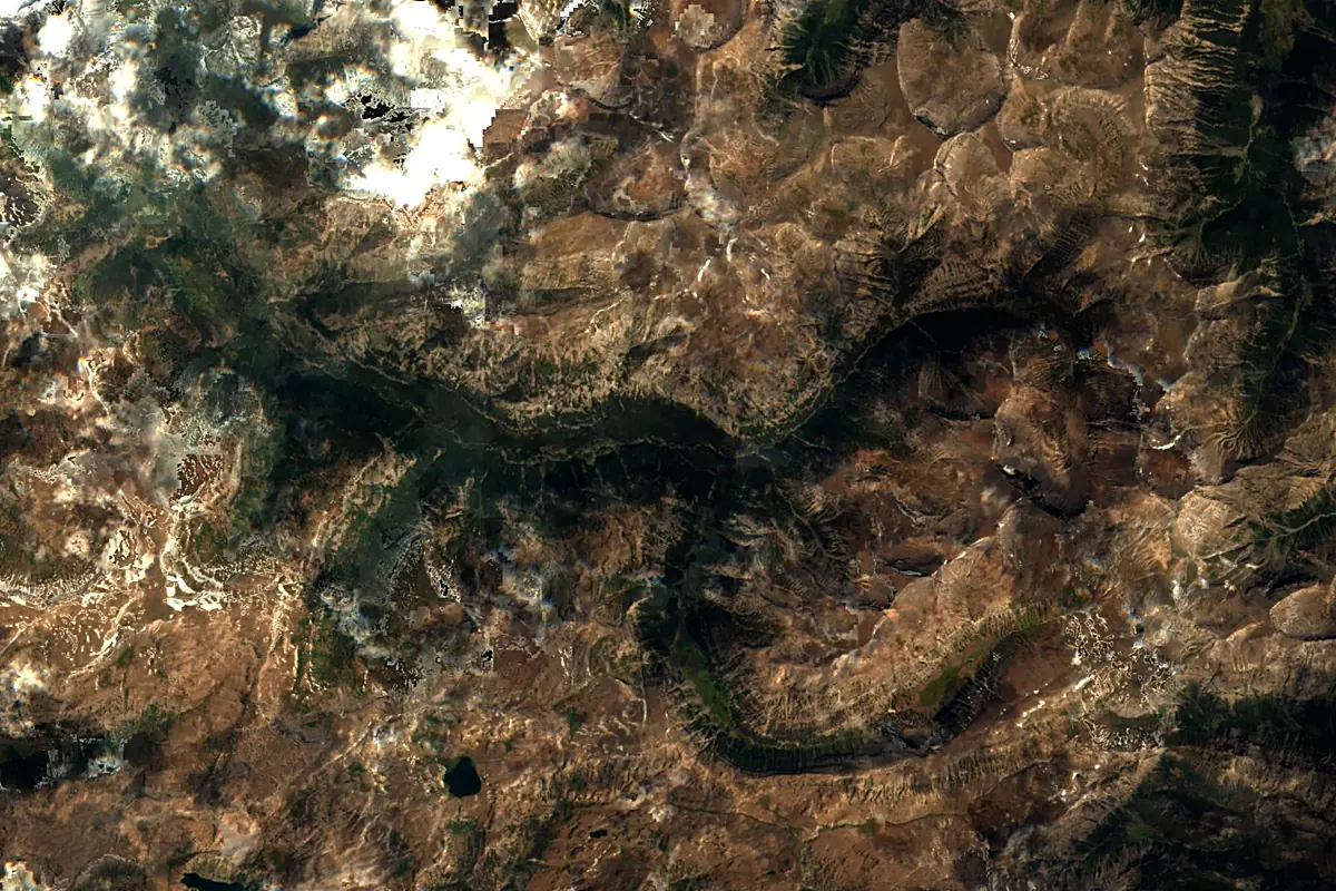
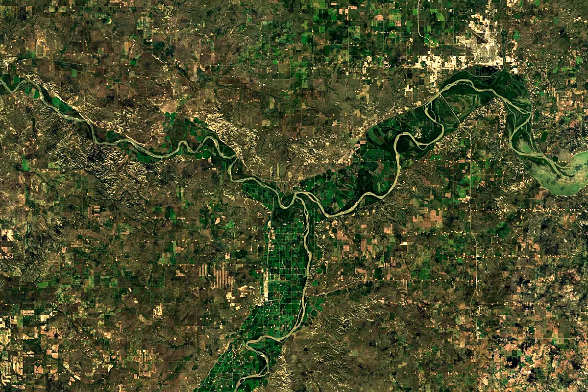
Sentinel-2 cloudless 2016 by EOX IT Services GmbH (contains modified Copernicus Sentinel data 2016), CC BY 4.0. The glowing line is the river as drawn by RiverATLAS.
Photos
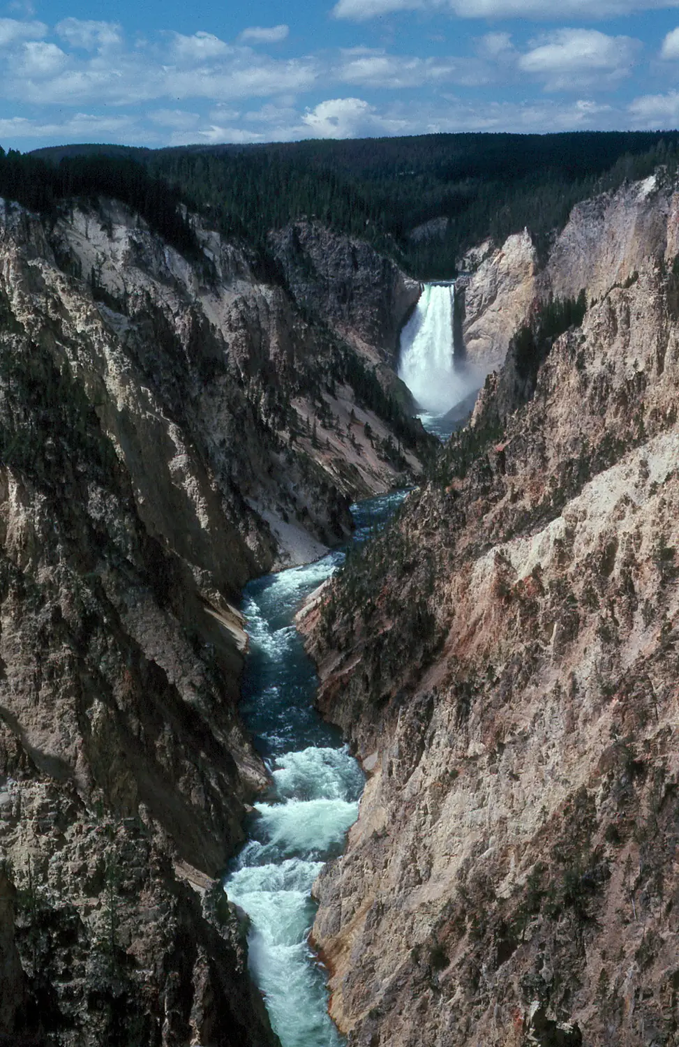
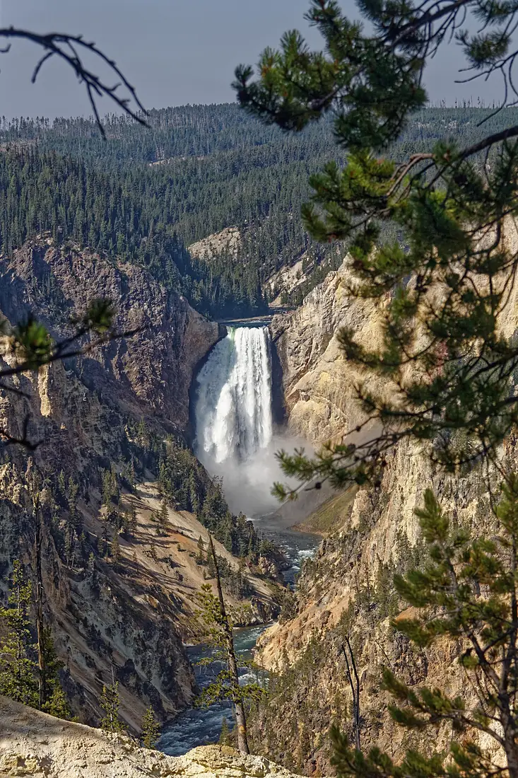
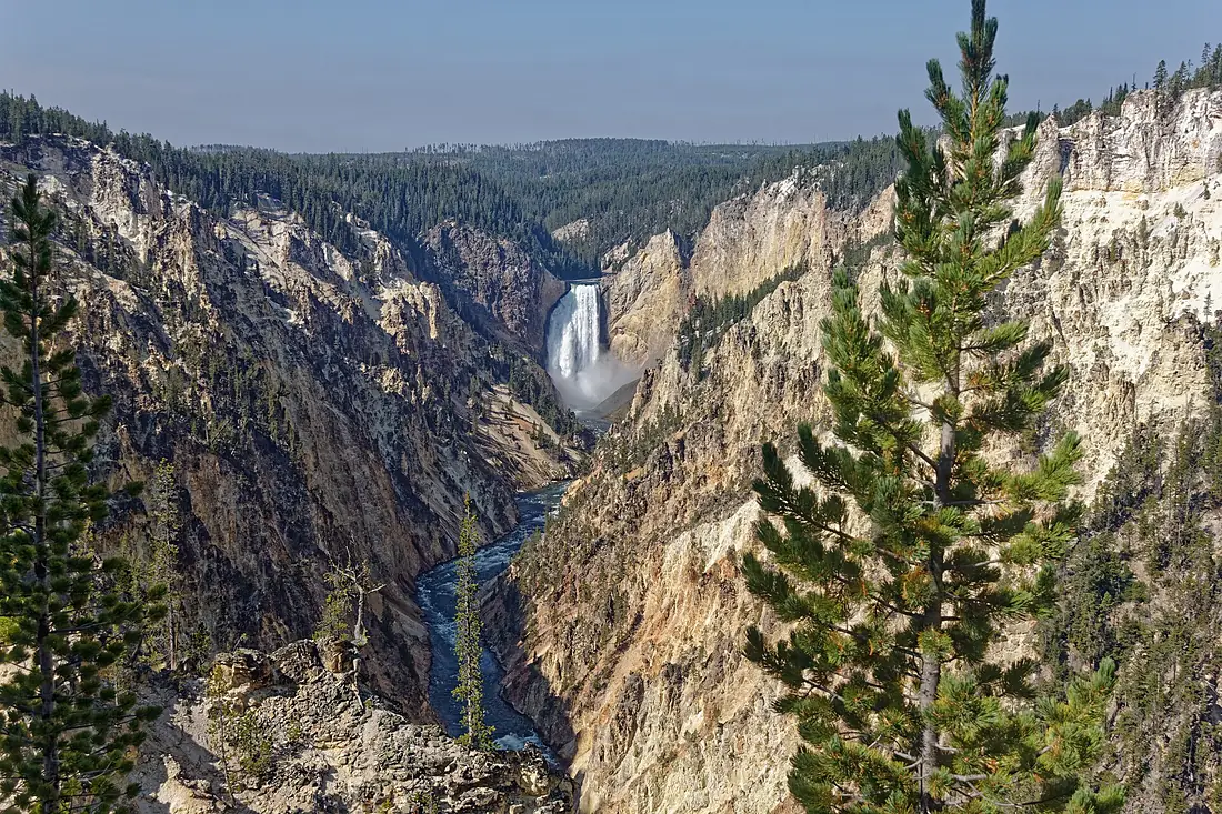
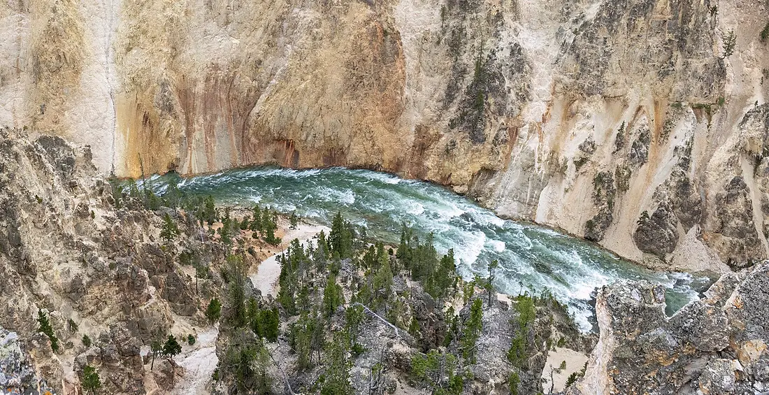
Yellowstone River in pictures
Tributaries
Where it flows, and what flows into it
It flows into
Missouri RiverUnited States3,726 km2,500 m³/sTributaries (15)
Also: Powder River, Tongue River, Lamar River, Clarks Fork Yellowstone River, Stillwater River, Boulder River, Gardner River, Rosebud Creek, Shields River, Hellroaring Creek, Sweet Grass Creek, Armells Creek, Atlantic Creek, Blacktail Deer Creek
In the same basin
United States3,766 km12,700 m³/sOhio RiverUnited States1,579 km8,000 m³/sArkansas RiverUnited States2,364 km240 m³/sTennessee RiverUnited States1,049 km2,000 m³/sRed RiverUnited States2,189 km1,900 m³/sPlatte RiverUnited States500 km200 m³/sCanadian RiverUnited States1,458 km200 m³/sIllinois RiverUnited States432 km660 m³/sAllegheny RiverUnited States523 km560 m³/sCumberland RiverUnited States1,107 km860 m³/s Canada
Where these numbers come from
| Name, length, places | Wikidata (Q374772) · CC0 |
|---|---|
| Course, profile, basin | RiverATLAS v1.0 (HydroATLAS, Linke et al. 2019) · CC BY 4.0 — followed from the source to the mouth given by Wikidata |
| Flow | WaterGAP (RiverATLAS), 1971–2000 · CC BY 4.0 |
| Climate along the river | WorldClim (RiverATLAS), 1970–2000 · CC BY 4.0 |
| Towns, bridges, dams | Wikidata · CC0; GeoNames · CC BY 4.0 |
| Along the river | © OpenStreetMap contributors · ODbL |
| Images | EOX Sentinel-2 cloudless 2016 · CC BY 4.0; Wikimedia Commons |
| Our other atlases | Cascadyas, Lakeyas, Peakyas — Wikidata · CC0; © OpenStreetMap contributors · ODbL; GeoNames · CC BY 4.0; HydroLAKES · CC BY 4.0; NOAA OISST |
Every source and licence is on the data sources page.
The family
Do you prefer beaches, lakes, mountains, waterfalls, islands, rivers or canyons?
Same idea, other landscapes: field atlases built on open data, month by month, in seven languages.
 beaches
 Find your beach: sea temperature, sun and swimming month by month.Visit lakes
 Every lake on Earth: water temperature, ice, depth and the shore.Coming soonVisit mountains
 Every summit in 3D: summit weather, the 0 °C line, huts and trails.Visit waterfalls
 Every waterfall: height, flow month by month and when it roars.Coming soonVisit
  islands
 Every island from the sea up: size, sea temperature, ferries and 3D.Coming soonVisit
  rivers
 Every river from source to sea: the journey, the flow and the basin in numbers.You are here
 canyons
 Every canyon cut to scale: depth to the floor, rim and floor temperatures, trails and viewpoints.Coming soonVisit