River
Ohio River
1,579 km from source to mouth · United States.
 United StatesFlows into Mississippi River8th longest in United States
In numbers
Length
1,579km
Average flow
8,000m³/s
Basin
528,100km²
Drop
136m
from 216 m to 80 m
Country
1
The journey
From source to mouth
1,579 km of river and 68 stops on the way: 28 towns and cities on its banks, dams, bridges and the tributaries that feed it.
- 0 kmMonongahela Riverat 216 m
- 3 kmPittsburgh302,971 people
- 5 kmMonongahela Rivertributary
- 5 kmAllegheny Rivertributary
- 9 kmChartiers Creektributary
- 44 kmBeaver Rivertributary
- 66 kmLittle Beaver Creektributary
- 144 kmWheeling Creektributary
- 239 kmMiddle Island Creektributary
- 262 kmLittle Muskingum Rivertributary
- 265 kmDuck Creektributary
- 266 kmMarietta13,385 people
- 267 kmMuskingum Rivertributary
- 279 kmVienna10,652 people
- 285 kmParkersburg29,738 people
- 285 kmLittle Kanawha Rivertributary
- 287 kmBelpre6,728 people
- 308 kmHocking Rivertributary
- 324 kmShade Rivertributary
- 340 kmSandy Creektributary
- 355 kmMill Creektributary
- 405 kmPoint Pleasant4,070 people
- 408 kmKanawha Rivertributary
- 468 kmGuyandotte Rivertributary
- 474 kmSymmes Creektributary
- 487 kmBig Sandy Rivertributary
- 494 kmAshland21,625 people
- 501 kmIronton10,571 people
- 517 kmLittle Sandy Rivertributary
- 543 kmPortsmouth18,252 people
- 546 kmLittle Scioto Rivertributary
- 548 kmScioto Rivertributary
- 596 kmOhio Brush Creektributary
- 627 kmMaysville8,873 people
- 712 kmLittle Miami Rivertributary
- 718 kmDayton5,666 people
- 720 kmBellevue5,548 people
- 722 kmCincinnati309,317 people
- 722 kmCovington40,961 people
- 722 kmLicking Rivertributary
- 725 kmLudlow4,385 people
- 755 kmGreat Miami Rivertributary
- 757 kmLawrenceburg5,129 people
- 765 kmLaughery Creektributary
- 776 kmRising Sun2,248 people
- 836 kmKentucky Rivertributary
- 856 kmMadison12,357 people
- 858 kmClifty Falls State Park
- 906 kmFourteen Mile Creektributary
- 922 kmJeffersonville49,447 people
- 925 kmLouisville246,161 people
- 929 kmClarksville22,333 people
- 932 kmNew Albany37,841 people
- 965 kmSalt Rivertributary
- 1,034 kmBlue Rivertributary
- 1,119 kmAnderson Rivertributary
- 1,155 kmOwensboro60,183 people
- 1,196 kmGreen Rivertributary
- 1,208 kmEvansville119,943 people
- 1,226 kmHenderson27,981 people
- 1,265 kmMount Vernon6,493 people
- 1,297 kmWabash Rivertributary
- 1,321 kmSaline Rivertributary
- 1,331 kmTradewater Rivertributary
- 1,405 kmCumberland Rivertributary
- 1,421 kmTennessee Rivertributary
- 1,424 kmPaducah27,137 people
- 1,437 kmMetropolis5,969 people
- 1,495 kmSwan Lake0.7 km²
- 1,579 kmMississippi Riverat 80 m
Water level along the river (RiverATLAS; the height is exaggerated). Towns: GeoNames and Wikidata; bridges, dams and tributaries: Wikidata.
River in the midwestern United States
At the mouth it carries 7,973 m³/s on average: 3.2 Olympic pools every second. It drops from 216 m to 80 m, 0.1 m per kilometre on average. Its basin covers 528,100 km², about the size of YE. 29.4 million people live in it. Highest water: from March to May. Dams and reservoirs hold back a large share of its water (27% of a year's flow).
Where to start
- CincinnatiLargest city on its banks · 309,317 people
- Cincinnati Municipal Airport Lunken Field (LUK)Nearest airport with scheduled flights, 8 km from the cityCar hire at CVG airport (Cincinnati / Covington)Discover Cars · Affiliate link↗
- On the water406 ferry piers, marinas, boat rentals and boat ramps along the river (OpenStreetMap)
- Kayak and canoe15 put-ins and rapids mapped (OpenStreetMap)
- From June to OctoberThe best months to visit
Ohio River, month by month
Highest water: from March to May
Best months to visit: from June to October.
From about 3,400 m³/s in the lowest month to 15,800 m³/s in the highest. An estimate: the monthly flow is modelled from the lowest and highest months of WaterGAP (RiverATLAS, 1971–2000) and the rain and snow along the river (WorldClim). Dams change the real rhythm. The chip is the average air temperature; below it, the month's rain.
Plan the trip
Plan the trip: boat trips, a bed by the river, a car
Some links above are affiliate links: if you book through them we may earn a commission, at no extra cost to you. It never changes what the data on this page says.
The basin
Ohio River: the basin in numbers
527,761 km² of land send their water to this river. This is what lives on it.
- 29.4millionpeople live in the basin
- 57/km²people per km²
- 348maverage altitude of the basin
- 1,178mmof rain a year (basin average)
- 11.7°Caverage air temperature
- 3%protected areas
- 0.8%covered by lakes
- 66km³held in reservoirs
What covers the basin
- 59% Forest
- 32% Cropland
- 5% Pasture
- 4% Towns and cities
RiverATLAS (HydroATLAS v1.0, CC BY 4.0): land cover, people, protected areas, glaciers and dams over the whole basin upstream of the mouth.
Along the river
Ohio River: what you find on the way
- 21WeirsMarkland Dam, US Dam Number Four, Dam Number 49 and 18 more
- 86LocksEmsworth Lock and Dam, Dashields Lock and Dam, Montgomery Lock and Dam and 83 more
- 14WaterfallsSnake Run, Hoffman Falls, Wallace Falls and 11 more
- 15Canoe put-insThree Rivers Rowing Launch, Lawrenceville Launch, Millvale Riverfront Park Launch and 12 more
- 348Boat rampsPFBC Glenfield Launch Ramp, Paden City Park Boat Launch, Saint Marys boat ramp and 345 more
- 19Ferry piersBlennerhassett Island Ferry, Augusta Ferry, Public Landing and 16 more
- 38MarinasLock Wall One Marina, Midway Marine Marina, Chestnut Street Motorized Boat Dock and 35 more
- 1River beachesBAB
From OpenStreetMap, within 2.8 km of the river. Not mapped is not the same as not there.
Cross-checked with our atlases
Ohio River in our other atlases
What our sister atlases know about the waterfalls on this river, the lakes it flows through, the beaches at its mouth, the mountains where it rises and the islands off its mouth.
 1waterfall on the riverCascadyas
 1lake on its wayLakeyas
 1mountain at the sourcePeakyas
Waterfalls (1)
On the river, by Cascadyas
- Clifty Falls State Parkkm 879
Cascadyas is coming soonOpen Cascadyas ↗
Lakes and reservoirs (1)
Lakes it flows through, by Lakeyas
- Swan Lakekm 1,5320.7km²
Lakeyas is coming soonOpen Lakeyas ↗
Mountains at the source (1)
Within 15 km of the source, by Peakyas
- Mount Washington1.8 km away
From space
The source and the mouth, seen from orbit
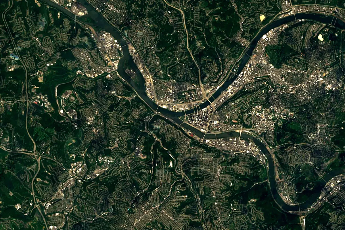
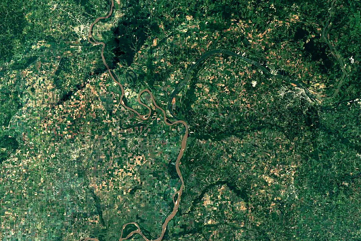
Sentinel-2 cloudless 2016 by EOX IT Services GmbH (contains modified Copernicus Sentinel data 2016), CC BY 4.0. The glowing line is the river as drawn by RiverATLAS.
Photos
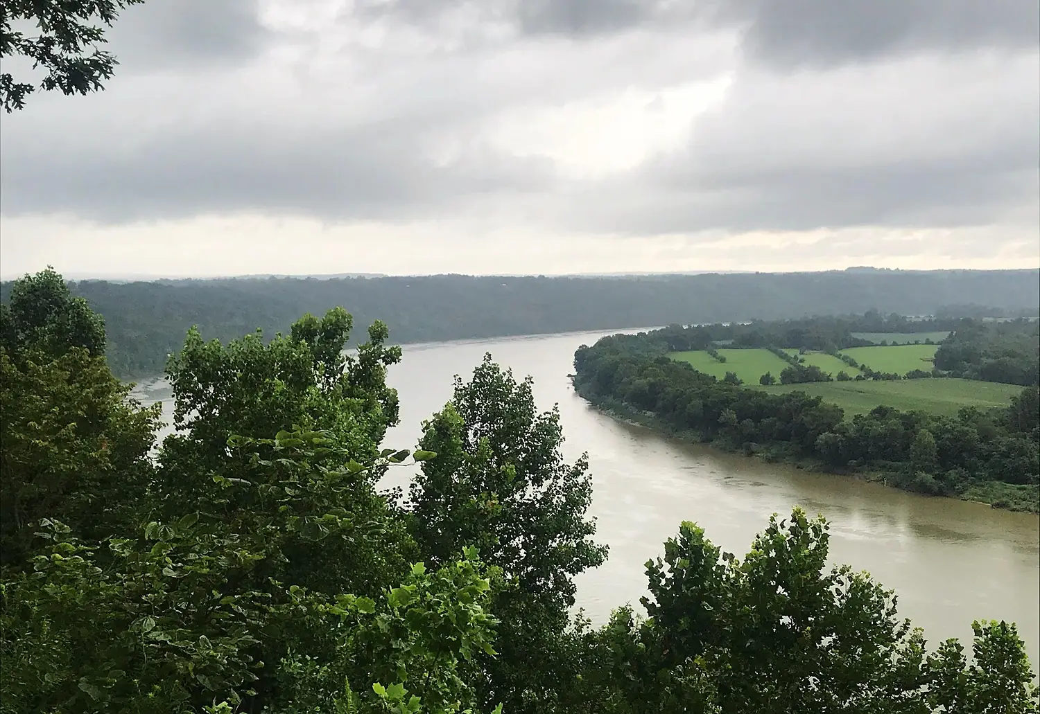
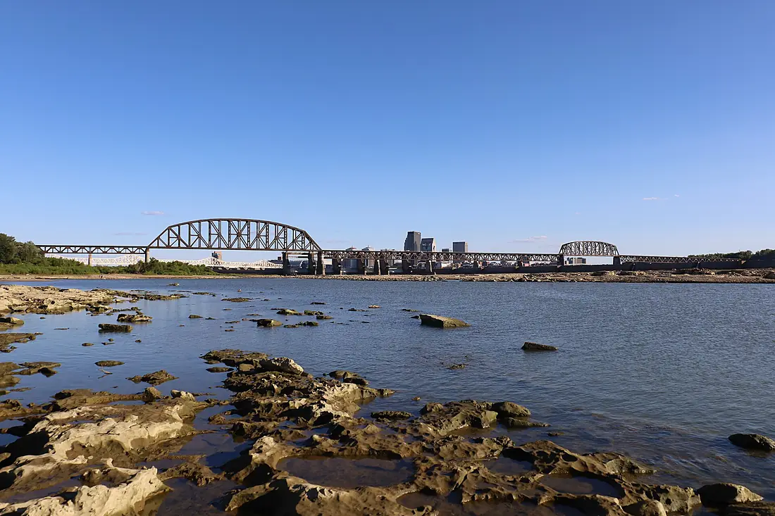
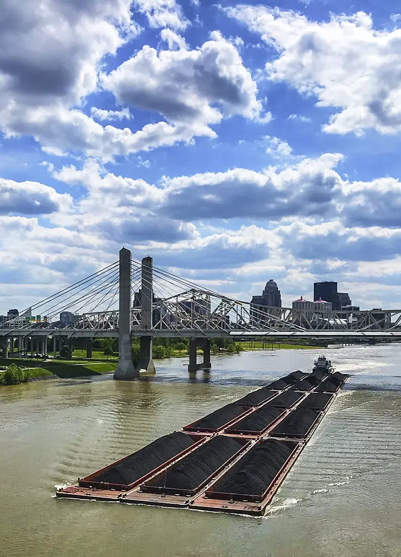
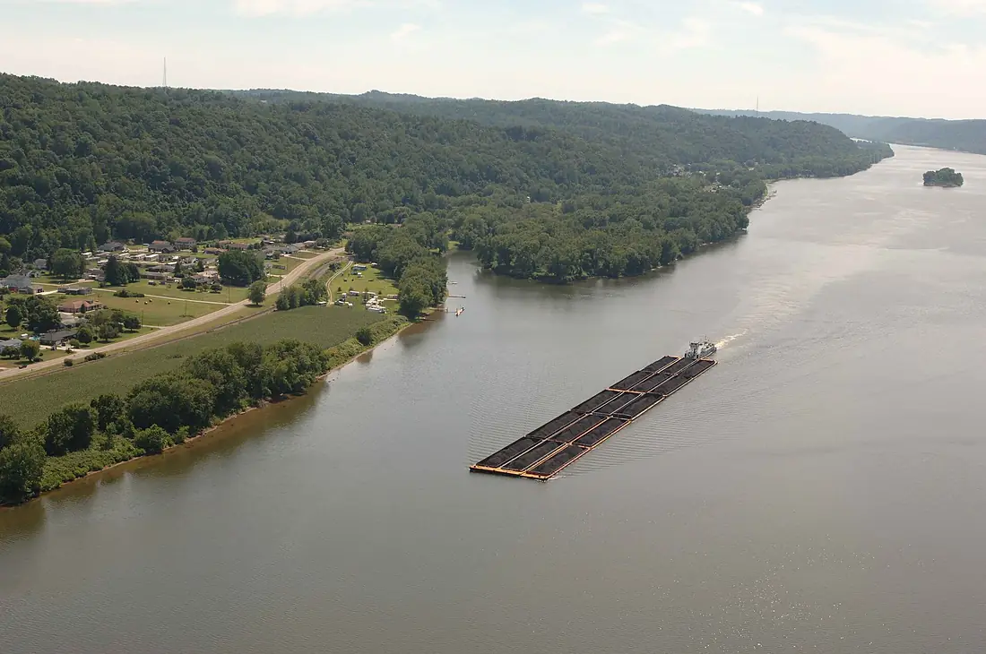
Ohio River in pictures
Tributaries
Where it flows, and what flows into it
It flows into
Mississippi RiverUnited States3,766 km12,700 m³/sTributaries (73)
United States1,107 km860 m³/sjoins at km 1,440Tennessee RiverUnited States1,049 km2,000 m³/sjoins at km 1,456Wabash RiverUnited States960 km1,000 m³/sjoins at km 1,329Allegheny RiverUnited States523 km560 m³/sjoins at km 5Kentucky RiverUnited States417 km280 m³/sjoins at km 857Scioto RiverUnited States372 km190 m³/sjoins at km 561Monongahela RiverUnited States209 km360 m³/sjoins at km 5Kanawha RiverUnited States156 km430 m³/sjoins at km 418Also: Muskingum River, Green River, Great Miami River, Licking River, Beaver River, Big Sandy River, Little Miami River, Little Kanawha River, Hocking River, Guyandotte River, Little Muskingum River, Salt River, Little Scioto River, Little Sandy River, Shade River, Ohio Brush Creek, Duck Creek, Little Beaver Creek, Little Hocking River, Symmes Creek, Anderson River, Chartiers Creek, Saline River, Laughery Creek
In the same basin
United States3,726 km2,500 m³/sArkansas RiverUnited States2,364 km240 m³/sRed RiverUnited States2,189 km1,900 m³/sYellowstone RiverUnited States1,114 km390 m³/sPlatte RiverUnited States500 km200 m³/sCanadian RiverUnited States1,458 km200 m³/sIllinois RiverUnited States432 km660 m³/sKansas RiverUnited States238 km210 m³/sCimarron RiverUnited States1,123 km1,100 m³/sMinnesota RiverUnited States534 km120 m³/sNearby
Rivers nearby
United States1,049 km2,000 m³/s51 km awayCumberland RiverUnited States1,107 km860 m³/s64 km awayWabash RiverUnited States960 km1,000 m³/s129 km awayMissouri RiverUnited States3,726 km2,500 m³/s220 km awayIllinois RiverUnited States432 km660 m³/s249 km awaySt. Francis RiverUnited States686 km400 m³/s294 km awayOsage RiverUnited States444 km310 m³/s305 km awayArkansas RiverUnited States2,364 km240 m³/s400 km awayWhere these numbers come from
| Name, length, places | Wikidata (Q4915) · CC0 |
|---|---|
| Course, profile, basin | RiverATLAS v1.0 (HydroATLAS, Linke et al. 2019) · CC BY 4.0 — followed from the source to the mouth given by Wikidata |
| Flow | WaterGAP (RiverATLAS), 1971–2000 · CC BY 4.0 |
| Climate along the river | WorldClim (RiverATLAS), 1970–2000 · CC BY 4.0 |
| Towns, bridges, dams | Wikidata · CC0; GeoNames · CC BY 4.0 |
| Along the river | © OpenStreetMap contributors · ODbL |
| Images | EOX Sentinel-2 cloudless 2016 · CC BY 4.0; Wikimedia Commons |
| Our other atlases | Cascadyas, Lakeyas, Peakyas — Wikidata · CC0; © OpenStreetMap contributors · ODbL; GeoNames · CC BY 4.0; HydroLAKES · CC BY 4.0; NOAA OISST |
Every source and licence is on the data sources page.
The family
Do you prefer beaches, lakes, mountains, waterfalls, islands, rivers or canyons?
Same idea, other landscapes: field atlases built on open data, month by month, in seven languages.
 beaches
 Find your beach: sea temperature, sun and swimming month by month.Visit lakes
 Every lake on Earth: water temperature, ice, depth and the shore.Coming soonVisit mountains
 Every summit in 3D: summit weather, the 0 °C line, huts and trails.Visit waterfalls
 Every waterfall: height, flow month by month and when it roars.Coming soonVisit
  islands
 Every island from the sea up: size, sea temperature, ferries and 3D.Coming soonVisit
  rivers
 Every river from source to sea: the journey, the flow and the basin in numbers.You are here
 canyons
 Every canyon cut to scale: depth to the floor, rim and floor temperatures, trails and viewpoints.Coming soonVisit