River
Mur
434 km from source to mouth · 4 countries.
 Croatia, Slovenia, Hungary and AustriaFlows into Drava2nd longest in Croatia
In numbers
Length
434km
Average flow
170m³/s
Basin
13,824km²
Drop
934m
from 1,056 m to 122 m
Countries
4
The journey
From source to mouth
434 km of river and 68 stops on the way: 56 towns and cities on its banks, dams, bridges and the tributaries that feed it.
- 0 kmHigh Tauernat 1,056 m
- 18 kmSt. Michael im Lungau3,520 people
- 23 kmSt. Margarethen im Lungau725 people
- 27 kmUnternberg1,035 people
- 33 kmSüdliche Taurachtributary
- 33 kmTamsweg5,717 people
- 40 kmRamingstein1,059 people
- 69 kmRantenbachtributary
- 69 kmMurau3,629 people
- 87 kmNiederwölz596 people
- 90 kmScheifling2,134 people
- 101 kmSankt Georgen ob Judenburg850 people
- 109 kmSt. Peter ob Judenburg1,108 people
- 115 kmJudenburg9,614 people
- 125 kmZeltweg7,212 people
- 133 kmKnittelfeld12,626 people
- 135 kmSt. Margarethen bei Knittelfeld2,750 people
- 137 kmKobenz1,864 people
- 148 kmKraubath an der Mur1,283 people
- 151 kmSankt Stefan ob Leoben1,930 people
- 156 kmLiesingtributary
- 156 kmSankt Michael in Obersteiermark3,060 people
- 168 kmLeoben24,645 people
- 172 kmProleb1,534 people
- 174 kmNiklasdorf2,515 people
- 180 kmOberaich3,243 people
- 183 kmBruck an der Mur15,837 people
- 184 kmMürztributary
- 192 kmPernegg an der Mur2,356 people
- 207 kmFrohnleiten6,655 people
- 216 kmPeggau2,199 people
- 217 kmDeutschfeistritz4,311 people
- 224 kmGratkorn7,892 people
- 225 kmGratwein3,635 people
- 235 kmLend30,199 people
- 236 kmInnere Stadt3,314 people
- 236 kmGraz306,971 people
- 237 kmGries29,363 people
- 239 kmJakomini32,912 people
- 243 kmFeldkirchen bei Graz6,622 people
- 246 kmGössendorf3,981 people
- 248 kmKalsdorf bei Graz6,954 people
- 255 kmWerndorf2,365 people
- 259 kmWildon5,367 people
- 268 kmKainachtributary
- 269 kmGralla2,390 people
- 272 kmGabersdorf1,227 people
- 273 kmLeibnitz13,014 people
- 275 kmWagna5,859 people
- 276 kmSulmtributary
- 281 kmStraß in Steiermark4,852 people
- 283 kmGamlitzbachtributary
- 283 kmSpielfeld992 people
- 294 kmMureck3,551 people
- 306 kmApače543 people
- 312 kmGornja Radgona3,086 people
- 312 kmBad Radkersburg3,156 people
- 326 kmMurska Sobota11,190 people
- 342 kmKutschenitzatributary
- 344 kmRazkrižje279 people
- 352 kmSveti Martin na Muri2,391 people
- 357 kmMursko Središće5,855 people
- 367 kmPodturen3,517 people
- 375 kmLedavatributary
- 375 kmBig Krkatributary
- 383 kmLetenye3,677 people
- 393 kmTrnavatributary
- 406 kmLegrad1,916 people
- 416 kmŠoderica1.2 km²
- 434 kmDravaat 122 m
Water level along the river (RiverATLAS; the height is exaggerated). Towns: GeoNames and Wikidata; bridges, dams and tributaries: Wikidata.
River in Central Europe
At the mouth it carries 166 m³/s on average: an Olympic pool every 15 seconds. It drops from 1,056 m to 122 m, 2.2 m per kilometre on average. Its basin covers 13,824 km², about the size of BS. 2.5 million people live in it. Highest water: from April to May; lowest: from January to February. Its dams hold back little of its water (4.2% of a year's flow).
Where to start
- GrazLargest city on its banks · 306,971 people
- Graz Airport (GRZ)Nearest airport with scheduled flights, 9 km from the cityCar hire at GRZ airport (Feldkirchen bei Graz)Discover Cars · Affiliate link↗
- On the water39 ferry piers, marinas, boat rentals and boat ramps along the river (OpenStreetMap)
- From May to SeptemberThe best months to visit
Mur, month by month
Highest water: from April to May
Lowest water: from January to February. Best months to visit: from May to September.
From about 160 m³/s in the lowest month to 900 m³/s in the highest. An estimate: the monthly flow is modelled from the lowest and highest months of WaterGAP (RiverATLAS, 1971–2000) and the rain and snow along the river (WorldClim). Dams change the real rhythm. The chip is the average air temperature; below it, the month's rain.
Plan the trip
Plan the trip: boat trips, a bed by the river, a car
Some links above are affiliate links: if you book through them we may earn a commission, at no extra cost to you. It never changes what the data on this page says.
The basin
Mur: the basin in numbers
30,972 km² of land send their water to this river. This is what lives on it.
- 2.5millionpeople live in the basin
- 80/km²people per km²
- 942maverage altitude of the basin
- 1,102mmof rain a year (basin average)
- 5.8°Caverage air temperature
- 26%protected areas
- 0.4%covered by lakes
- 1%permafrost
- 0.6km³held in reservoirs
What covers the basin
- 77% Forest
- 13% Cropland
- 22% Pasture
- 3% Towns and cities
RiverATLAS (HydroATLAS v1.0, CC BY 4.0): land cover, people, protected areas, glaciers and dams over the whole basin upstream of the mouth.
Along the river
Mur: what you find on the way
- 267WeirsMurbrecher, Bachfassung Altenbergbach, Tennenwehr St. Andrä and 264 more
- 2Locks
- 20WaterfallsRossfall, Muhrfall, Kleiner Wasserfall and 17 more
- 20Boat rampsDrauchenbachmündung, Mura Novakovec - Dekanovec and 18 more
- 15Ferry piersSladki vrh, Weitersfeld, Brod Krog and 12 more
- 5River beachesGrüne Lagune Insel, Plaża, Plaža Šoderica and 2 more
From OpenStreetMap, within 2.1 km of the river. Not mapped is not the same as not there.
Cross-checked with our atlases
Mur in our other atlases
What our sister atlases know about the waterfalls on this river, the lakes it flows through, the beaches at its mouth, the mountains where it rises and the islands off its mouth.
 1lake on its wayLakeyas
 111mountains at the sourcePeakyas
Lakes and reservoirs (1)
Lakes it flows through, by Lakeyas
- Šodericakm 424 · 20 m deep1.2km²
Lakeyas is coming soonOpen Lakeyas ↗
Mountains at the source (111)
Within 15 km of the source, by Peakyas
- Hochalmspitze13 km away · prominence 942 m3,360m
- Ankogel11 km away3,252m
- Großelendkopf12 km away3,317m
- Grosser Hafner7.7 km away · prominence 824 m3,076m
- Großer Sonnblick11 km away · prominence 133 m3,030m
- Tischlerspitze10 km away3,002m
- Preimlspitze11 km away3,133m
- Winkelspitz13 km away3,112m
103 more on PeakyasOpen Peakyas ↗
From space
The source and the mouth, seen from orbit
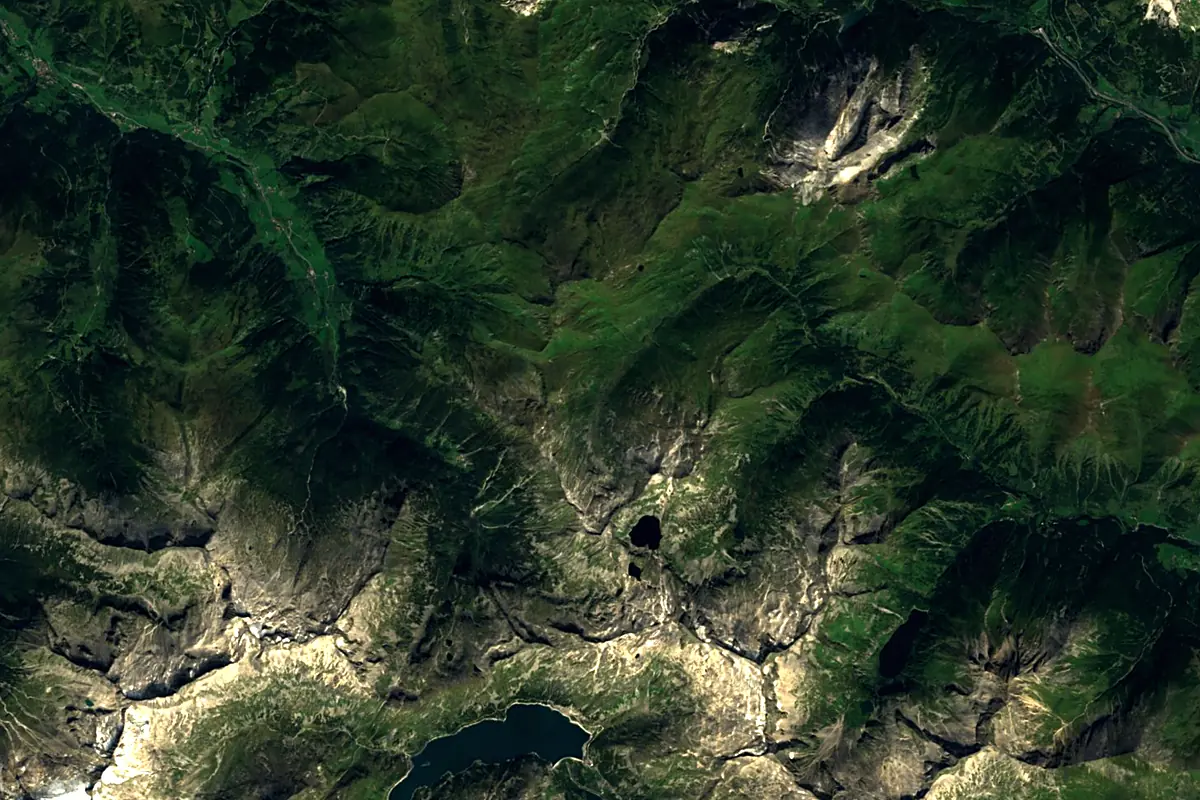
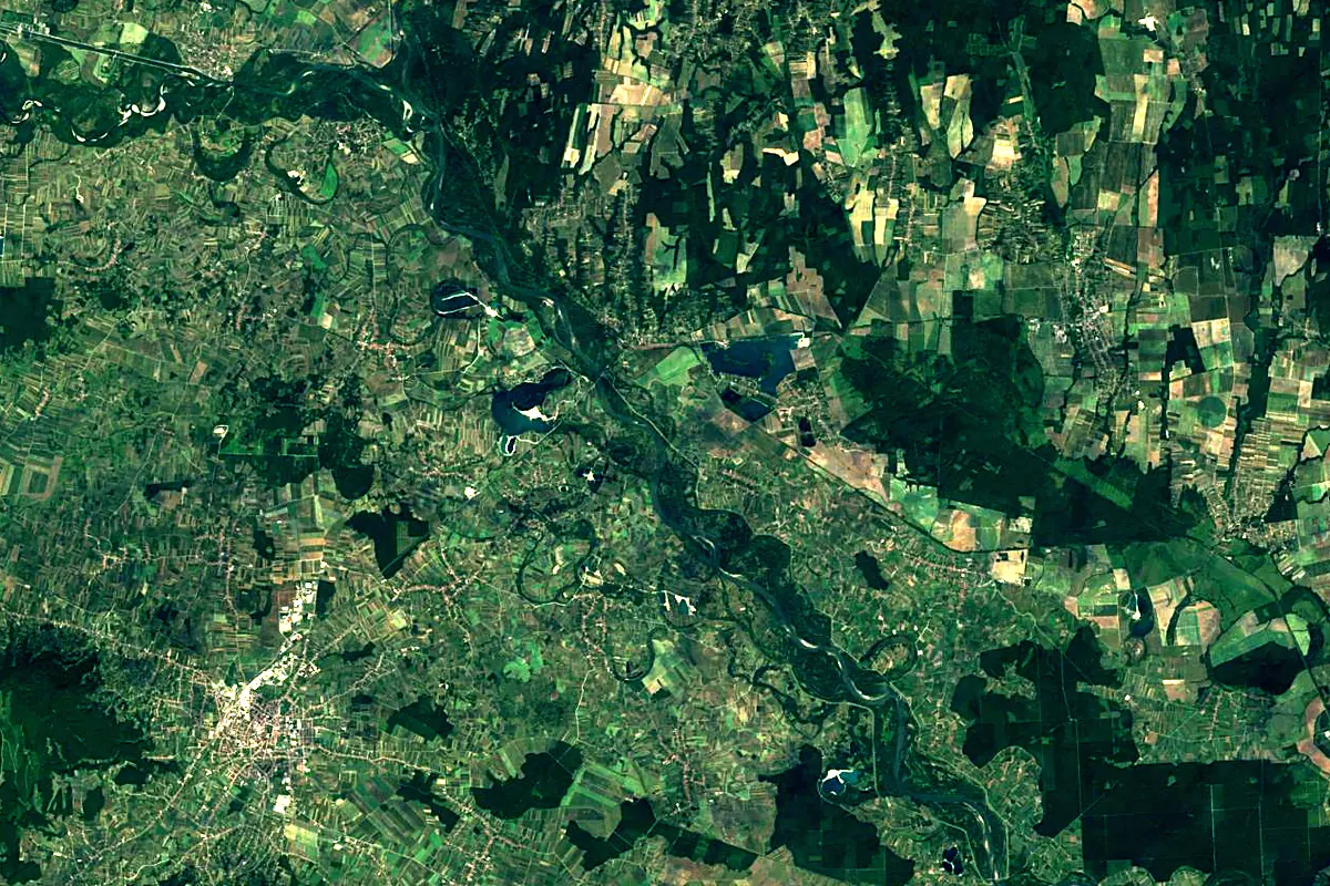
Sentinel-2 cloudless 2016 by EOX IT Services GmbH (contains modified Copernicus Sentinel data 2016), CC BY 4.0. The glowing line is the river as drawn by RiverATLAS.
Photos
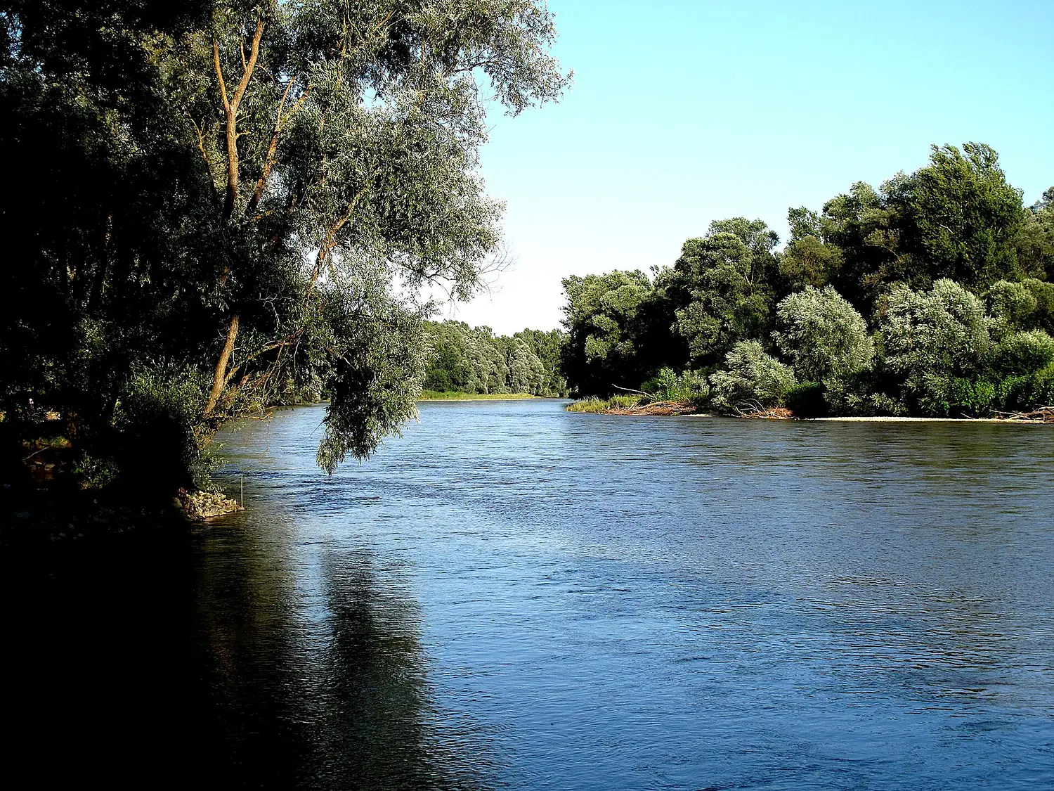
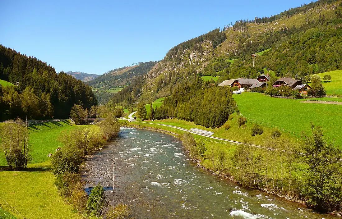
Mur in pictures
Tributaries
Where it flows, and what flows into it
It flows into
DravaCroatia720 km620 m³/sTributaries (34)
Also: Ledava, Mürz, Big Krka, Sulm, Kainach, Trnava, Liesing, Südliche Taurach, Turrach, Übelbach, Rantenbach, Granitzenbach, Lassnitzbach, Kutschenitza, Andritzbach, Grazbach, Paalbach, Schwarzaubach, Gamlitzbach, Rigyáci-patak, Petersbach, Stübingbach, Tyrnauer Bach, Vordernberger Bach
 Romania
 Serbia
 Germany
 Moldova
Nearby
Rivers nearby
Hungary138 km6.0 m³/s61 km awayKupaCroatia297 km280 m³/s97 km awayUnaCroatia207 km200 m³/s111 km awayKrkaSlovenia93 km170 m³/s109 km awayVrbas Bosnia and Herzegovina240 km33 m³/s132 km awaySutlaCroatia90 km170 m³/s106 km awayKoranaCroatia144 km86 m³/s134 km awaySanaBosnia and Herzegovina146 km69 m³/s138 km away
Where these numbers come from
| Name, length, places | Wikidata (Q204040) · CC0 |
|---|---|
| Course, profile, basin | RiverATLAS v1.0 (HydroATLAS, Linke et al. 2019) · CC BY 4.0 — followed from the source to the mouth given by Wikidata |
| Flow | WaterGAP (RiverATLAS), 1971–2000 · CC BY 4.0 |
| Climate along the river | WorldClim (RiverATLAS), 1970–2000 · CC BY 4.0 |
| Towns, bridges, dams | Wikidata · CC0; GeoNames · CC BY 4.0 |
| Along the river | © OpenStreetMap contributors · ODbL |
| Images | EOX Sentinel-2 cloudless 2016 · CC BY 4.0; Wikimedia Commons |
| Our other atlases | Lakeyas, Peakyas — Wikidata · CC0; © OpenStreetMap contributors · ODbL; GeoNames · CC BY 4.0; HydroLAKES · CC BY 4.0; NOAA OISST |
Every source and licence is on the data sources page.
The family
Do you prefer beaches, lakes, mountains, waterfalls, islands, rivers or canyons?
Same idea, other landscapes: field atlases built on open data, month by month, in seven languages.
 beaches
 Find your beach: sea temperature, sun and swimming month by month.Visit lakes
 Every lake on Earth: water temperature, ice, depth and the shore.Coming soonVisit mountains
 Every summit in 3D: summit weather, the 0 °C line, huts and trails.Visit
  waterfalls
 Every waterfall: height, flow month by month and when it roars.Coming soonVisit
  islands
 Every island from the sea up: size, sea temperature, ferries and 3D.Coming soonVisit
  rivers
 Every river from source to sea: the journey, the flow and the basin in numbers.You are here
 canyons
 Every canyon cut to scale: depth to the floor, rim and floor temperatures, trails and viewpoints.Coming soonVisit