River
Morava
388 km from source to mouth · Austria, Czechia and Slovakia.
 Austria, Czechia and SlovakiaFlows into Danube1st longest in Austria
In numbers
Length
388km
Average flow
110m³/s
Basin
26,658km²
Drop
310m
from 459 m to 149 m
Countries
3
The journey
From source to mouth
388 km of river and 68 stops on the way: 21 towns and cities on its banks, dams, bridges and the tributaries that feed it.
- 0 kmSource of the Morava Riverat 459 m
- 0 kmSmall Waterfall in Dolní Morava
- 3 kmŽlebský vodopád7 m
- 10 kmRaškovský vodopád4 m
- 16 kmBrannátributary
- 25 kmBludov3,155 people
- 27 kmDesnátributary
- 35 kmMoravská Sázavatributary
- 41 kmMohelnice9,886 people
- 44 kmMírovkatributary
- 44 kmMoravičanské jezero0.4 km²
- 47 kmTřebůvkatributary
- 57 kmweir in Morava river
- 58 kmLitovel9,510 people
- 58 kmSvatojánský most
- 70 kmŠtěpánov3,555 people
- 73 kmChomoutovské jezero0.8 km²
- 76 kmOskavatributary
- 77 kmTrusovický potoktributary
- 80 kmBridge Komenského - Gorazdovo náměstí
- 80 kmVáclav Render Bridge
- 80 kmOlomouc103,063 people
- 81 kmŽelezniční most přes Moravu u teplárny Olomouc
- 81 kmBridge of Wittgensteinova street over the Morava
- 82 kmRailway bridge Hodolany - Nové Sady
- 82 kmMlýnský potoktributary
- 82 kmBystřicetributary
- 91 kmWeir Bolelouc
- 101 kmSkašovské jezero0.7 km²
- 101 kmBečvatributary
- 101 kmTroubecké jezero1.1 km²
- 105 kmBlatatributary
- 109 kmKojetín6,397 people
- 111 kmRomžetributary
- 113 kmChropyně5,172 people
- 113 kmBezměrov bridge
- 115 kmHanátributary
- 118 kmMoštěnkatributary
- 119 kmKroměříž27,917 people
- 119 kmFootbridge over the Morava river in Kroměříž
- 126 kmRusavatributary
- 134 kmDřevnicetributary
- 134 kmOtrokovice17,239 people
- 138 kmNapajedla6,981 people
- 148 kmBřeznicetributary
- 151 kmUherské Hradiště24,852 people
- 153 kmStaré Město6,585 people
- 156 kmSalaškatributary
- 157 kmOlšavatributary
- 157 kmKostelany nad Moravou889 people
- 162 kmOstrožská Nová Ves3,362 people
- 162 kmTěžební jezero2.6 km²
- 164 kmUherský Ostroh4,209 people
- 166 kmOklukytributary
- 169 kmVeselí nad Moravou10,574 people
- 174 kmSvodnicetributary
- 185 kmSyrovinkatributary
- 185 kmVeličkatributary
- 187 kmRadějovkatributary
- 188 kmRohatec3,446 people
- 192 kmHolíč10,735 people
- 193 kmHodonín23,344 people
- 197 kmChvojnica (river)tributary
- 201 kmGreat Moravia Footbridge
- 215 kmBrodské2,244 people
- 224 kmMyjavatributary
- 226 kmZayatributary
- 226 kmThayatributary
- 226 kmHohenau an der March2,738 people
- 227 kmDanubeat 149 m
Water level along the river (RiverATLAS; the height is exaggerated). Towns: GeoNames and Wikidata; bridges, dams and tributaries: Wikidata.
River in Central Europe
At the mouth it carries 109 m³/s on average: an Olympic pool every 23 seconds. It drops from 459 m to 149 m, 0.8 m per kilometre on average. Its basin covers 26,658 km², about the size of RW. 1.4 million people live in it. Highest water: from April to May and from July to August; lowest: from January to February. No large dam holds it back: it is one of the world's free-flowing rivers.
Where to start
- OlomoucLargest city on its banks · 103,063 people
- Leoš Janáček Airport Ostrava (OSR)Nearest airport with scheduled flights, 63 km from the cityCar hire at OSR airport (Mošnov)Discover Cars · Affiliate link↗
- On the water54 ferry piers, marinas, boat rentals and boat ramps along the river (OpenStreetMap)
- From May to SeptemberThe best months to visit
Morava, month by month
Highest water: from April to May and from July to August
Lowest water: from January to February. Best months to visit: from May to September.
From about 34 m³/s in the lowest month to 160 m³/s in the highest. An estimate: the monthly flow is modelled from the lowest and highest months of WaterGAP (RiverATLAS, 1971–2000) and the rain and snow along the river (WorldClim). Dams change the real rhythm. The chip is the average air temperature; below it, the month's rain.
Plan the trip
Plan the trip: boat trips, a bed by the river, a car
Some links above are affiliate links: if you book through them we may earn a commission, at no extra cost to you. It never changes what the data on this page says.
The basin
Morava: the basin in numbers
10,736 km² of land send their water to this river. This is what lives on it.
- 1.4millionpeople live in the basin
- 134/km²people per km²
- 386maverage altitude of the basin
- 668mmof rain a year (basin average)
- 7.8°Caverage air temperature
- 15%protected areas
- 0.2%covered by lakes
- 0.0km³held in reservoirs
What covers the basin
- 42% Forest
- 46% Cropland
- 11% Pasture
- 6% Towns and cities
RiverATLAS (HydroATLAS v1.0, CC BY 4.0): land cover, people, protected areas, glaciers and dams over the whole basin upstream of the mouth.
Along the river
Morava: what you find on the way
- 187Weirsjez Šargoun, Bělovský jez, Spytihněv and 184 more
- 8LocksVnorovy I., Baťův kanál and 6 more
- 2WaterfallsŽlebské vodopády
- 22Boat rampsŚjezd pro lodě and 21 more
- 8Ferry piersPlavby Olomouc, Přístaviště Otrokovice, Napajedla - Přístaviště Emila Spiro and 5 more
- 17MarinasMarina di Olomouc, Loděnice, Napajedla - Pahrbek and 14 more
From OpenStreetMap, within 1.8 km of the river. Not mapped is not the same as not there.
Cross-checked with our atlases
Morava in our other atlases
What our sister atlases know about the waterfalls on this river, the lakes it flows through, the beaches at its mouth, the mountains where it rises and the islands off its mouth.
 3waterfalls on the riverCascadyas
 5lakes on its wayLakeyas
 97mountains at the sourcePeakyas
Waterfalls (3)
On the river, by Cascadyas
- Small Waterfall in Dolní Moravakm 0
- Žlebský vodopádkm 37m
- Raškovský vodopádkm 104m
Cascadyas is coming soonOpen Cascadyas ↗
Lakes and reservoirs (5)
Lakes it flows through, by Lakeyas
- Moravičanské jezerokm 440.4km²
- Chomoutovské jezerokm 73 · 2 m deep0.8km²
- Skašovské jezerokm 1010.7km²
- Troubecké jezerokm 1011.1km²
- Těžební jezerokm 1622.6km²
Lakeyas is coming soonOpen Lakeyas ↗
Mountains at the source (97)
Within 15 km of the source, by Peakyas
- Králický Sněžník0.3 km away · prominence 665 m1,423m
- Malý Sněžník2.9 km away · prominence 100 m1,327m
- Sušina3.7 km away · prominence 108 m1,321m
- Podbělka4.5 km away1,308m
- Goworek3.4 km away1,320m
- Černá kupa2.9 km away1,295m
- Souš6.7 km away1,225m
- Smrk13 km away · prominence 312 m1,127m
89 more on PeakyasOpen Peakyas ↗
From space
The source and the mouth, seen from orbit
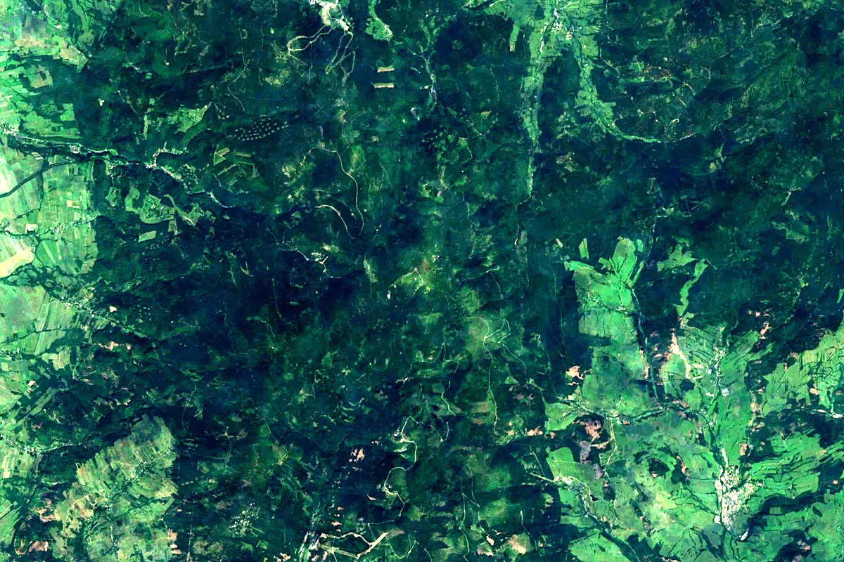
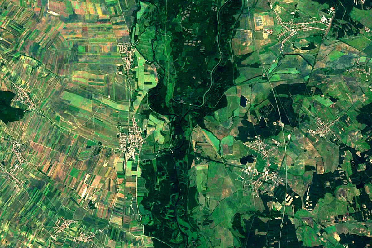
Sentinel-2 cloudless 2016 by EOX IT Services GmbH (contains modified Copernicus Sentinel data 2016), CC BY 4.0. The glowing line is the river as drawn by RiverATLAS.
Photos
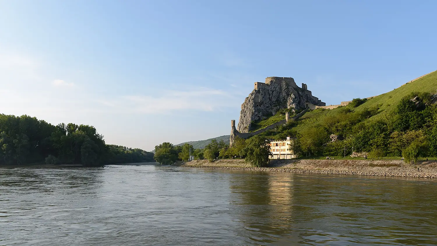
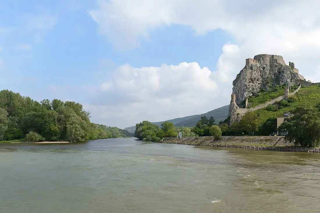
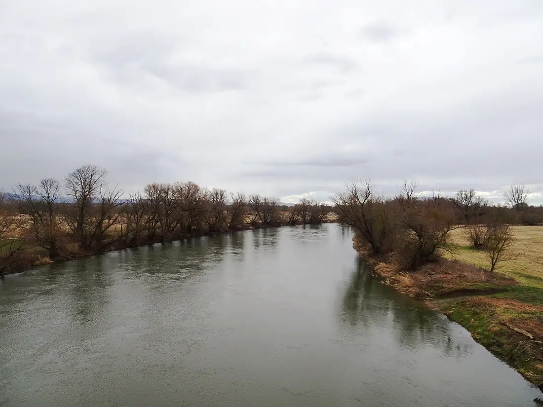
Morava in pictures
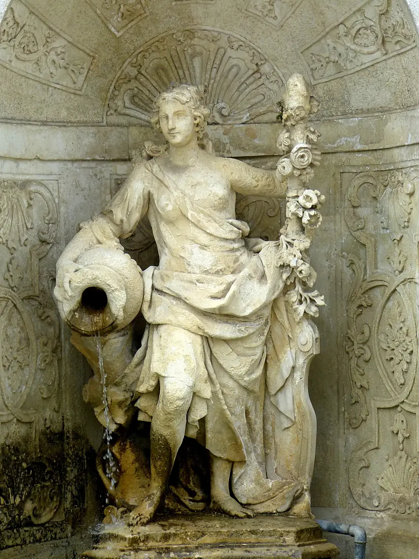
Tributaries
Where it flows, and what flows into it
It flows into
Danube Romania2,850 km5,400 m³/s
Tributaries (47)
Also: Myjava, Desná, Dřevnice, Haná, Moravská Sázava, Oskava, Bystřice, Třebůvka, Olšava, Rudava, Krupá, Romže, Velička, Zaya, Blata, Moštěnka, Chvojnica (river), Rusava, Mírovka, Malina River, Březnice, Okluky, Trusovický potok, Radějovka
 Serbia
 Croatia
 Germany
 Moldova
 Hungary
Nearby
Rivers nearby
Where these numbers come from
| Name, length, places | Wikidata (Q179251) · CC0 |
|---|---|
| Course, profile, basin | RiverATLAS v1.0 (HydroATLAS, Linke et al. 2019) · CC BY 4.0 — followed from the source to the mouth given by Wikidata |
| Flow | WaterGAP (RiverATLAS), 1971–2000 · CC BY 4.0 |
| Climate along the river | WorldClim (RiverATLAS), 1970–2000 · CC BY 4.0 |
| Towns, bridges, dams | Wikidata · CC0; GeoNames · CC BY 4.0 |
| Along the river | © OpenStreetMap contributors · ODbL |
| Images | EOX Sentinel-2 cloudless 2016 · CC BY 4.0; Wikimedia Commons |
| Our other atlases | Cascadyas, Lakeyas, Peakyas — Wikidata · CC0; © OpenStreetMap contributors · ODbL; GeoNames · CC BY 4.0; HydroLAKES · CC BY 4.0; NOAA OISST |
Every source and licence is on the data sources page.
The family
Do you prefer beaches, lakes, mountains, waterfalls, islands, rivers or canyons?
Same idea, other landscapes: field atlases built on open data, month by month, in seven languages.
 beaches
 Find your beach: sea temperature, sun and swimming month by month.Visit lakes
 Every lake on Earth: water temperature, ice, depth and the shore.Coming soonVisit mountains
 Every summit in 3D: summit weather, the 0 °C line, huts and trails.Visit waterfalls
 Every waterfall: height, flow month by month and when it roars.Coming soonVisit
  islands
 Every island from the sea up: size, sea temperature, ferries and 3D.Coming soonVisit
  rivers
 Every river from source to sea: the journey, the flow and the basin in numbers.You are here
 canyons
 Every canyon cut to scale: depth to the floor, rim and floor temperatures, trails and viewpoints.Coming soonVisit