River
North Platte River
1,152 km from source to mouth · United States.
 United StatesFlows into Platte River
In numbers
Length
1,152km
Average flow
38m³/s
Basin
80,031km²
Drop
1,616m
from 2,456 m to 840 m
Country
1
The journey
From source to mouth
1,152 km of river and 34 stops on the way: 11 towns and cities on its banks, dams, bridges and the tributaries that feed it.
- 0 kmGrizzly Creekat 2,456 m
- 47 kmMichigan Rivertributary
- 47 kmCanadian Rivertributary
- 115 kmDML Butler Bridge
- 128 kmEncampment Rivertributary
- 160 kmDMJ Pick Bridge
- 203 kmLincoln Highway Bridge over North Platte River
- 282 kmSeminoe Dam
- 285 kmKortes Dam
- 327 kmPathfinder Reservoir75 km²
- 344 kmAlcova Reservoir8.1 km²
- 345 kmAlcova Dam
- 385 kmBessemer Bend202 people
- 387 kmDUX Bessemer Bend Bridge
- 415 kmCasper60,285 people
- 421 kmEvansville2,746 people
- 423 kmBrookhurst205 people
- 546 kmOrin52 people
- 587 kmGlendo Reservoir36 km²
- 587 kmGlendo Dam
- 633 kmGuernsey Reservoir6.8 km²
- 633 kmGuernsey Dam
- 666 kmLaramie Rivertributary
- 700 kmTorrington6,119 people
- 716 kmHenry State Aid Bridges
- 757 kmScottsbluff14,436 people
- 758 kmTerrytown1,057 people
- 760 kmGering8,334 people
- 868 kmLisco68 people
- 868 kmLisco State Aid Bridge
- 967 kmLake McConaughy109 km²
- 967 kmKingsley Dam
- 971 kmOgallala Lake2.2 km²
- 1,034 kmSutherland State Aid Bridge
- 1,060 kmNorth Platte24,194 people
- 1,152 kmPlatte Riverat 840 m
Water level along the river (RiverATLAS; the height is exaggerated). Towns: GeoNames and Wikidata; bridges, dams and tributaries: Wikidata.
Major tributary of the Platte River in Wyoming, Colorado, and Nebraska in the United States
At the mouth it carries 38 m³/s on average: an Olympic pool every 66 seconds. It drops from 2,456 m to 840 m, 1.4 m per kilometre on average. Its basin covers 80,031 km², about the size of CZ. 3.8 million people live in it. Highest water: from May to June; lowest: from December to February. It is heavily dammed: reservoirs can hold 272% of a year's flow.
Where to start
- CasperLargest city on its banks · 60,285 people
- Casper-Natrona County International Airport (CPR)Nearest airport with scheduled flights, 13 km from the cityCar hire in CasperDiscover Cars · Affiliate link↗
- On the water21 ferry piers, marinas, boat rentals and boat ramps along the river (OpenStreetMap)
- From June to SeptemberThe best months to visit
North Platte River, month by month
Highest water: from May to June
Lowest water: from December to February. Freezing months (average below −4 °C): January. Best months to visit: from June to September.
From about 30 m³/s in the lowest month to 310 m³/s in the highest. An estimate: the monthly flow is modelled from the lowest and highest months of WaterGAP (RiverATLAS, 1971–2000) and the rain and snow along the river (WorldClim). Dams change the real rhythm. The chip is the average air temperature; below it, the month's rain.
Plan the trip
Plan the trip: boat trips, a bed by the river, a car
Some links above are affiliate links: if you book through them we may earn a commission, at no extra cost to you. It never changes what the data on this page says.
The basin
North Platte River: the basin in numbers
142,824 km² of land send their water to this river. This is what lives on it.
- 3.8millionpeople live in the basin
- 27/km²people per km²
- 1,818maverage altitude of the basin
- 397mmof rain a year (basin average)
- 6.7°Caverage air temperature
- 4%protected areas
- 0.6%covered by lakes
- 9.4km³held in reservoirs
What covers the basin
- 19% Forest
- 19% Cropland
- 56% Pasture
- 2% Towns and cities
RiverATLAS (HydroATLAS v1.0, CC BY 4.0): land cover, people, protected areas, glaciers and dams over the whole basin upstream of the mouth.
Along the river
North Platte River: what you find on the way
- 40Weirs
- 20Boat rampsDon Johnson Boat Ramp, Gray Reef Dam boat launch, Lusby boat ramp and 17 more
- 1Marinas
- 4River beachesCedar View Beach, Ogallala Beach, Martin Bay Beach and 1 more
From OpenStreetMap, within 2.5 km of the river. Not mapped is not the same as not there.
Cross-checked with our atlases
North Platte River in our other atlases
What our sister atlases know about the waterfalls on this river, the lakes it flows through, the beaches at its mouth, the mountains where it rises and the islands off its mouth.
 6lakes on its wayLakeyas
 3mountains at the sourcePeakyas
Lakes and reservoirs (6)
Lakes it flows through, by Lakeyas
- Pathfinder Reservoirkm 29475km²
- Alcova Reservoirkm 3108.1km²
- Glendo Reservoirkm 52836km²
- Guernsey Reservoirkm 5706.8km²
- Lake McConaughykm 871109km²
- Ogallala Lakekm 8742.2km²
Lakeyas is coming soonOpen Lakeyas ↗
Mountains at the source (3)
Within 15 km of the source, by Peakyas
- Delaney Butte9.6 km away
- Pitchpine Mountain13 km away
- Pole Mountain14 km away
From space
The source and the mouth, seen from orbit
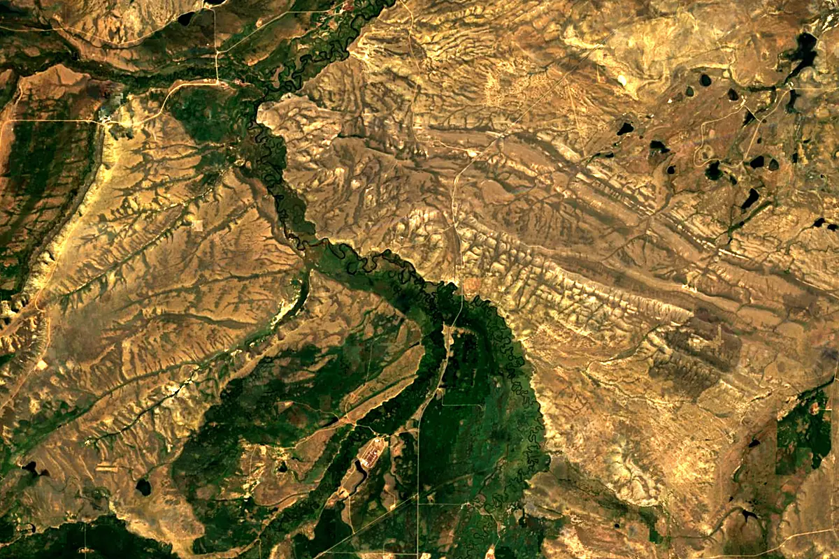
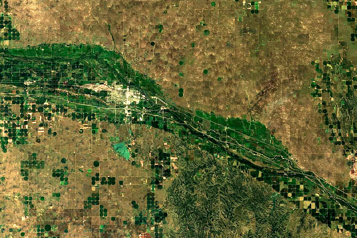
Sentinel-2 cloudless 2016 by EOX IT Services GmbH (contains modified Copernicus Sentinel data 2016), CC BY 4.0. The glowing line is the river as drawn by RiverATLAS.
Photos
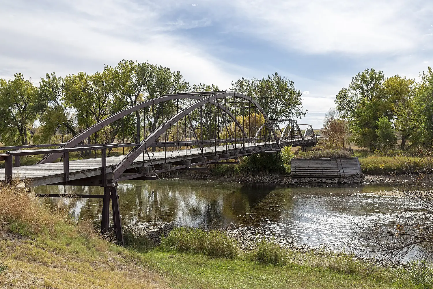
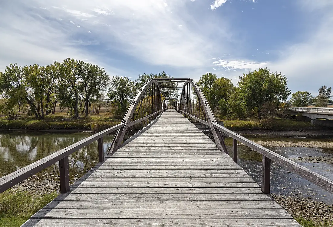
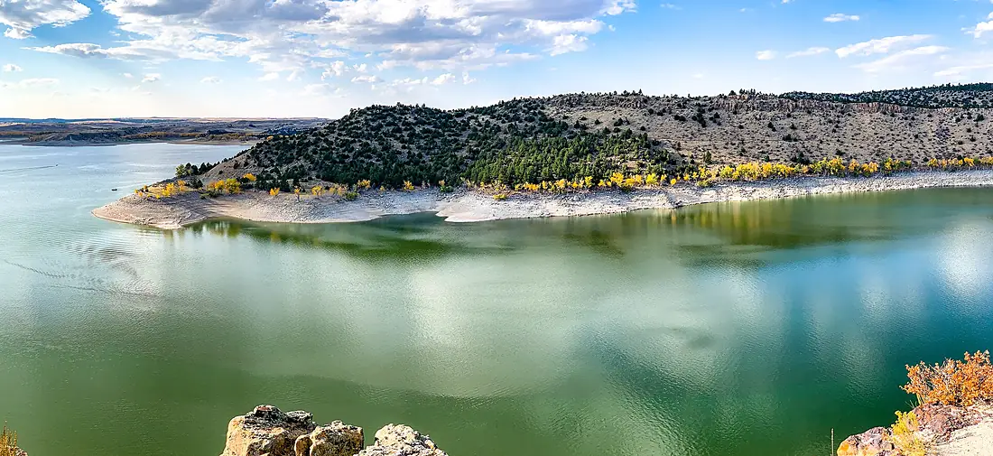
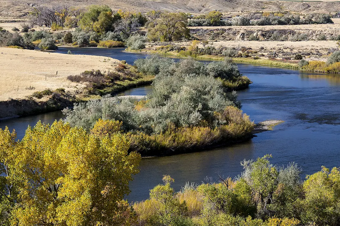
North Platte River in pictures
Tributaries
Where it flows, and what flows into it
It flows into
Platte RiverUnited States500 km200 m³/sTributaries (10)
Also: Laramie River, Sweetwater River, Medicine Bow River, Michigan River, Canadian River, Encampment River, Pumpkin Creek, Horse Creek, Rawhide Creek, Pass Creek
In the same basin
United States3,766 km12,700 m³/sMissouri RiverUnited States3,726 km2,500 m³/sOhio RiverUnited States1,579 km8,000 m³/sArkansas RiverUnited States2,364 km240 m³/sTennessee RiverUnited States1,049 km2,000 m³/sRed RiverUnited States2,189 km1,900 m³/sYellowstone RiverUnited States1,114 km390 m³/sCanadian RiverUnited States1,458 km200 m³/sIllinois RiverUnited States432 km660 m³/sAllegheny RiverUnited States523 km560 m³/sWhere these numbers come from
| Name, length, places | Wikidata (Q1755015) · CC0 |
|---|---|
| Course, profile, basin | RiverATLAS v1.0 (HydroATLAS, Linke et al. 2019) · CC BY 4.0 — followed from the source to the mouth given by Wikidata |
| Flow | WaterGAP (RiverATLAS), 1971–2000 · CC BY 4.0 |
| Climate along the river | WorldClim (RiverATLAS), 1970–2000 · CC BY 4.0 |
| Towns, bridges, dams | Wikidata · CC0; GeoNames · CC BY 4.0 |
| Along the river | © OpenStreetMap contributors · ODbL |
| Images | EOX Sentinel-2 cloudless 2016 · CC BY 4.0; Wikimedia Commons |
| Our other atlases | Lakeyas, Peakyas — Wikidata · CC0; © OpenStreetMap contributors · ODbL; GeoNames · CC BY 4.0; HydroLAKES · CC BY 4.0; NOAA OISST |
Every source and licence is on the data sources page.
The family
Do you prefer beaches, lakes, mountains, waterfalls, islands, rivers or canyons?
Same idea, other landscapes: field atlases built on open data, month by month, in seven languages.
 beaches
 Find your beach: sea temperature, sun and swimming month by month.Visit lakes
 Every lake on Earth: water temperature, ice, depth and the shore.Coming soonVisit mountains
 Every summit in 3D: summit weather, the 0 °C line, huts and trails.Visit
  waterfalls
 Every waterfall: height, flow month by month and when it roars.Coming soonVisit
  islands
 Every island from the sea up: size, sea temperature, ferries and 3D.Coming soonVisit
  rivers
 Every river from source to sea: the journey, the flow and the basin in numbers.You are here
 canyons
 Every canyon cut to scale: depth to the floor, rim and floor temperatures, trails and viewpoints.Coming soonVisit