River
Someș
418 km from source to mouth · Hungary and Romania.

 Hungary and RomaniaFlows into Tisza2nd longest in Hungary
In numbers
Length
418km
Average flow
120m³/s
Basin
15,015km²
Drop
592m
from 698 m to 106 m
Countries
2
The journey
From source to mouth
418 km of river and 37 stops on the way: 30 towns and cities on its banks, dams, bridges and the tributaries that feed it.
- 0 kmSourceat 698 m
- 18 kmRodna6,218 people
- 25 kmMăieru7,259 people
- 32 kmCormaia10,254 people
- 33 kmSângeorz-Băi8,244 people
- 39 kmIlva Mică3,431 people
- 47 kmFeldru6,967 people
- 62 kmRebrişoara4,637 people
- 67 kmNăsăud10,380 people
- 72 kmSalva4,368 people
- 76 kmNimigea de Sus5,457 people
- 94 kmBeclean10,909 people
- 108 kmUriu3,572 people
- 108 kmBraniştea3,347 people
- 122 kmMica3,799 people
- 124 kmSomeșul Mictributary
- 124 kmSomeșul Mare Rivertributary
- 127 kmDej38,033 people
- 131 kmCăşeiu4,791 people
- 142 kmSălătruc Rivertributary
- 205 kmSurduc3,934 people
- 208 kmAlmaș Rivertributary
- 211 kmAgrij Rivertributary
- 212 kmJibou11,183 people
- 240 kmUlmeni7,047 people
- 245 kmMireşu Mare5,054 people
- 249 kmSălsig3,097 people
- 257 kmFărcaşa3,716 people
- 271 kmLăpuș Rivertributary
- 288 kmSeini10,382 people
- 322 kmCulciu Mic3,941 people
- 327 kmOdoreu4,765 people
- 335 kmPăuleşti4,258 people
- 338 kmCable-stayed bridge of Satu Mare
- 340 kmSatu Mare112,490 people
- 351 kmVetiş4,365 people
- 358 kmCsenger5,225 people
- 410 kmVásárosnamény9,310 people
- 418 kmTiszaat 106 m
Water level along the river (RiverATLAS; the height is exaggerated). Towns: GeoNames and Wikidata; bridges, dams and tributaries: Wikidata.
River in Romania and Hungary
At the mouth it carries 120 m³/s on average: an Olympic pool every 21 seconds. It drops from 698 m to 106 m, 1.4 m per kilometre on average. Its basin covers 15,015 km², about the size of TL. 1.6 million people live in it. Highest water: from March to May; lowest: from December to February. Dams and reservoirs hold back a large share of its water (10% of a year's flow).
Where to start
- Satu MareLargest city on its banks · 112,490 people
- Satu Mare International Airport (SUJ)Nearest airport with scheduled flights, 11 km from the cityCar hire at DEB airport (Debrecen)Discover Cars · Affiliate link↗
- On the water6 ferry piers, marinas, boat rentals and boat ramps along the river (OpenStreetMap)
- From May to SeptemberThe best months to visit
Someș, month by month
Highest water: from March to May
Lowest water: from December to February. Best months to visit: from May to September.
From about 54 m³/s in the lowest month to 320 m³/s in the highest. An estimate: the monthly flow is modelled from the lowest and highest months of WaterGAP (RiverATLAS, 1971–2000) and the rain and snow along the river (WorldClim). Dams change the real rhythm. The chip is the average air temperature; below it, the month's rain.
Plan the trip
Plan the trip: boat trips, a bed by the river, a car
Some links above are affiliate links: if you book through them we may earn a commission, at no extra cost to you. It never changes what the data on this page says.
The basin
Someș: the basin in numbers
19,109 km² of land send their water to this river. This is what lives on it.
- 1.6millionpeople live in the basin
- 85/km²people per km²
- 460maverage altitude of the basin
- 686mmof rain a year (basin average)
- 8.3°Caverage air temperature
- 4%protected areas
- 0.1%covered by lakes
- 0.4km³held in reservoirs
What covers the basin
- 44% Forest
- 32% Cropland
- 32% Pasture
- 3% Towns and cities
RiverATLAS (HydroATLAS v1.0, CC BY 4.0): land cover, people, protected areas, glaciers and dams over the whole basin upstream of the mouth.
Along the river
Someș: what you find on the way
- 1Waterfalls
- 6Ferry piersSzamossályi-Porcsalma rév and 5 more
- 2River beachesPlaja PGR, Panyolai strand
From OpenStreetMap, within 2.0 km of the river. Not mapped is not the same as not there.
From space
The source and the mouth, seen from orbit
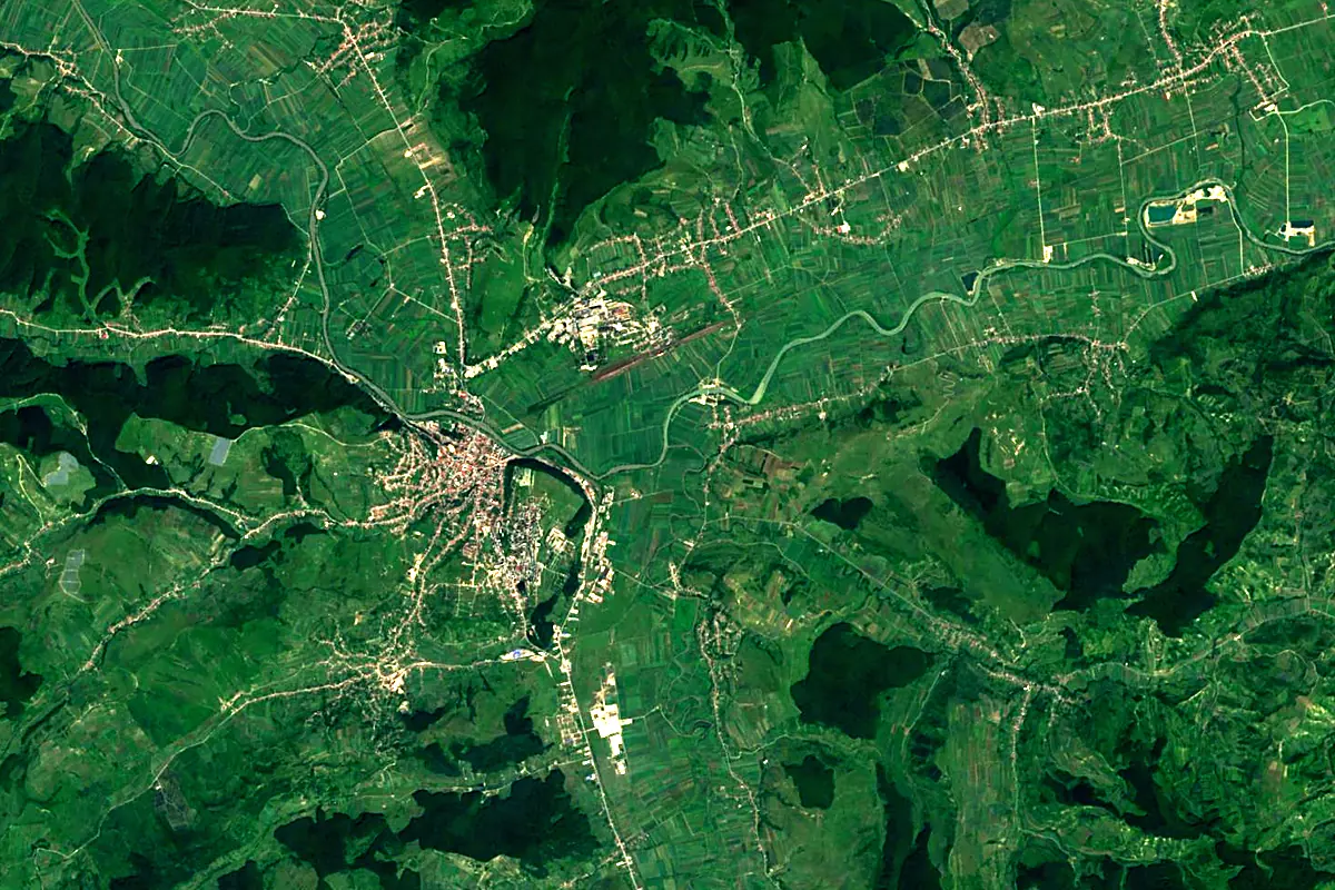
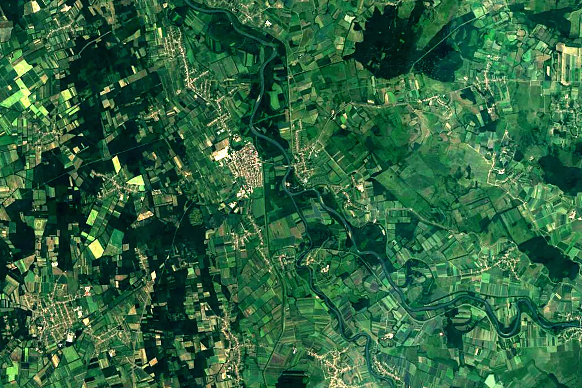
Sentinel-2 cloudless 2016 by EOX IT Services GmbH (contains modified Copernicus Sentinel data 2016), CC BY 4.0. The glowing line is the river as drawn by RiverATLAS.
Photos
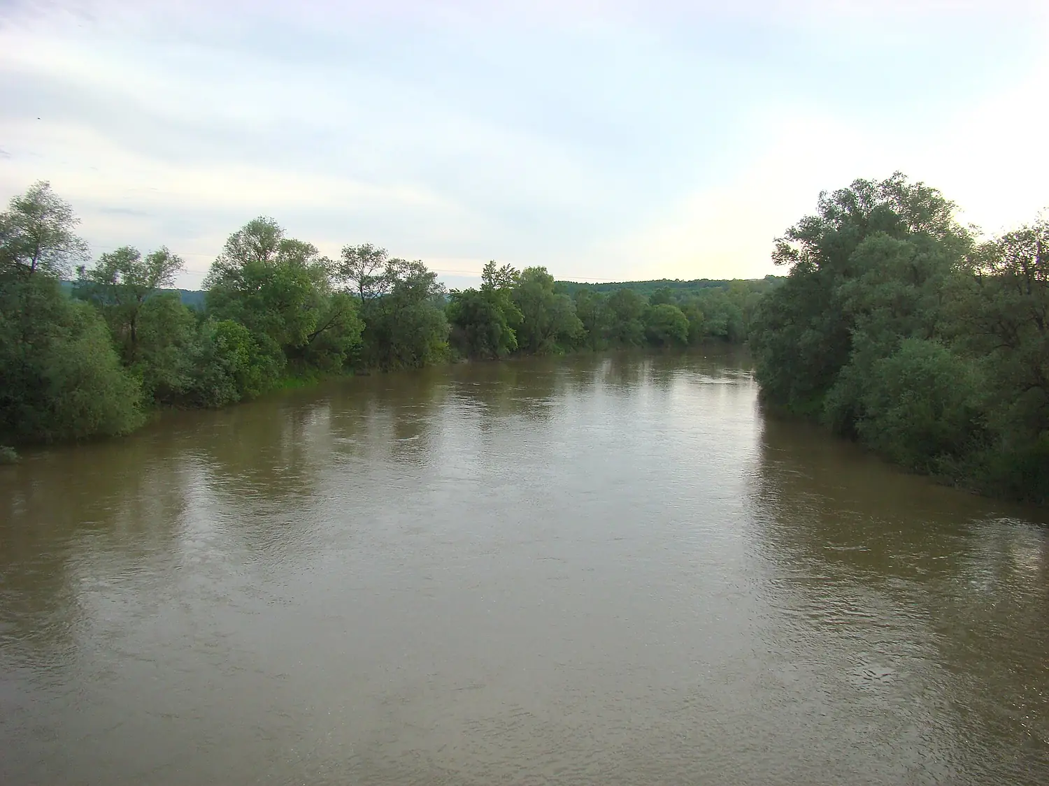
Someș in pictures
Tributaries
Where it flows, and what flows into it
It flows into
Tisza Serbia966 km800 m³/s
Tributaries (40)
Also: Someșul Mare River, Lăpuș River, Almaș River, Sălaj River, Agrij River, Jichiș River, Vad River, Șimișna, Balcaia River, Cristolțel River, Băița River, Arieș River, Bârsa River, Sălătruc River, Bicău River, Bârsău River, Bârsău River, Cheud River, Cicârlău River, Gârbou River, Olpret River, Lozna River, Valea Vinului River, Șinel River
 Croatia
 Germany
 Moldova
 Austria
Nearby
Rivers nearby
 Slovakia182 km37 m³/s54 km awayLaborecSlovakia129 km540 m³/s54 km awayUzh RiverSlovakia127 km33 m³/s60 km awayOndavaSlovakia146 km21 m³/s54 km awayBodrogHungary67 km120 m³/s69 km awaySajóHungary229 km70 m³/s94 km awayHornádHungary286 km31 m³/s101 km awayIza RiverRomania80 km17 m³/s114 km away
Where these numbers come from
| Name, length, places | Wikidata (Q217401) · CC0 |
|---|---|
| Course, profile, basin | RiverATLAS v1.0 (HydroATLAS, Linke et al. 2019) · CC BY 4.0 — followed from the source to the mouth given by Wikidata |
| Flow | WaterGAP (RiverATLAS), 1971–2000 · CC BY 4.0 |
| Climate along the river | WorldClim (RiverATLAS), 1970–2000 · CC BY 4.0 |
| Towns, bridges, dams | Wikidata · CC0; GeoNames · CC BY 4.0 |
| Along the river | © OpenStreetMap contributors · ODbL |
| Images | EOX Sentinel-2 cloudless 2016 · CC BY 4.0; Wikimedia Commons |
Every source and licence is on the data sources page.
The family
Do you prefer beaches, lakes, mountains, waterfalls, islands, rivers or canyons?
Same idea, other landscapes: field atlases built on open data, month by month, in seven languages.
 beaches
 Find your beach: sea temperature, sun and swimming month by month.Visit
  lakes
lakes Every lake on Earth: water temperature, ice, depth and the shore.Coming soonVisit
  mountains
 Every summit in 3D: summit weather, the 0 °C line, huts and trails.Visit
  waterfalls
 Every waterfall: height, flow month by month and when it roars.Coming soonVisit
  islands
 Every island from the sea up: size, sea temperature, ferries and 3D.Coming soonVisit
  rivers
 Every river from source to sea: the journey, the flow and the basin in numbers.You are here
 canyons
 Every canyon cut to scale: depth to the floor, rim and floor temperatures, trails and viewpoints.Coming soonVisit