River
Svitava
98 km from source to mouth · Czechia.
 CzechiaFlows into Svratka
In numbers
Length
98km
Average flow
5.2m³/s
Basin
1,149km²
Drop
228m
from 415 m to 187 m
Country
1
The journey
From source to mouth
98 km of river and 50 stops on the way: 26 towns and cities on its banks, dams, bridges and the tributaries that feed it.
- 0 kmSourceat 415 m
- 0 kmHradec nad Svitavou1,584 people
- 12 kmBřezová nad Svitavou1,518 people
- 15 kmBrněnec1,405 people
- 26 kmVodní nádrž Letovice0.8 km²
- 27 kmLetovice7,124 people
- 34 kmSvitávka1,700 people
- 34 kmKřetínkatributary
- 36 kmSemíčtributary
- 41 kmÚmořítributary
- 46 kmDoubravice nad Svitavou1,333 people
- 50 kmRájec-Jestřebí3,736 people
- 52 kmRáječko1,367 people
- 56 kmBlansko20,002 people
- 57 kmJežek's railway siding bridge
- 59 kmPunkvatributary
- 65 kmPytlácký vodopád
- 67 kmAdamov4,564 people
- 71 kmBabice nad Svitavou1,462 people
- 76 kmBílovice nad Svitavou3,725 people
- 79 kmrailway bridge over the Svitava and Mlýnské nábřeží in Brno
- 80 kmMakovského lávka
- 80 kmrailway bridge in Obřany
- 80 kmObřany Weir
- 80 kmObřanský most
- 80 kmObřany3,014 people
- 81 kmLávka Simony Monyové
- 81 kmCacovice Weir
- 81 kmBrno-Maloměřice a Obřany6,376 people
- 81 kmfootbridge over the Svitava near Olší street
- 81 kmMaloměřice II Weir
- 82 kmMaloměřice3,363 people
- 82 kmBaganka footbridge
- 82 kmMaloměřice Weir
- 82 kmMaloměřický most
- 82 kmVinohrady11,202 people
- 83 kmHusovický most
- 83 kmpipeline bridge over the Svitava in Husovice
- 84 kmHusovice6,915 people
- 84 kmHusovice Weir
- 84 kmZábrdovický most
- 85 kmRadlas Weir
- 85 kmŽidenice18,920 people
- 87 kmBrno402,739 people
- 87 kmBrno střed86,685 people
- 88 kmČernovice6,692 people
- 89 kmBrno-jih7,594 people
- 93 kmTuřany5,084 people
- 96 kmChrlice3,121 people
- 97 kmModřice5,755 people
- 98 kmRebešovice1,092 people
- 98 kmSvratkaat 187 m
Water level along the river (RiverATLAS; the height is exaggerated). Towns: GeoNames and Wikidata; bridges, dams and tributaries: Wikidata.
River in the Czech Republic
At the mouth it carries 5.2 m³/s on average: an Olympic pool every 479 seconds. It drops from 415 m to 187 m, 2.3 m per kilometre on average. Its basin covers 1,149 km², about the size of MQ. 619,000 people live in it. Highest water: March; lowest: from December to February. Dams and reservoirs hold back a large share of its water (16% of a year's flow).
Where to start
- BrnoLargest city on its banks · 402,739 people
- Brno-Tuřany Airport (BRQ)Nearest airport with scheduled flights, 8 km from the cityCar hire at BRQ airport (Brno)Discover Cars · Affiliate link↗
- On the water2 ferry piers, marinas, boat rentals and boat ramps along the river (OpenStreetMap)
- Kayak and canoe1 put-ins and rapids mapped (OpenStreetMap)
- From May to SeptemberThe best months to visit
Svitava, month by month
Highest water: March
Lowest water: from December to February. Best months to visit: from May to September.
From about 7.9 m³/s in the lowest month to 42 m³/s in the highest. An estimate: the monthly flow is modelled from the lowest and highest months of WaterGAP (RiverATLAS, 1971–2000) and the rain and snow along the river (WorldClim). Dams change the real rhythm. The chip is the average air temperature; below it, the month's rain.
Plan the trip
Plan the trip: boat trips, a bed by the river, a car
Some links above are affiliate links: if you book through them we may earn a commission, at no extra cost to you. It never changes what the data on this page says.
The basin
Svitava: the basin in numbers
2,935 km² of land send their water to this river. This is what lives on it.
- 619,000people live in the basin
- 211/km²people per km²
- 499maverage altitude of the basin
- 621mmof rain a year (basin average)
- 7.2°Caverage air temperature
- 14%protected areas
- 0.2%covered by lakes
- 0.1km³held in reservoirs
What covers the basin
- 40% Forest
- 37% Cropland
- 9% Pasture
- 9% Towns and cities
RiverATLAS (HydroATLAS v1.0, CC BY 4.0): land cover, people, protected areas, glaciers and dams over the whole basin upstream of the mouth.
Along the river
Svitava: what you find on the way
- 57Weirsjez Obřany, jez Cacovice, jez Maloměřice II and 54 more
- 1Waterfalls
- 1Rapids
- 2Marinas
From OpenStreetMap, within 1.5 km of the river. Not mapped is not the same as not there.
Cross-checked with our atlases
Svitava in our other atlases
What our sister atlases know about the waterfalls on this river, the lakes it flows through, the beaches at its mouth, the mountains where it rises and the islands off its mouth.
 1waterfall on the riverCascadyas
 1lake on its wayLakeyas
 26mountains at the sourcePeakyas
Waterfalls (1)
On the river, by Cascadyas
- Pytlácký vodopádkm 53
Cascadyas is coming soonOpen Cascadyas ↗
Lakes and reservoirs (1)
Lakes it flows through, by Lakeyas
- Vodní nádrž Letovicekm 210.8km²
Lakeyas is coming soonOpen Lakeyas ↗
Mountains at the source (26)
Within 15 km of the source, by Peakyas
- Drašarov12 km away687m
- Mladějovský vrch11 km away648m
- Palice15 km away · prominence 175 m613m
- Hřebcov11 km away636m
- Roh13 km away · prominence 208 m661m
- Hřebečov11 km away623m
- Kozlovský kopec10 km away604m
- Velký vrch14 km away604m
18 more on PeakyasOpen Peakyas ↗
From space
The source and the mouth, seen from orbit
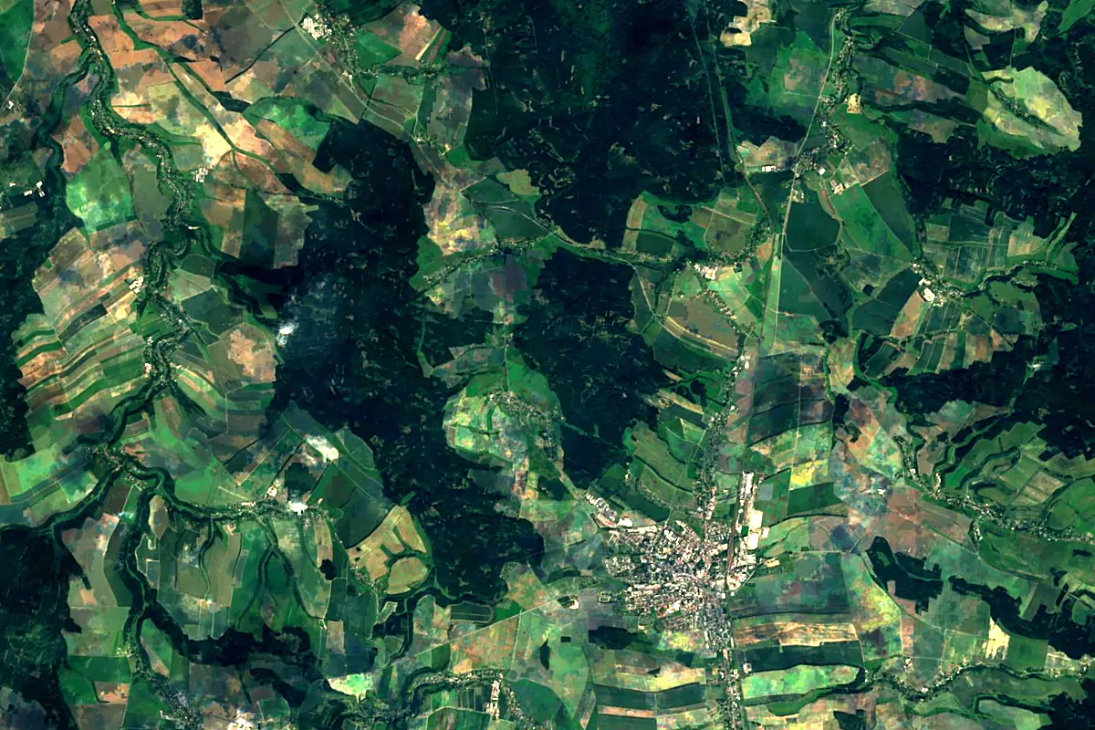
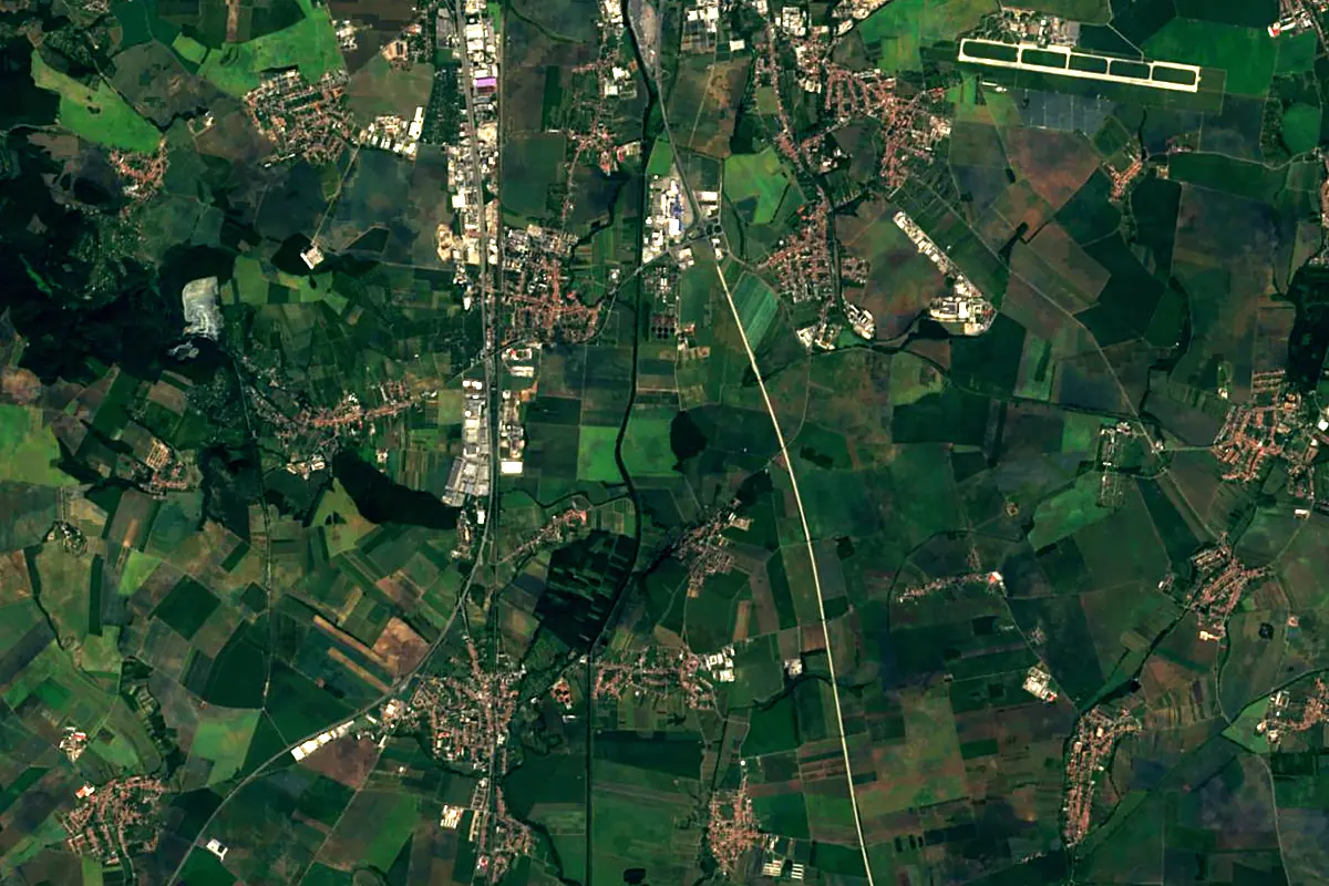
Sentinel-2 cloudless 2016 by EOX IT Services GmbH (contains modified Copernicus Sentinel data 2016), CC BY 4.0. The glowing line is the river as drawn by RiverATLAS.
Photos
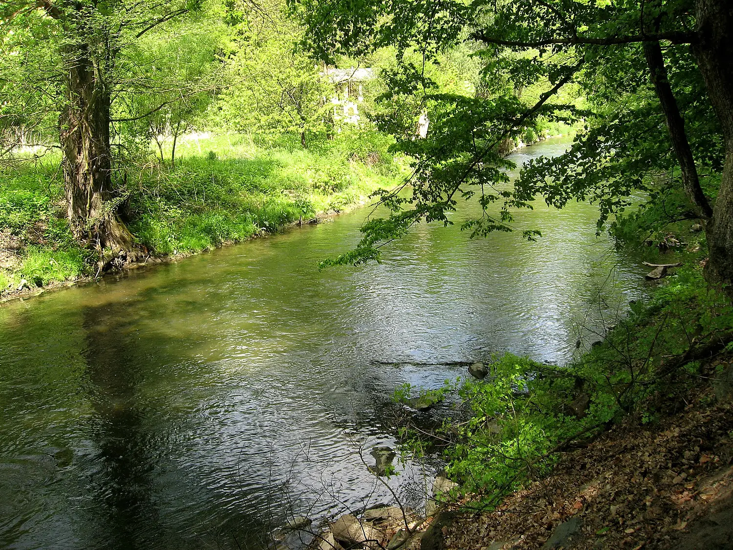
Svitava in pictures
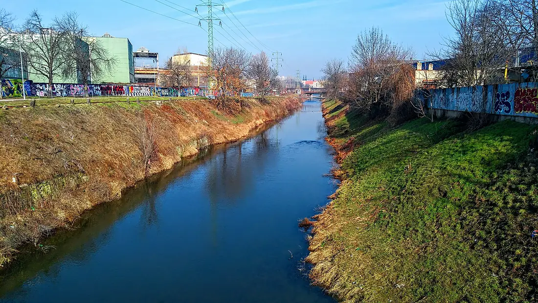
Tributaries
Where it flows, and what flows into it
It flows into
SvratkaCzechia174 km27 m³/sTributaries (10)
Also: Punkva, Křetínka, Křtinský potok, Bělá, Úmoří, Semíč, Býkovka, Časnýř, Melatín, Radiměřský potok
 Romania
 Serbia
 Croatia
 Germany
 Moldova
 Austria
Nearby
Rivers nearby
 Hungary
 Slovakia
Where these numbers come from
| Name, length, places | Wikidata (Q45094) · CC0 |
|---|---|
| Course, profile, basin | RiverATLAS v1.0 (HydroATLAS, Linke et al. 2019) · CC BY 4.0 — followed from the source to the mouth given by Wikidata |
| Flow | WaterGAP (RiverATLAS), 1971–2000 · CC BY 4.0 |
| Climate along the river | WorldClim (RiverATLAS), 1970–2000 · CC BY 4.0 |
| Towns, bridges, dams | Wikidata · CC0; GeoNames · CC BY 4.0 |
| Along the river | © OpenStreetMap contributors · ODbL |
| Images | EOX Sentinel-2 cloudless 2016 · CC BY 4.0; Wikimedia Commons |
| Our other atlases | Cascadyas, Lakeyas, Peakyas — Wikidata · CC0; © OpenStreetMap contributors · ODbL; GeoNames · CC BY 4.0; HydroLAKES · CC BY 4.0; NOAA OISST |
Every source and licence is on the data sources page.
The family
Do you prefer beaches, lakes, mountains, waterfalls, islands, rivers or canyons?
Same idea, other landscapes: field atlases built on open data, month by month, in seven languages.
 beaches
 Find your beach: sea temperature, sun and swimming month by month.Visit lakes
 Every lake on Earth: water temperature, ice, depth and the shore.Coming soonVisit mountains
 Every summit in 3D: summit weather, the 0 °C line, huts and trails.Visit waterfalls
 Every waterfall: height, flow month by month and when it roars.Coming soonVisit
  islands
 Every island from the sea up: size, sea temperature, ferries and 3D.Coming soonVisit
  rivers
 Every river from source to sea: the journey, the flow and the basin in numbers.You are here
 canyons
 Every canyon cut to scale: depth to the floor, rim and floor temperatures, trails and viewpoints.Coming soonVisit