River
Vienne
372 km from source to mouth · France.
 FranceFlows into Loire
In numbers
Length
372km
Average flow
210m³/s
Basin
21,105km²
Drop
584m
from 612 m to 28 m
Country
1
The journey
From source to mouth
372 km of river and 68 stops on the way: 53 towns and cities on its banks, dams, bridges and the tributaries that feed it.
- 0 kmMillevachesat 612 m
- 0 kmPeyrelevade824 people
- 17 kmFeuillade Rivertributary
- 32 kmEymoutiers2,042 people
- 38 kmAugne126 people
- 47 kmBujaleuf869 people
- 55 kmMauldetributary
- 59 kmEybouleuf463 people
- 62 kmSaint-Léonard-de-Noblat4,366 people
- 73 kmSaint-Priest-Taurion2,901 people
- 74 kmTauriontributary
- 75 kmSaint-Just-le-Martel2,606 people
- 81 kmCanetributary
- 82 kmLe Palais-sur-Vienne5,775 people
- 84 kmPanazol11,342 people
- 88 kmLimoges129,937 people
- 93 kmIsle7,995 people
- 94 kmCondat-sur-Vienne5,281 people
- 97 kmBosmie-l'Aiguille2,667 people
- 98 kmBriancetributary
- 98 kmBeynac735 people
- 103 kmAixe-sur-Vienne5,890 people
- 108 kmSaint-Priest-sous-Aixe1,743 people
- 109 kmVerneuil-sur-Vienne4,903 people
- 122 kmSaint-Victurnien1,774 people
- 122 kmCognac-la-Forêt1,188 people
- 128 kmSaint-Brice-sur-Vienne1,656 people
- 132 kmSaint-Junien11,415 people
- 134 kmGlanetributary
- 135 kmChaillac-sur-Vienne1,250 people
- 143 kmÉtagnac982 people
- 146 kmChassenon836 people
- 150 kmChabanais1,589 people
- 151 kmGorretributary
- 155 kmExideuil-sur-Vienne1,035 people
- 160 kmChirac781 people
- 167 kmSaint-Maurice-des-Lions892 people
- 171 kmAnsac-sur-Vienne815 people
- 174 kmConfolens2,730 people
- 179 kmGoiretributary
- 185 kmAbzac518 people
- 188 kmAvailles-Limouzine1,312 people
- 220 kmBlourdetributary
- 227 kmLussac-les-Châteaux2,263 people
- 233 kmCivaux1,210 people
- 241 kmValdivienne2,715 people
- 250 kmChauvigny7,007 people
- 256 kmBonnes1,688 people
- 262 kmLa Chapelle-Moulière723 people
- 266 kmBonneuil-Matours2,081 people
- 271 kmVouneuil-sur-Vienne2,277 people
- 276 kmAvailles-en-Châtellerault1,730 people
- 278 kmCenon-sur-Vienne1,666 people
- 280 kmClaintributary
- 281 kmOzontributary
- 283 kmEnvignetributary
- 284 kmChâtellerault31,003 people
- 288 kmAntran1,148 people
- 292 kmIngrandes1,709 people
- 300 kmDangé-Saint-Romain2,959 people
- 305 kmLes Ormes1,613 people
- 311 kmCreusetributary
- 332 kmL'Île-Bouchard1,606 people
- 334 kmMansetributary
- 345 kmVeudetributary
- 351 kmChinon8,144 people
- 356 kmBeaumont-en-Véron2,717 people
- 362 kmSavigny-en-Véron1,541 people
- 368 kmMontsoreau408 people
- 372 kmLoireat 28 m
Water level along the river (RiverATLAS; the height is exaggerated). Towns: GeoNames and Wikidata; bridges, dams and tributaries: Wikidata.
River in France, tributary of the Loire
At the mouth it carries 210 m³/s on average: an Olympic pool every 12 seconds. It drops from 612 m to 28 m, 1.6 m per kilometre on average. Its basin covers 21,105 km², about the size of SV. 1.0 million people live in it. Highest water: from December to February. Its dams hold back little of its water (3.4% of a year's flow).
Where to start
- LimogesLargest city on its banks · 129,937 people
- Limoges Airport (LIG)Nearest airport with scheduled flights, 7 km from the cityCar hire at LIG airport (Limoges/Bellegarde)Discover Cars · Affiliate link↗
- On the water30 ferry piers, marinas, boat rentals and boat ramps along the river (OpenStreetMap)
- From May to SeptemberThe best months to visit
Vienne, month by month
Highest water: from December to February
Best months to visit: from May to September.
From about 79 m³/s in the lowest month to 340 m³/s in the highest. An estimate: the monthly flow is modelled from the lowest and highest months of WaterGAP (RiverATLAS, 1971–2000) and the rain and snow along the river (WorldClim). Dams change the real rhythm. The chip is the average air temperature; below it, the month's rain.
Plan the trip
Plan the trip: boat trips, a bed by the river, a car
Some links above are affiliate links: if you book through them we may earn a commission, at no extra cost to you. It never changes what the data on this page says.
The basin
Vienne: the basin in numbers
21,028 km² of land send their water to this river. This is what lives on it.
- 1.0millionpeople live in the basin
- 48/km²people per km²
- 257maverage altitude of the basin
- 850mmof rain a year (basin average)
- 10.9°Caverage air temperature
- 20%protected areas
- 0.3%covered by lakes
- 0.2km³held in reservoirs
What covers the basin
- 17% Forest
- 33% Cropland
- 21% Pasture
- 1% Towns and cities
RiverATLAS (HydroATLAS v1.0, CC BY 4.0): land cover, people, protected areas, glaciers and dams over the whole basin upstream of the mouth.
Along the river
Vienne: what you find on the way
- 111WeirsSeuil de la Centrale de Brignac, Seuil du Moulin des Roches, Seuil du Moulin du Forgeron and 108 more
- 1Waterfalls
- 26Boat rampsAixe canoë-kayak, Le Moulin de Gady and 24 more
- 2Ferry piersPort of the Château de Montsoreau-Museum of contemporary art, Bateau Amarante
- 1River beachesPlage de Bonneuil-Matours
From OpenStreetMap, within 2.0 km of the river. Not mapped is not the same as not there.
Cross-checked with our atlases
Vienne in our other atlases
What our sister atlases know about the waterfalls on this river, the lakes it flows through, the beaches at its mouth, the mountains where it rises and the islands off its mouth.
 2mountains at the sourcePeakyas
Mountains at the source (2)
Within 15 km of the source, by Peakyas
- Mont Bessou12 km away976m
- Puy Pendu10 km away973m
From space
The source and the mouth, seen from orbit
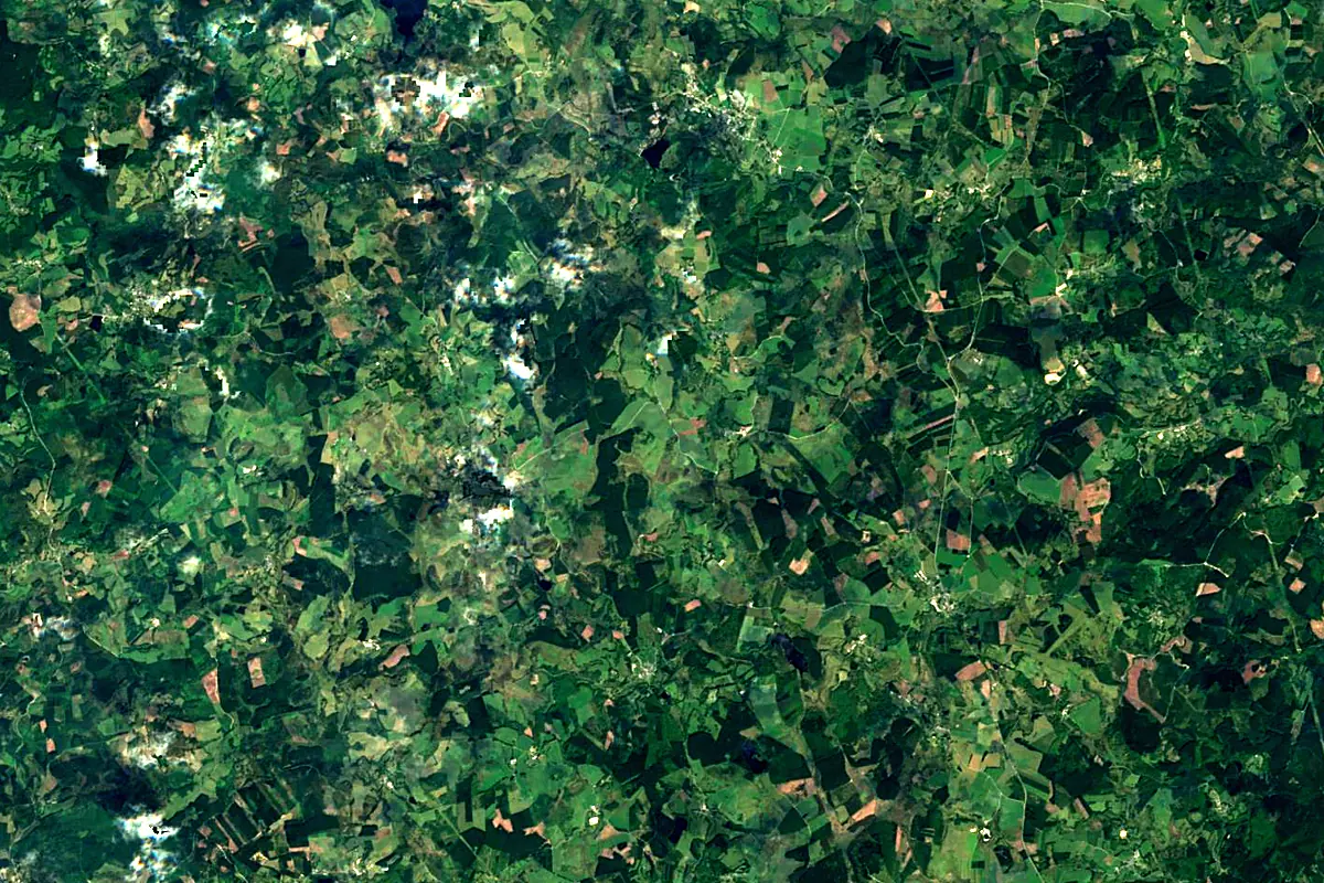
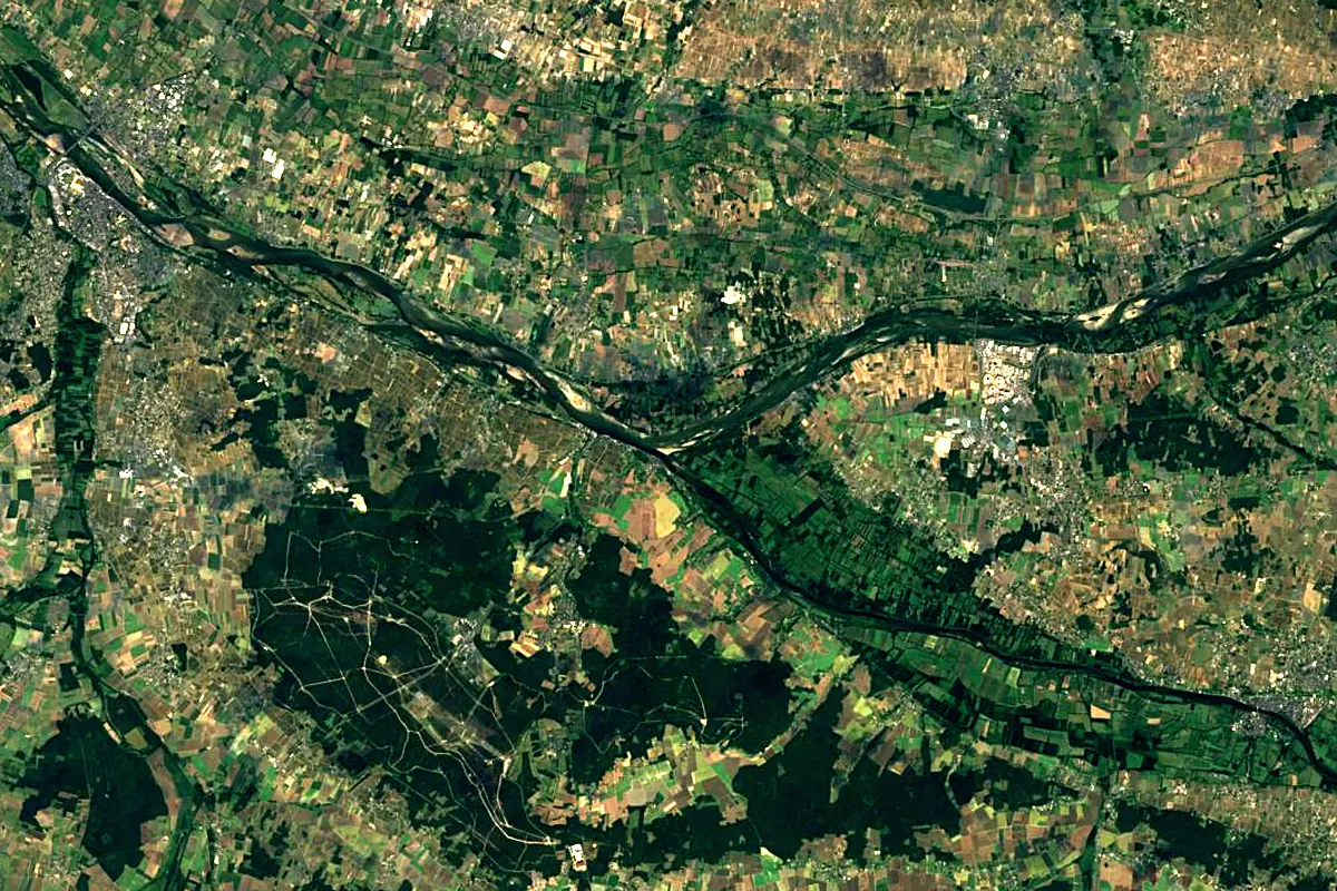
Sentinel-2 cloudless 2016 by EOX IT Services GmbH (contains modified Copernicus Sentinel data 2016), CC BY 4.0. The glowing line is the river as drawn by RiverATLAS.
Photos
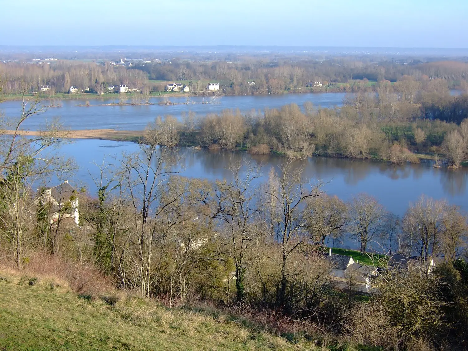
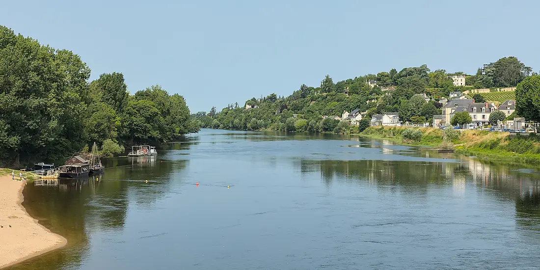
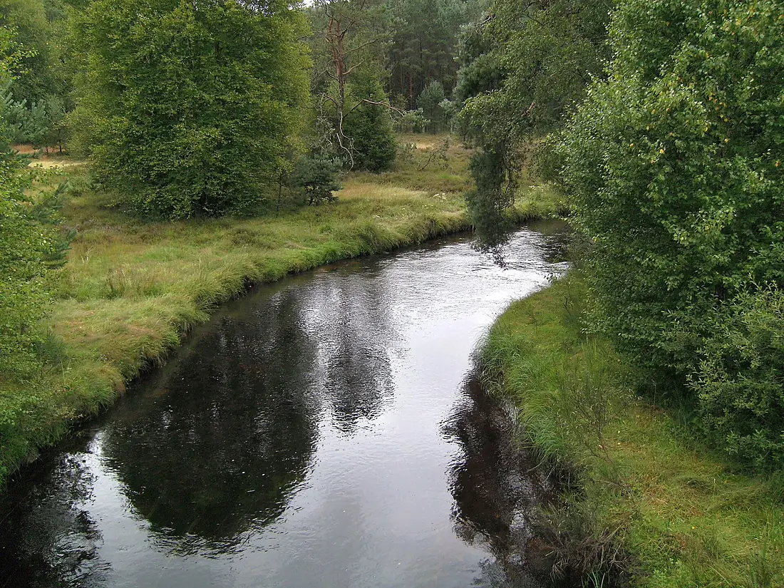
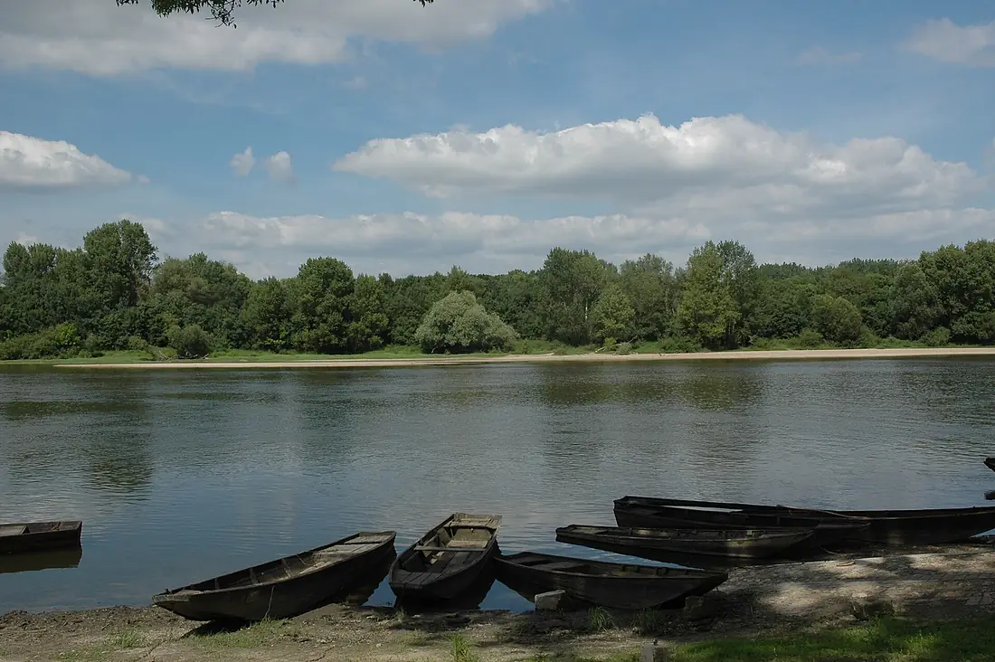
Vienne in pictures
Tributaries
Where it flows, and what flows into it
It flows into
LoireFrance1,006 km840 m³/sTributaries (26)
Also: Taurion, Briance, Combade, Gorre, Blourde, Glane, Grêne, Issoire, Maulde, Manse, Veude, Aixette, Goire, Ozon, Aurence, Envigne, Valoine, Bourouse, Feuillade River, Réveillon, Cane, Petite Blourde, Négron, Dive
Nearby
Rivers nearby
Where these numbers come from
| Name, length, places | Wikidata (Q659546) · CC0 |
|---|---|
| Course, profile, basin | RiverATLAS v1.0 (HydroATLAS, Linke et al. 2019) · CC BY 4.0 — followed from the source to the mouth given by Wikidata |
| Flow | WaterGAP (RiverATLAS), 1971–2000 · CC BY 4.0 |
| Climate along the river | WorldClim (RiverATLAS), 1970–2000 · CC BY 4.0 |
| Towns, bridges, dams | Wikidata · CC0; GeoNames · CC BY 4.0 |
| Along the river | © OpenStreetMap contributors · ODbL |
| Images | EOX Sentinel-2 cloudless 2016 · CC BY 4.0; Wikimedia Commons |
| Our other atlases | Peakyas — Wikidata · CC0; © OpenStreetMap contributors · ODbL; GeoNames · CC BY 4.0; HydroLAKES · CC BY 4.0; NOAA OISST |
Every source and licence is on the data sources page.
The family
Do you prefer beaches, lakes, mountains, waterfalls, islands, rivers or canyons?
Same idea, other landscapes: field atlases built on open data, month by month, in seven languages.
 beaches
 Find your beach: sea temperature, sun and swimming month by month.Visit
  lakes
lakes Every lake on Earth: water temperature, ice, depth and the shore.Coming soonVisit mountains
 Every summit in 3D: summit weather, the 0 °C line, huts and trails.Visit
  waterfalls
 Every waterfall: height, flow month by month and when it roars.Coming soonVisit
  islands
 Every island from the sea up: size, sea temperature, ferries and 3D.Coming soonVisit
  rivers
 Every river from source to sea: the journey, the flow and the basin in numbers.You are here
 canyons
 Every canyon cut to scale: depth to the floor, rim and floor temperatures, trails and viewpoints.Coming soonVisit