River
Allier
421 km from source to mouth · France.
 FranceFlows into Loire10th longest in France
In numbers
Length
421km
Average flow
150m³/s
Basin
14,321km²
Drop
774m
from 940 m to 166 m
Country
1
The journey
From source to mouth
421 km of river and 68 stops on the way: 54 towns and cities on its banks, dams, bridges and the tributaries that feed it.
- 0 kmMoure de la Gardilleat 940 m
- 14 kmLangogne2,836 people
- 18 kmLac de Naussac9.0 km²
- 21 kmPradelles531 people
- 40 kmChapeaurouxtributary
- 95 kmDesgestributary
- 96 kmLangeac3,499 people
- 97 kmMazeyrat-d'Allier1,432 people
- 112 kmCroncetributary
- 130 kmCérouxtributary
- 131 kmSenouiretributary
- 135 kmBrioude6,527 people
- 148 kmAuzon858 people
- 150 kmVergongheon1,797 people
- 153 kmBrassac-les-Mines3,412 people
- 159 kmAuzat-la-Combelle1,956 people
- 161 kmAlagnontributary
- 176 kmEau Mèretributary
- 176 kmIssoire15,115 people
- 190 kmCouze Chambontributary
- 190 kmCouze Pavintributary
- 192 kmVic-le-Comte5,396 people
- 203 kmLes Martres-de-Veyre3,826 people
- 207 kmLe Cendre5,415 people
- 209 kmCournon-d'Auvergne19,951 people
- 219 kmPont-du-Château12,412 people
- 224 kmBeauregard-l'Évêque1,586 people
- 239 kmMaringues3,141 people
- 260 kmDoretributary
- 261 kmMariol679 people
- 268 kmSaint-Yorre2,641 people
- 272 kmHauterive1,186 people
- 273 kmAbrest2,915 people
- 278 kmBellerive-sur-Allier8,943 people
- 278 kmVichy25,115 people
- 283 kmCharmeil947 people
- 285 kmCreuzier-le-Vieux3,205 people
- 286 kmSaint-Rémy-en-Rollat1,774 people
- 291 kmSaint-Germain-des-Fossés3,579 people
- 293 kmMarcenat386 people
- 294 kmBilly817 people
- 297 kmCréchy428 people
- 304 kmParay-sous-Briailles616 people
- 305 kmVarennes-sur-Allier3,549 people
- 309 kmSaint-Pourçain-sur-Sioule4,884 people
- 311 kmSaint-Loup575 people
- 315 kmAndelottributary
- 315 kmContigny573 people
- 316 kmSiouletributary
- 318 kmMonétay-sur-Allier536 people
- 320 kmLa Ferté-Hauterive254 people
- 321 kmChâtel-de-Neuvre563 people
- 326 kmBessay-sur-Allier1,382 people
- 332 kmChemilly580 people
- 337 kmToulon-sur-Allier1,166 people
- 339 kmBressolles1,143 people
- 343 kmMoulins19,206 people
- 346 kmNeuvy1,475 people
- 347 kmAvermes4,074 people
- 352 kmTrévol1,643 people
- 353 kmMontilly488 people
- 359 kmVilleneuve-sur-Allier1,024 people
- 362 kmBagneux329 people
- 367 kmAubigny146 people
- 371 kmSaint-Léopardin-d'Augy354 people
- 372 kmBurgetributary
- 386 kmLe Veurdre475 people
- 387 kmChâteau-sur-Allier160 people
- 417 kmMarzy3,623 people
- 421 kmLoireat 166 m
Water level along the river (RiverATLAS; the height is exaggerated). Towns: GeoNames and Wikidata; bridges, dams and tributaries: Wikidata.
River in France
At the mouth it carries 147 m³/s on average: an Olympic pool every 17 seconds. It drops from 940 m to 166 m, 1.8 m per kilometre on average. Its basin covers 14,321 km², about the size of ME. 885,000 people live in it. Highest water: from November to January and June. Its dams hold back little of its water (6.1% of a year's flow).
Where to start
- VichyLargest city on its banks · 25,115 people
- Clermont-Ferrand Auvergne airport (CFE)Nearest airport with scheduled flights, 43 km from the cityCar hire at CFE airport (Clermont-Ferrand)Discover Cars · Affiliate link↗
- On the water25 ferry piers, marinas, boat rentals and boat ramps along the river (OpenStreetMap)
- Kayak and canoe2 put-ins and rapids mapped (OpenStreetMap)
- From June to SeptemberThe best months to visit
Allier, month by month
Highest water: from November to January and June
Best months to visit: from June to September.
From about 42 m³/s in the lowest month to 210 m³/s in the highest. An estimate: the monthly flow is modelled from the lowest and highest months of WaterGAP (RiverATLAS, 1971–2000) and the rain and snow along the river (WorldClim). Dams change the real rhythm. The chip is the average air temperature; below it, the month's rain.
Plan the trip
Plan the trip: boat trips, a bed by the river, a car
Some links above are affiliate links: if you book through them we may earn a commission, at no extra cost to you. It never changes what the data on this page says.
The basin
Allier: the basin in numbers
14,308 km² of land send their water to this river. This is what lives on it.
- 885,000people live in the basin
- 62/km²people per km²
- 659maverage altitude of the basin
- 753mmof rain a year (basin average)
- 9.2°Caverage air temperature
- 30%protected areas
- 0.1%covered by lakes
- 0.3km³held in reservoirs
What covers the basin
- 40% Forest
- 24% Cropland
- 33% Pasture
- 3% Towns and cities
RiverATLAS (HydroATLAS v1.0, CC BY 4.0): land cover, people, protected areas, glaciers and dams over the whole basin upstream of the mouth.
Along the river
Allier: what you find on the way
- 18WeirsBarrage des Lorrains and 17 more
- 9LocksBief de Rocpierre, Rigole d'Alimentation des Lorrains, Canal Latéral à la Loire and 6 more
- 6WaterfallsCascade d'Alleyras, Cascades de la Besque, Cascade d'Enval and 3 more
- 2Canoe put-insEmbarquement Saint-Étienne-du-Vigan
- 9Boat ramps
- 6Ferry piersBoucle des Isles, Pont Jacques Chirac, Sporting Golf and 3 more
- 4MarinasCentre Nautique, Port de la Rotonde, Halte Nautique de Guétin and 1 more
- 3River beachesPlage de l’Île d'Amour, Plage des Célestins, Moulins Bain
From OpenStreetMap, within 1.9 km of the river. Not mapped is not the same as not there.
Cross-checked with our atlases
Allier in our other atlases
What our sister atlases know about the waterfalls on this river, the lakes it flows through, the beaches at its mouth, the mountains where it rises and the islands off its mouth.
 1lake on its wayLakeyas
 18mountains at the sourcePeakyas
Lakes and reservoirs (1)
Lakes it flows through, by Lakeyas
- Lac de Naussackm 14 · 50 m deep9.0km²
Lakeyas is coming soonOpen Lakeyas ↗
Mountains at the source (18)
Within 15 km of the source, by Peakyas
- Moure de la Gardille10 km away1,505m
- Les Valadous13 km away1,548m
- serre de la Croix de Bauzons13 km away1,548m
- Tanargue15 km away1,511m
- La Loubeire2.7 km away
- Montalafia11 km away
- Serre du Brugeas9.5 km away
- Serre de la Pialade8.3 km away
10 more on PeakyasOpen Peakyas ↗
From space
The source and the mouth, seen from orbit
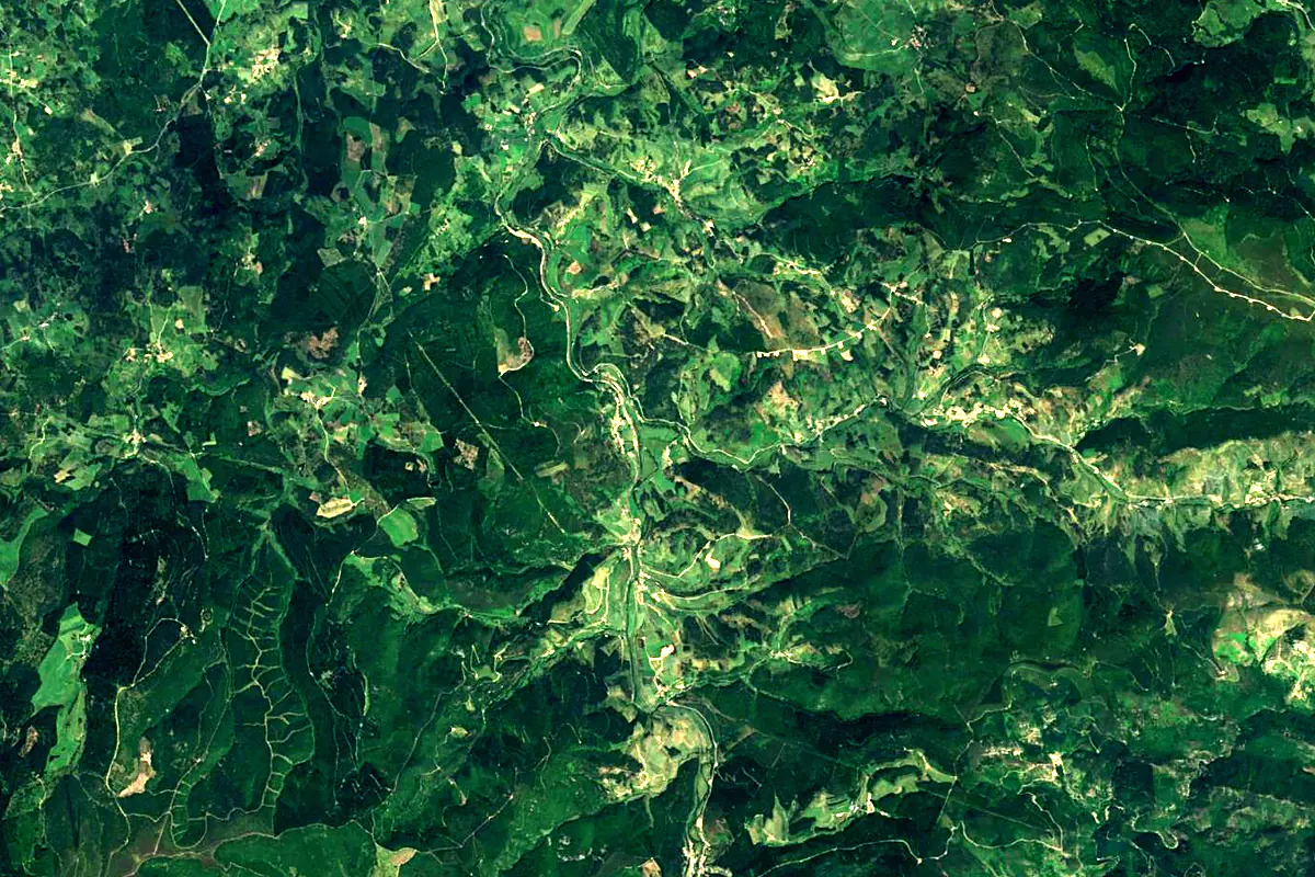
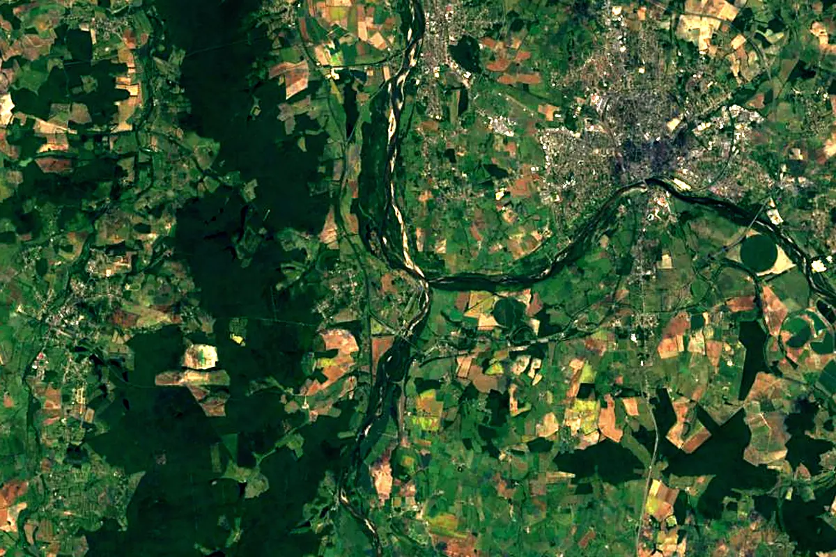
Sentinel-2 cloudless 2016 by EOX IT Services GmbH (contains modified Copernicus Sentinel data 2016), CC BY 4.0. The glowing line is the river as drawn by RiverATLAS.
Photos
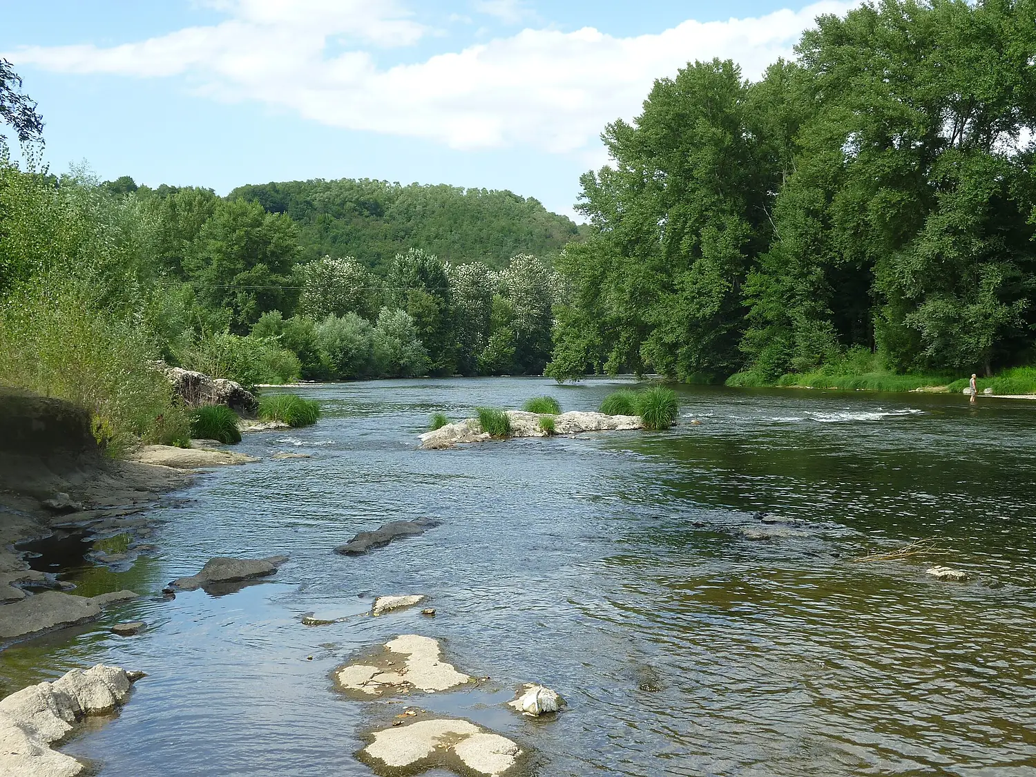
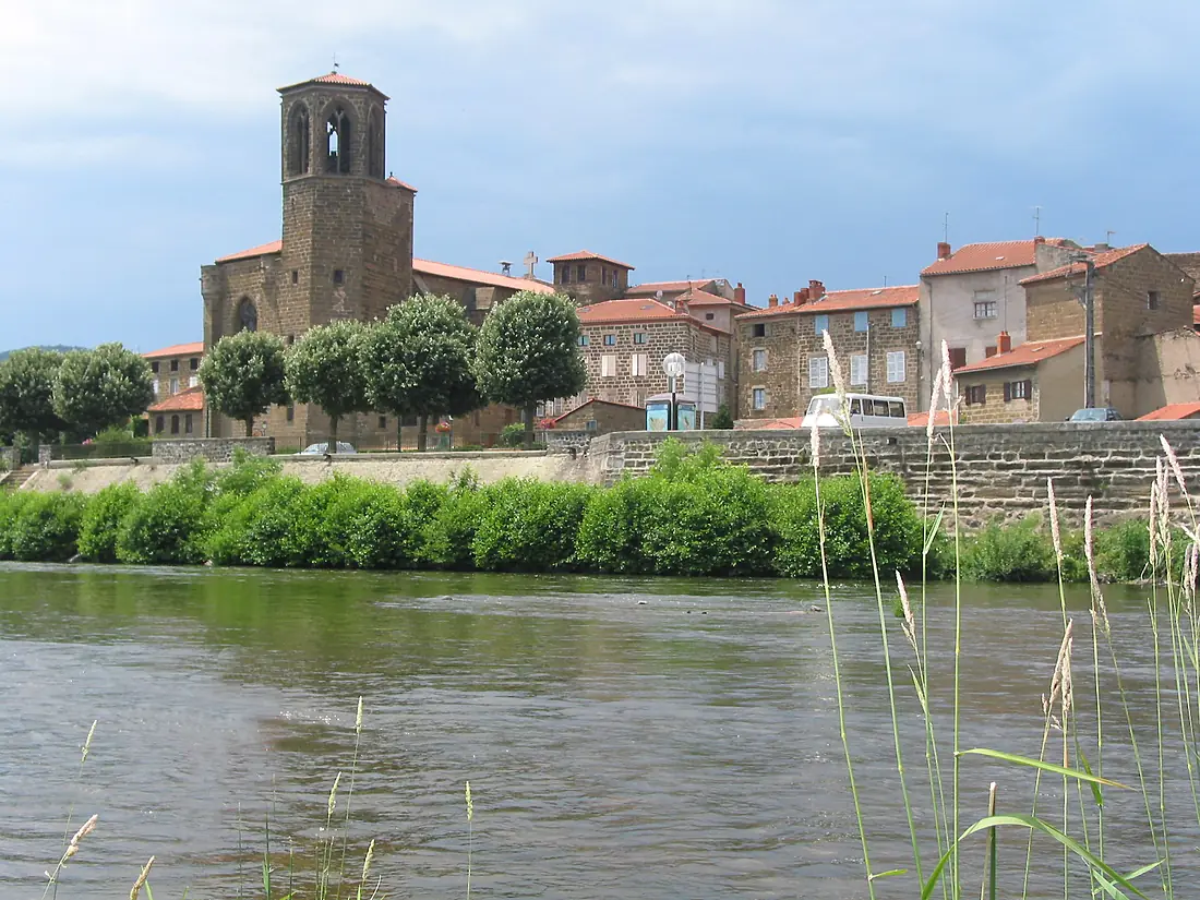
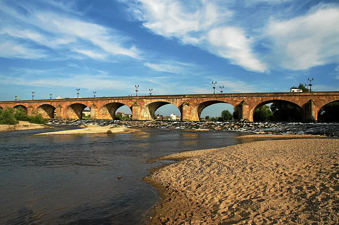
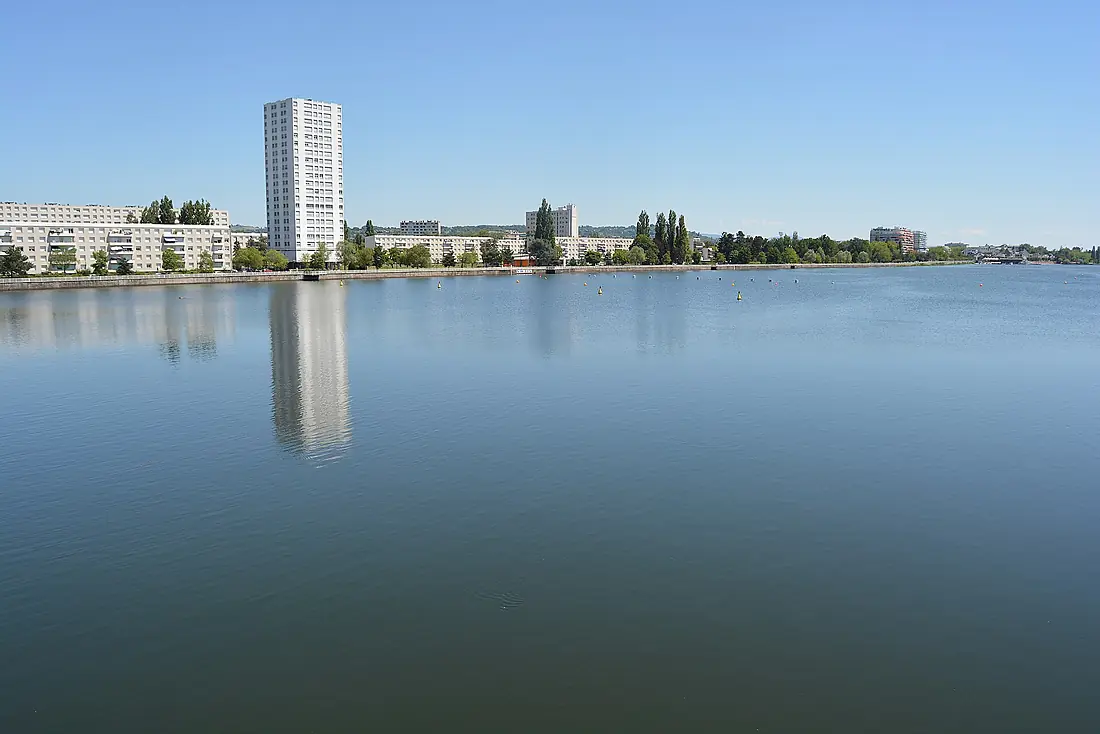
Allier in pictures
Tributaries
Where it flows, and what flows into it
It flows into
LoireFrance1,006 km840 m³/sTributaries (37)
Also: Sioule, Alagnon, Dore, Chapeauroux, Senouire, Couze Pavin, Andelot, Couze Chambon, Burge, Morge, Couze d'Ardes, Sichon, Langouyrou, Auzon, Ance du Sud, Artière, Céroux, Eau Mère, Valençon, Ruisseau le Litroux, Bieudre, Auzon, Cronce, Desges
Nearby
Rivers nearby
Where these numbers come from
| Name, length, places | Wikidata (Q2464) · CC0 |
|---|---|
| Course, profile, basin | RiverATLAS v1.0 (HydroATLAS, Linke et al. 2019) · CC BY 4.0 — followed along the river network from the point given by Wikidata |
| Flow | WaterGAP (RiverATLAS), 1971–2000 · CC BY 4.0 |
| Climate along the river | WorldClim (RiverATLAS), 1970–2000 · CC BY 4.0 |
| Towns, bridges, dams | Wikidata · CC0; GeoNames · CC BY 4.0 |
| Along the river | © OpenStreetMap contributors · ODbL |
| Images | EOX Sentinel-2 cloudless 2016 · CC BY 4.0; Wikimedia Commons |
| Our other atlases | Lakeyas, Peakyas — Wikidata · CC0; © OpenStreetMap contributors · ODbL; GeoNames · CC BY 4.0; HydroLAKES · CC BY 4.0; NOAA OISST |
Every source and licence is on the data sources page.
The family
Do you prefer beaches, lakes, mountains, waterfalls, islands, rivers or canyons?
Same idea, other landscapes: field atlases built on open data, month by month, in seven languages.
 beaches
 Find your beach: sea temperature, sun and swimming month by month.Visit lakes
 Every lake on Earth: water temperature, ice, depth and the shore.Coming soonVisit mountains
 Every summit in 3D: summit weather, the 0 °C line, huts and trails.Visit
  waterfalls
 Every waterfall: height, flow month by month and when it roars.Coming soonVisit
  islands
 Every island from the sea up: size, sea temperature, ferries and 3D.Coming soonVisit
  rivers
 Every river from source to sea: the journey, the flow and the basin in numbers.You are here
 canyons
 Every canyon cut to scale: depth to the floor, rim and floor temperatures, trails and viewpoints.Coming soonVisit