River
Lech
248 km from source to mouth · Germany and Austria.

 Germany and AustriaFlows into Danube
In numbers
Length
248km
Average flow
120m³/s
Basin
4,100km²
Drop
945m
from 1,333 m to 388 m
Countries
2
The journey
From source to mouth
248 km of river and 55 stops on the way: 16 towns and cities on its banks, dams, bridges and the tributaries that feed it.
- 0 kmSourceat 1,333 m
- 22 kmWooden bridge over the Lech, creek
- 25 kmLechbrücke Bach
- 46 kmHornbachtributary
- 64 kmReutte6,989 people
- 68 kmAußerfernbahn Lechbrücke
- 75 kmWeißensee1.1 km²
- 78 kmLechfall
- 78 kmFüssen15,334 people
- 79 kmAlpsee0.7 km²
- 79 kmLechstaustufe Horn
- 81 kmVilstributary
- 81 kmSchwangau3,505 people
- 84 kmBannwaldsee2.1 km²
- 90 kmForggensee12 km²
- 90 kmForggensee dam
- 94 kmHalblechtributary
- 95 kmLechstaustufe 2 – Prem1.0 km²
- 98 kmLechbruck am See2,767 people
- 101 kmLechstausee Urspring1.2 km²
- 101 kmIllachtributary
- 107 kmDeutensee0.4 km²
- 116 kmLechstaustufe 6 – Dornau1.6 km²
- 117 kmAltenstadt3,282 people
- 117 kmSchongau12,676 people
- 118 kmPeiting12,106 people
- 124 kmLechstaustufe 8 – Sperber
- 126 kmLechstaustufe 8a – Kinsau
- 130 kmLechstaustufe 9 – Apfeldorf
- 130 kmRott-Bachtributary
- 136 kmLechstaustufe 11 – Lechblick
- 138 kmLechstaustufe 12 – Lechmühlen
- 142 kmLechstaustufe 13 – Dornstetten
- 146 kmLechstaustufe 14 – Pitzling
- 149 kmLechstaustufe 15 – Landsberg
- 151 kmLandsberg am Lech29,230 people
- 155 kmKaufering railway bridge
- 156 kmKaufering9,820 people
- 159 kmLechstaustufe 18 – Kaufering
- 179 kmMandichosee1.3 km²
- 183 kmWeitmannsee0.3 km²
- 185 kmKissing11,150 people
- 190 kmEiskanal
- 195 kmUlrichsbrücke
- 195 kmAugsburg301,786 people
- 199 kmLechbrücke Gersthofen
- 201 kmGersthofen20,254 people
- 205 kmWertachtributary
- 209 kmLangweid7,653 people
- 215 kmMeitingen11,201 people
- 217 kmThierhaupten3,841 people
- 221 kmLechstaustufe Ellgau
- 232 kmRain8,438 people
- 233 kmLechstaustufe Rain
- 244 kmLech-Donau-Winkel
- 246 kmBertoldsheimer Stausee1.2 km²
- 248 kmDanubeat 388 m
Water level along the river (RiverATLAS; the height is exaggerated). Towns: GeoNames and Wikidata; bridges, dams and tributaries: Wikidata.
River in Austria and Germany, tributary of Danube
At the mouth it carries 120 m³/s on average: an Olympic pool every 21 seconds. It drops from 1,333 m to 388 m, 3.8 m per kilometre on average. Its basin covers 4,100 km², about the size of CV. 3.0 million people live in it. Highest water: from April to May; lowest: from December to February. Its dams hold back little of its water (2.1% of a year's flow).
Where to start
- AugsburgLargest city on its banks · 301,786 people
- Memmingen Allgau Airport (FMM)Nearest airport with scheduled flights, 65 km from the cityCar hire at FMM airport (Memmingen)Discover Cars · Affiliate link↗
- On the water69 ferry piers, marinas, boat rentals and boat ramps along the river (OpenStreetMap)
- Kayak and canoe7 put-ins and rapids mapped (OpenStreetMap)
- From June to SeptemberThe best months to visit
Lech, month by month
Highest water: from April to May
Lowest water: from December to February. Best months to visit: from June to September.
From about 210 m³/s in the lowest month to 510 m³/s in the highest. An estimate: the monthly flow is modelled from the lowest and highest months of WaterGAP (RiverATLAS, 1971–2000) and the rain and snow along the river (WorldClim). Dams change the real rhythm. The chip is the average air temperature; below it, the month's rain.
Plan the trip
Plan the trip: boat trips, a bed by the river, a car
Some links above are affiliate links: if you book through them we may earn a commission, at no extra cost to you. It never changes what the data on this page says.
The basin
Lech: the basin in numbers
19,460 km² of land send their water to this river. This is what lives on it.
- 3.0millionpeople live in the basin
- 154/km²people per km²
- 724maverage altitude of the basin
- 927mmof rain a year (basin average)
- 7.3°Caverage air temperature
- 20%protected areas
- 0.4%covered by lakes
- 0.2km³held in reservoirs
What covers the basin
- 41% Forest
- 25% Cropland
- 26% Pasture
- 7% Towns and cities
RiverATLAS (HydroATLAS v1.0, CC BY 4.0): land cover, people, protected areas, glaciers and dams over the whole basin upstream of the mouth.
Along the river
Lech: what you find on the way
- 167WeirsLechfall, Lechstaustufe 7 - Finsterau, Lechstaustufe 8a - Kinsau and 164 more
- 8LocksWertachkanal Leerschuss, Holzbach and 6 more
- 23WaterfallsHägerauer Wasserfall, Simms Wasserfall, Modertalwasserfall and 20 more
- 4Rapids
- 3Canoe put-ins
- 50Boat rampsSlipanlage, Slipstelle and 48 more
- 8Ferry piersFüssen Bootshafen, Füssen Festspielhaus, Schwangau Waltenhofen and 5 more
- 7MarinasSegelclub Füssen Forggensee, WSG Kaufbeuren, Bootshafen and 4 more
- 21River beachesNaturbadeplatz Schwansee, Liegewiese am Bootshafen, Familienbad Forggensee and 18 more
From OpenStreetMap, within 2.0 km of the river. Not mapped is not the same as not there.
Cross-checked with our atlases
Lech in our other atlases
What our sister atlases know about the waterfalls on this river, the lakes it flows through, the beaches at its mouth, the mountains where it rises and the islands off its mouth.
 1waterfall on the riverCascadyas
 11lakes on its wayLakeyas
 144mountains at the sourcePeakyas
Waterfalls (1)
On the river, by Cascadyas
- Lechfallkm 75
Cascadyas is coming soonOpen Cascadyas ↗
Lakes and reservoirs (11)
Lakes it flows through, by Lakeyas
- Weißenseekm 731.1km²
- Alpseekm 760.7km²
- Bannwaldseekm 81 · 12 m deep2.1km²
- Forggenseekm 87 · 41 m deep12km²
- Lechstaustufe 2 – Premkm 921.0km²
- Lechstaustufe 6 – Dornaukm 1111.6km²
- Mandichoseekm 1731.3km²
- Weitmannseekm 1760.3km²
3 more on LakeyasLakeyas is coming soonOpen Lakeyas ↗
Mountains at the source (144)
Within 15 km of the source, by Peakyas
- Pflunspitzen14 km away · prominence 974 m2,912m
- Untere Wildgrubenspitze9.3 km away · prominence 980 m2,753m
- Kaltenberg14 km away2,896m
- Rote Wand2.0 km away · prominence 876 m2,703m
- Roggalspitze8.6 km away2,673m
- Braunarlspitze7.7 km away · prominence 599 m2,649m
- Mohnenfluh9.9 km away · prominence 387 m2,542m
- Krachelspitze14 km away2,686m
136 more on PeakyasOpen Peakyas ↗
From space
The source and the mouth, seen from orbit
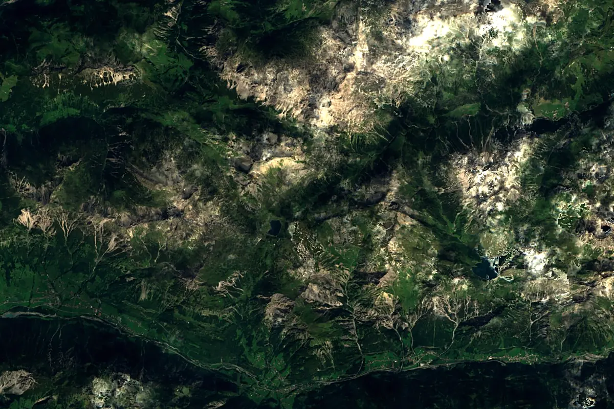
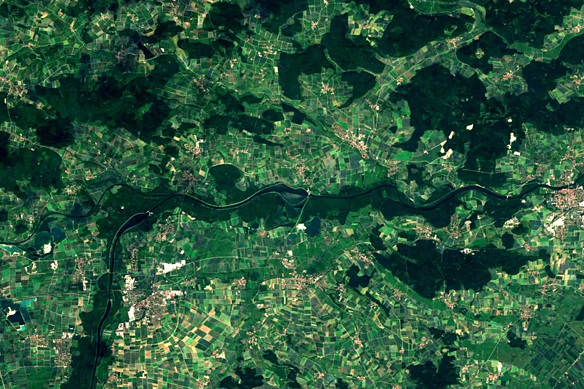
Sentinel-2 cloudless 2016 by EOX IT Services GmbH (contains modified Copernicus Sentinel data 2016), CC BY 4.0. The glowing line is the river as drawn by RiverATLAS.
Photos
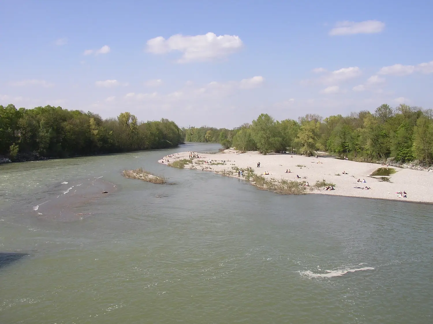
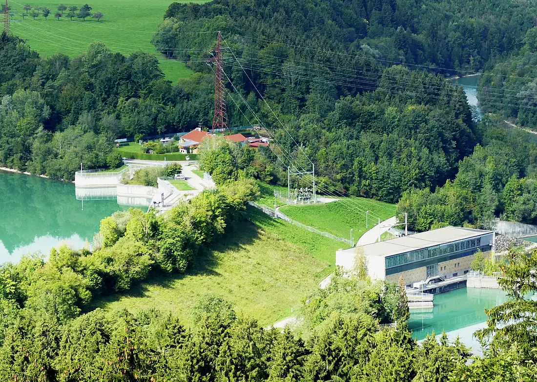
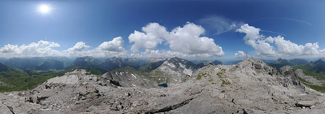
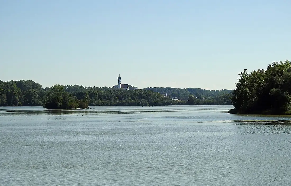
Lech in pictures
Tributaries
Where it flows, and what flows into it
It flows into
Danube Romania2,850 km5,400 m³/s
Tributaries (16)
Also: Wertach, Vils, Archbach, Halblech, Illach, Rotlech, Schönach, Hornbach, Münsterer Alte, Rott-Bach, Formarin stream, Spullerbach, Höhenbach, Streimbach, Füssener Achen, Mühlbach
 Serbia
 Croatia
 Moldova
Nearby
Rivers nearby
Where these numbers come from
| Name, length, places | Wikidata (Q155841) · CC0 |
|---|---|
| Course, profile, basin | RiverATLAS v1.0 (HydroATLAS, Linke et al. 2019) · CC BY 4.0 — followed from the source to the mouth given by Wikidata |
| Flow | WaterGAP (RiverATLAS), 1971–2000 · CC BY 4.0 |
| Climate along the river | WorldClim (RiverATLAS), 1970–2000 · CC BY 4.0 |
| Towns, bridges, dams | Wikidata · CC0; GeoNames · CC BY 4.0 |
| Along the river | © OpenStreetMap contributors · ODbL |
| Images | EOX Sentinel-2 cloudless 2016 · CC BY 4.0; Wikimedia Commons |
| Our other atlases | Cascadyas, Lakeyas, Peakyas — Wikidata · CC0; © OpenStreetMap contributors · ODbL; GeoNames · CC BY 4.0; HydroLAKES · CC BY 4.0; NOAA OISST |
Every source and licence is on the data sources page.
The family
Do you prefer beaches, lakes, mountains, waterfalls, islands, rivers or canyons?
Same idea, other landscapes: field atlases built on open data, month by month, in seven languages.
 beaches
 Find your beach: sea temperature, sun and swimming month by month.Visit lakes
 Every lake on Earth: water temperature, ice, depth and the shore.Coming soonVisit mountains
 Every summit in 3D: summit weather, the 0 °C line, huts and trails.Visit waterfalls
 Every waterfall: height, flow month by month and when it roars.Coming soonVisit
  islands
 Every island from the sea up: size, sea temperature, ferries and 3D.Coming soonVisit
  rivers
 Every river from source to sea: the journey, the flow and the basin in numbers.You are here
 canyons
 Every canyon cut to scale: depth to the floor, rim and floor temperatures, trails and viewpoints.Coming soonVisit