River
Váh
433 km from source to mouth · Slovakia.
 SlovakiaFlows into Danube1st longest in Slovakia
In numbers
Length
433km
Average flow
150m³/s
Basin
19,600km²
Drop
585m
from 689 m to 104 m
Country
1
The journey
From source to mouth
433 km of river and 68 stops on the way: 43 towns and cities on its banks, dams, bridges and the tributaries that feed it.
- 0 kmSourceat 689 m
- 17 kmKráľova Lehota598 people
- 18 kmČierny Váh Rivertributary
- 23 kmLiptovská Porúbka1,221 people
- 24 kmLiptovský Hrádok6,979 people
- 25 kmŠtiavnicatributary
- 25 kmBelátributary
- 29 kmUhorská Ves561 people
- 31 kmTrnovectributary
- 36 kmSmrečiankatributary
- 37 kmLiptovský Mikuláš29,710 people
- 50 kmLiptovská Mara18 km²
- 54 kmVodná nádrž Bešeňová1.4 km²
- 55 kmKľačiankatributary
- 57 kmIvachnová772 people
- 68 kmRužomberok26,099 people
- 68 kmRevúca Rivertributary
- 82 kmHubová1,089 people
- 89 kmOravatributary
- 96 kmKrpeľany Reservoir0.5 km²
- 100 kmKrpeľany1,047 people
- 106 kmTurany4,054 people
- 108 kmSučany4,702 people
- 115 kmTuriectributary
- 117 kmLipovec896 people
- 129 kmNezbudská Lúčka397 people
- 130 kmStrečno2,553 people
- 136 kmMojš1,515 people
- 140 kmŽilina Reservoir2.1 km²
- 145 kmŽilina79,873 people
- 146 kmKysucatributary
- 150 kmRajčankatributary
- 150 kmDivinka1,021 people
- 151 kmHričov Reservoir1.6 km²
- 153 kmHorný Hričov879 people
- 158 kmDolný Hričov1,704 people
- 165 kmBytča11,729 people
- 167 kmPetrovičkatributary
- 169 kmPredmier1,360 people
- 174 kmHradniankatributary
- 183 kmPovažská Bystrica36,690 people
- 195 kmNosice Reservoir4.7 km²
- 199 kmPúchov16,622 people
- 207 kmBeluša6,199 people
- 229 kmNová Dubnica10,130 people
- 230 kmNemšová6,132 people
- 236 kmSkalka nad Váhom1,318 people
- 243 kmTrenčín54,104 people
- 253 kmTrenčianske Stankovce3,402 people
- 268 kmNové Mesto nad Váhom19,171 people
- 268 kmZelená Voda0.7 km²
- 296 kmPiešťany26,086 people
- 301 kmSĺňava Reservoir3.8 km²
- 315 kmDrahovce-Madunice Waterworks
- 316 kmHlohovec19,214 people
- 316 kmLeopoldov3,850 people
- 339 kmSereď14,946 people
- 340 kmDolná Streda1,766 people
- 346 kmŠoporňa4,018 people
- 351 kmGalanta15,402 people
- 353 kmKráľová Reservoir11 km²
- 357 kmKráľová nad Váhom1,877 people
- 361 kmŠaľa19,534 people
- 382 kmNeded3,151 people
- 398 kmNitratributary
- 398 kmLittle Danubetributary
- 399 kmKolárovo10,381 people
- 412 kmKameničná1,892 people
- 425 kmKomárno31,560 people
- 433 kmDanubeat 104 m
Water level along the river (RiverATLAS; the height is exaggerated). Towns: GeoNames and Wikidata; bridges, dams and tributaries: Wikidata.
River in Slovakia
At the mouth it carries 152 m³/s on average: an Olympic pool every 16 seconds. It drops from 689 m to 104 m, 1.4 m per kilometre on average. Its basin covers 19,600 km², about the size of SI. 2.5 million people live in it. Highest water: from March to May; lowest: from January to February. Dams and reservoirs hold back a large share of its water (15% of a year's flow).
Where to start
- ŽilinaLargest city on its banks · 79,873 people
- Leoš Janáček Airport Ostrava (OSR)Nearest airport with scheduled flights, 70 km from the cityCar hire at OSR airport (Mošnov)Discover Cars · Affiliate link↗
- On the water72 ferry piers, marinas, boat rentals and boat ramps along the river (OpenStreetMap)
- Kayak and canoe5 put-ins and rapids mapped (OpenStreetMap)
- From May to SeptemberThe best months to visit
Váh, month by month
Highest water: from March to May
Lowest water: from January to February. Best months to visit: from May to September.
From about 81 m³/s in the lowest month to 430 m³/s in the highest. An estimate: the monthly flow is modelled from the lowest and highest months of WaterGAP (RiverATLAS, 1971–2000) and the rain and snow along the river (WorldClim). Dams change the real rhythm. The chip is the average air temperature; below it, the month's rain.
Plan the trip
Plan the trip: boat trips, a bed by the river, a car
Some links above are affiliate links: if you book through them we may earn a commission, at no extra cost to you. It never changes what the data on this page says.
The basin
Váh: the basin in numbers
19,484 km² of land send their water to this river. This is what lives on it.
- 2.5millionpeople live in the basin
- 127/km²people per km²
- 479maverage altitude of the basin
- 796mmof rain a year (basin average)
- 7.6°Caverage air temperature
- 27%protected areas
- 0.5%covered by lakes
- 0.9km³held in reservoirs
What covers the basin
- 51% Forest
- 35% Cropland
- 15% Pasture
- 7% Towns and cities
RiverATLAS (HydroATLAS v1.0, CC BY 4.0): land cover, people, protected areas, glaciers and dams over the whole basin upstream of the mouth.
Along the river
Váh: what you find on the way
- 177WeirsJamburov prah, Jaz and 175 more
- 21LocksKočkovský kanál, Biskupický derivačný kanál and 19 more
- 10WaterfallsZmrzlinový and 9 more
- 5Canoe put-ins
- 42Boat rampsPred Kolárovom, Kolárovo and 40 more
- 9Ferry piersKompa Strečno, vyhliadkoveplavby.sk, Kikötő and 6 more
- 17MarinasMarina, Královský prístav, Dani & Kati Marine and 14 more
- 7River beachesMestská pláž pri Liptovskej Mare, Maladinovo, Plážové kúpalisko Liptovský Trnovec and 4 more
From OpenStreetMap, within 2.0 km of the river. Not mapped is not the same as not there.
Cross-checked with our atlases
Váh in our other atlases
What our sister atlases know about the waterfalls on this river, the lakes it flows through, the beaches at its mouth, the mountains where it rises and the islands off its mouth.
 9lakes on its wayLakeyas
 33mountains at the sourcePeakyas
Lakes and reservoirs (9)
Lakes it flows through, by Lakeyas
- Liptovská Marakm 4318km²
- Vodná nádrž Bešeňovákm 461.4km²
- Krpeľany Reservoirkm 820.5km²
- Žilina Reservoirkm 1202.1km²
- Hričov Reservoirkm 1291.6km²
- Nosice Reservoirkm 166 · 18 m deep4.7km²
- Sĺňava Reservoirkm 2563.8km²
- Kráľová Reservoirkm 30111km²
1 more on LakeyasLakeyas is coming soonOpen Lakeyas ↗
Mountains at the source (33)
Within 15 km of the source, by Peakyas
- Štiavnica15 km away2,025m
- Krakova hoľa13 km away1,752m
- Besná15 km away1,807m
- Veľký bok9.7 km away1,727m
- Ludárova hoľa14 km away1,731m
- Tanečnica14 km away1,681m
- Homôľka13 km away1,660m
- Zadná hoľa13 km away1,620m
25 more on PeakyasOpen Peakyas ↗
From space
The source and the mouth, seen from orbit
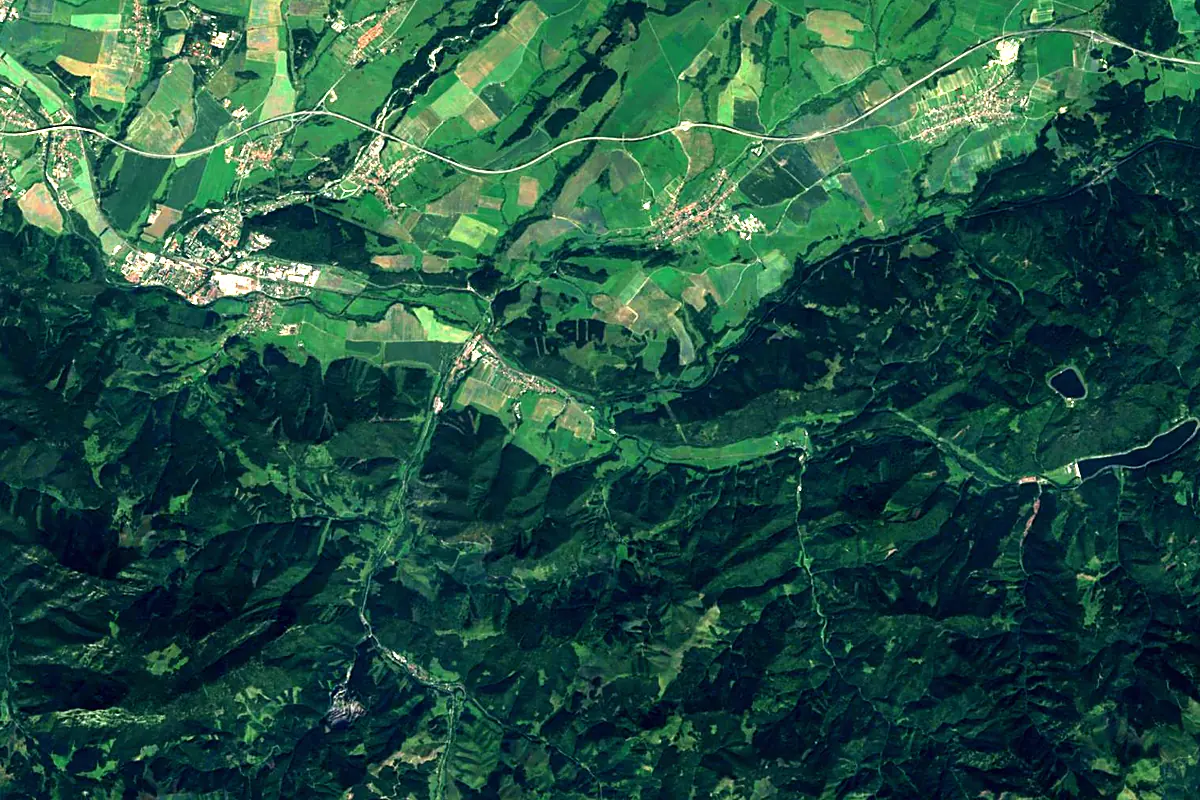
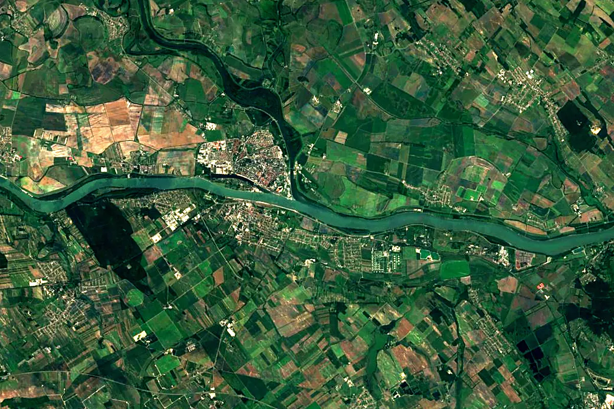
Sentinel-2 cloudless 2016 by EOX IT Services GmbH (contains modified Copernicus Sentinel data 2016), CC BY 4.0. The glowing line is the river as drawn by RiverATLAS.
Photos
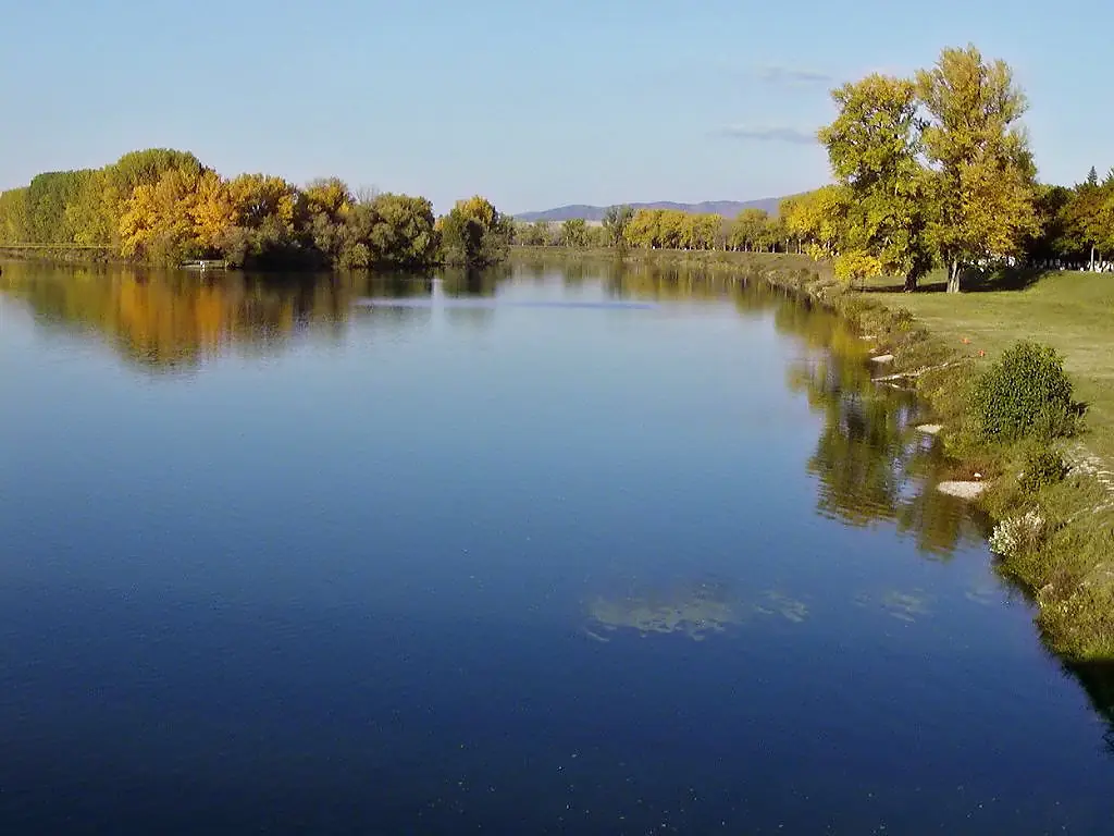
Váh in pictures
Tributaries
Where it flows, and what flows into it
It flows into
Danube Romania2,850 km5,400 m³/s
Tributaries (57)
Slovakia197 km24 m³/sjoins at km 339Little DanubeSlovakia128 km13 m³/sjoins at km 339OravaSlovakia60 km340 m³/sjoins at km 76Also: Kysuca, Turiec, Rajčanka, Belá, Revúca River, Čierny Váh River, Vlára, Biely Váh, Demänovka, Varínka, Boca, Smrečianka, Petrovička, Rosinka, Likavka, Prosiečanka, Biela Voda, Domanižanka, Iľanovianka, Štiavnica, Hradnianka, Studenec, Bošáčka, Kantorský potok
 Serbia
 Croatia
 Germany
 Moldova
 Austria
Nearby
Rivers nearby
 Hungary
Where these numbers come from
| Name, length, places | Wikidata (Q202598) · CC0 |
|---|---|
| Course, profile, basin | RiverATLAS v1.0 (HydroATLAS, Linke et al. 2019) · CC BY 4.0 — followed from the source to the mouth given by Wikidata |
| Flow | WaterGAP (RiverATLAS), 1971–2000 · CC BY 4.0 |
| Climate along the river | WorldClim (RiverATLAS), 1970–2000 · CC BY 4.0 |
| Towns, bridges, dams | Wikidata · CC0; GeoNames · CC BY 4.0 |
| Along the river | © OpenStreetMap contributors · ODbL |
| Images | EOX Sentinel-2 cloudless 2016 · CC BY 4.0; Wikimedia Commons |
| Our other atlases | Lakeyas, Peakyas — Wikidata · CC0; © OpenStreetMap contributors · ODbL; GeoNames · CC BY 4.0; HydroLAKES · CC BY 4.0; NOAA OISST |
Every source and licence is on the data sources page.
The family
Do you prefer beaches, lakes, mountains, waterfalls, islands, rivers or canyons?
Same idea, other landscapes: field atlases built on open data, month by month, in seven languages.
 beaches
 Find your beach: sea temperature, sun and swimming month by month.Visit lakes
 Every lake on Earth: water temperature, ice, depth and the shore.Coming soonVisit mountains
 Every summit in 3D: summit weather, the 0 °C line, huts and trails.Visit
  waterfalls
 Every waterfall: height, flow month by month and when it roars.Coming soonVisit
  islands
 Every island from the sea up: size, sea temperature, ferries and 3D.Coming soonVisit
  rivers
 Every river from source to sea: the journey, the flow and the basin in numbers.You are here
 canyons
 Every canyon cut to scale: depth to the floor, rim and floor temperatures, trails and viewpoints.Coming soonVisit