River
Aare
295 km from source to mouth · Switzerland.
 SwitzerlandFlows into Rhine1st longest in Switzerland
In numbers
Length
295km
Average flow
560m³/s
Basin
17,800km²
Drop
1,463m
from 1,772 m to 309 m
Country
1
The journey
From source to mouth
295 km of river and 68 stops on the way: 45 towns and cities on its banks, dams, bridges and the tributaries that feed it.
- 0 kmAar Glaciersat 1,772 m
- 0 kmOberaarsee0.9 km²
- 5 kmGrimselsee3.0 km²
- 7 kmRäterichsbodensee0.5 km²
- 9 kmGelmersee0.3 km²
- 10 kmHandek
- 27 kmReichenbach Falls
- 28 kmMeiringen4,621 people
- 42 kmBrienz3,090 people
- 56 kmLake Brienz29 km²
- 58 kmLütschinetributary
- 58 kmMatten bei Interlaken4,201 people
- 58 kmInterlaken6,123 people
- 59 kmUnterseen5,757 people
- 81 kmKandertributary
- 82 kmLake Thun46 km²
- 84 kmThun43,905 people
- 85 kmSteffisburg15,709 people
- 87 kmUetendorf5,892 people
- 96 kmWichtrach4,294 people
- 101 kmMünsingen12,724 people
- 105 kmBelp11,510 people
- 109 kmMuri bei Bern13,318 people
- 110 kmKehrsatz4,302 people
- 114 kmKöniz42,958 people
- 116 kmBern136,988 people
- 119 kmSulgenbachtributary
- 121 kmBremgarten bei Bern4,386 people
- 128 kmWohlen bei Bern9,281 people
- 135 kmLake Wohlen1.9 km²
- 145 kmSaane/Sarinetributary
- 147 kmAarberg4,629 people
- 156 kmThielletributary
- 165 kmLake Biel38 km²
- 166 kmNidau6,815 people
- 167 kmBiel/Bienne55,932 people
- 167 kmSuzetributary
- 170 kmBrügg4,388 people
- 178 kmBüren an der Aare3,806 people
- 185 kmGrenchen17,140 people
- 193 kmBellach5,214 people
- 198 kmSolothurn16,847 people
- 198 kmBiberist8,567 people
- 199 kmZuchwil8,875 people
- 201 kmEmmetributary
- 220 kmAarwangen4,561 people
- 234 kmRothrist9,896 people
- 235 kmWiggertributary
- 236 kmAarburg8,917 people
- 239 kmDünnerntributary
- 240 kmOlten19,051 people
- 240 kmTrimbach6,543 people
- 255 kmAarau22,710 people
- 257 kmKüttigen6,997 people
- 257 kmSuhretributary
- 263 kmRupperswil5,486 people
- 266 kmMöriken-Wildegg4,438 people
- 276 kmBrugg15,234 people
- 276 kmWindisch7,654 people
- 277 kmGebenstorf5,807 people
- 279 kmLimmattributary
- 279 kmReusstributary
- 279 kmUntersiggenthal7,812 people
- 281 kmWürenlingen5,262 people
- 285 kmBöttstein4,326 people
- 288 kmDöttingen4,561 people
- 290 kmKlingnau3,700 people
- 292 kmKlingnauer Stausee0.9 km²
- 294 kmKoblenz AG1,821 people
- 295 kmRhineat 309 m
Water level along the river (RiverATLAS; the height is exaggerated). Towns: GeoNames and Wikidata; bridges, dams and tributaries: Wikidata.
River in Switzerland and tributary of the Rhine
At the mouth it carries 560 m³/s on average: an Olympic pool every 4.5 seconds. It drops from 1,772 m to 309 m, 5.0 m per kilometre on average. Its basin covers 17,800 km², about the size of KW. 3.7 million people live in it. Highest water: February, April and August. Its dams hold back little of its water (6.4% of a year's flow).
Where to start
- BernLargest city on its banks · 136,988 people
- Bern Airport (BRN)Nearest airport with scheduled flights, 6 km from the cityCar hire at BRN airport (Bern)Discover Cars · Affiliate link↗
- On the water204 ferry piers, marinas, boat rentals and boat ramps along the river (OpenStreetMap)
- Kayak and canoe6 put-ins and rapids mapped (OpenStreetMap)
- From June to SeptemberThe best months to visit
Aare, month by month
Highest water: February, April and August
Best months to visit: from June to September.
From about 350 m³/s in the lowest month to 780 m³/s in the highest. An estimate: the monthly flow is modelled from the lowest and highest months of WaterGAP (RiverATLAS, 1971–2000) and the rain and snow along the river (WorldClim). Dams change the real rhythm. The chip is the average air temperature; below it, the month's rain.
Plan the trip
Plan the trip: boat trips, a bed by the river, a car
Some links above are affiliate links: if you book through them we may earn a commission, at no extra cost to you. It never changes what the data on this page says.
The basin
Aare: the basin in numbers
17,504 km² of land send their water to this river. This is what lives on it.
- 3.7millionpeople live in the basin
- 223/km²people per km²
- 1,065maverage altitude of the basin
- 1,291mmof rain a year (basin average)
- 6.1°Caverage air temperature
- 8%protected areas
- 4.0%covered by lakes
- 2%glaciers
- 2%permafrost
- 1.1km³held in reservoirs
What covers the basin
- 59% Forest
- 11% Cropland
- 27% Pasture
- 13% Towns and cities
- 2% Ice
RiverATLAS (HydroATLAS v1.0, CC BY 4.0): land cover, people, protected areas, glaciers and dams over the whole basin upstream of the mouth.
Along the river
Aare: what you find on the way
- 185WeirsStaatsschleuse, Untere Schleuse, Energie Thun and 182 more
- 3Locks
- 51WaterfallsSchräybach-Wasserfall, Reichenbach Falls, Reichenbachfall and 48 more
- 2RapidsBahnbrücke Uttigen, Uttigenschwelle
- 4Canoe put-insInnertkirchen, Thun, Aarberg and 1 more
- 86Boat rampsEinwasserungsstelle, Boot-Transportanlage, Sliprampe and 83 more
- 65Ferry piersBrienz (See), Brienz Dorf, Giessbach and 62 more
- 46MarinasSC Neuhaus, Därligen, Leissigen and 43 more
- 9River beachesDr. H. Spreng-Bucht, Sundlauenen Beach, Nase and 6 more
From OpenStreetMap, within 1.9 km of the river. Not mapped is not the same as not there.
Cross-checked with our atlases
Aare in our other atlases
What our sister atlases know about the waterfalls on this river, the lakes it flows through, the beaches at its mouth, the mountains where it rises and the islands off its mouth.
 2waterfalls on the riverCascadyas
 9lakes on its wayLakeyas
 211mountains at the sourcePeakyas
Waterfalls (2)
On the river, by Cascadyas
- Handekkm 10
- Reichenbach Fallskm 26
Cascadyas is coming soonOpen Cascadyas ↗
Lakes and reservoirs (9)
Lakes it flows through, by Lakeyas
- Oberaarseekm 0 · 90 m deep0.9km²
- Grimselseekm 5 · 42 m deep3.0km²
- Gelmerseekm 90.3km²
- Lake Brienzkm 55 · 260 m deep29km²
- Lake Thunkm 80 · 217 m deep46km²
- Lake Wohlenkm 1311.9km²
- Lake Bielkm 160 · 74 m deep38km²
- Klingnauer Stauseekm 283 · 500 m deep0.9km²
1 more on LakeyasLakeyas is coming soonOpen Lakeyas ↗
Mountains at the source (211)
Within 15 km of the source, by Peakyas
- Finsteraarhorn12 km away · prominence 2,278 m4,274m
- Schreckhorn13 km away · prominence 795 m4,078m
- Lauteraarhorn12 km away · prominence 128 m4,042m
- Agassizhorn13 km away · prominence 200 m3,947m
- Dammastock14 km away · prominence 1,467 m3,630m
- Galenstock12 km away · prominence 252 m3,586m
- Mittelhorn14 km away · prominence 578 m3,702m
- Bärglistock12 km away · prominence 223 m3,655m
203 more on PeakyasOpen Peakyas ↗
From space
The source and the mouth, seen from orbit
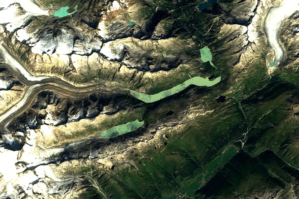
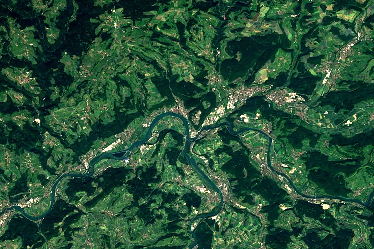
Sentinel-2 cloudless 2016 by EOX IT Services GmbH (contains modified Copernicus Sentinel data 2016), CC BY 4.0. The glowing line is the river as drawn by RiverATLAS.
Photos
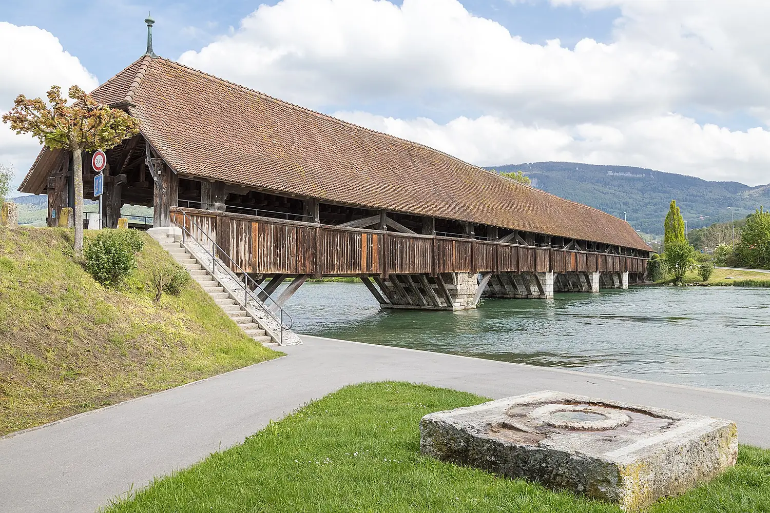
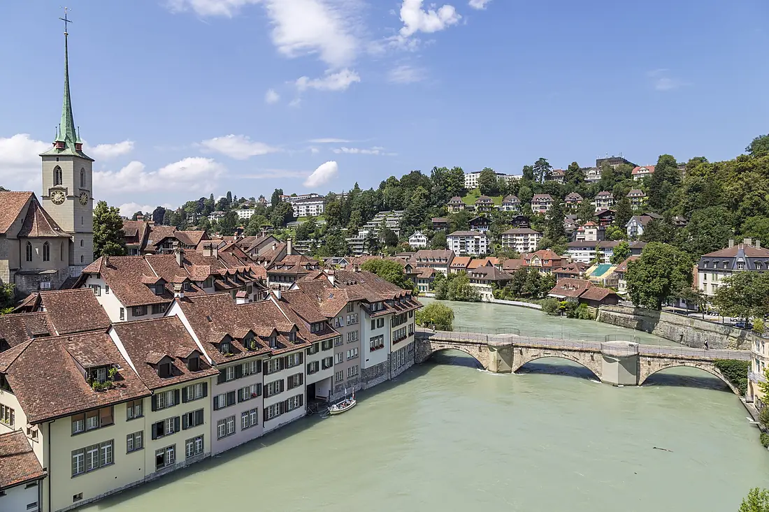
Aare in pictures
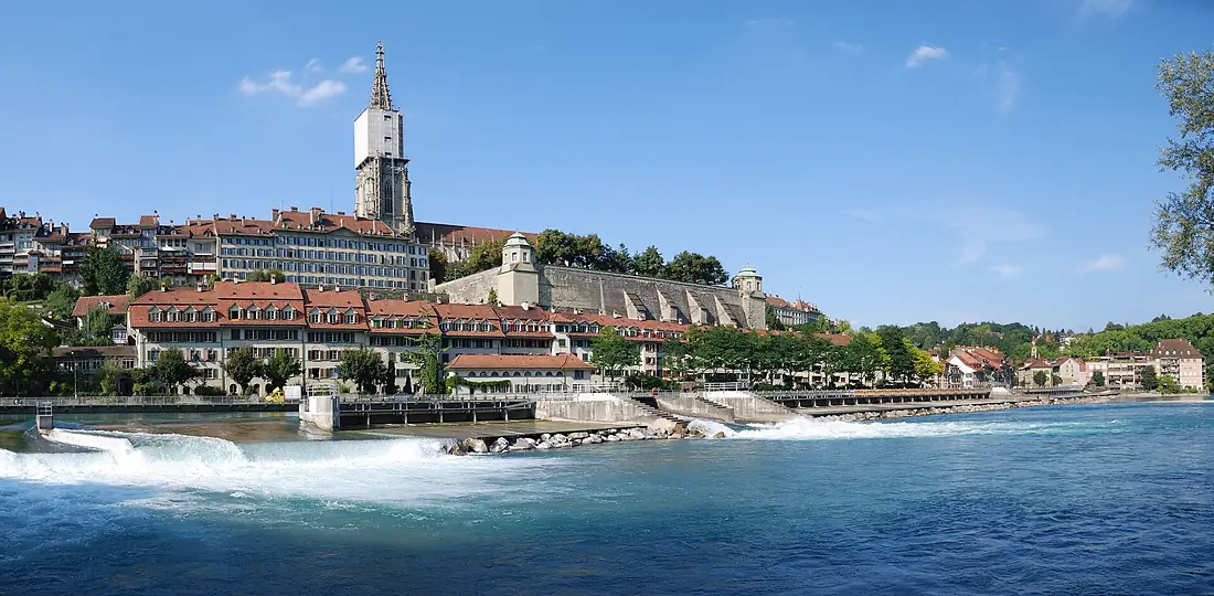
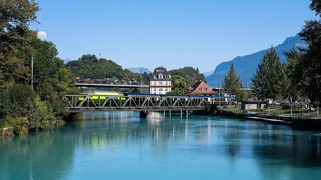
Tributaries
Where it flows, and what flows into it
It flows into
Rhine The Netherlands1,233 km2,200 m³/s
Tributaries (38)
Switzerland159 km130 m³/sjoins at km 270LimmatSwitzerland140 km100 m³/sjoins at km 270Saane/SarineSwitzerland126 km54 m³/sjoins at km 141Also: Emme, Kander, Lütschine, Wigger, Thielle, Suze, Suhre, Aabach (Seetal), Dünnern, Gürbe, Gadmerwasser, Surb, Alte Aare, Worble River, Ösch, Zulg, Chise River, Reichenbach, Önz, Glütschbach (Aare), Murg, Sulgenbach, Stadtbach, Chräbsbach
Nearby
Rivers nearby
Switzerland159 km130 m³/s13 km awayLimmatSwitzerland140 km100 m³/s13 km awayThurSwitzerland135 km47 m³/s28 km awayBreg Germany49 km9.7 m³/s43 km awayLinthSwitzerland37 km55 m³/s68 km awaySaane/SarineSwitzerland126 km54 m³/s97 km awayIll
 France217 km54 m³/s124 km awayIll
 Austria72 km210 m³/s107 km away
Where these numbers come from
| Name, length, places | Wikidata (Q1675) · CC0 |
|---|---|
| Course, profile, basin | RiverATLAS v1.0 (HydroATLAS, Linke et al. 2019) · CC BY 4.0 — followed along the river network from the point given by Wikidata |
| Flow | WaterGAP (RiverATLAS), 1971–2000 · CC BY 4.0 |
| Climate along the river | WorldClim (RiverATLAS), 1970–2000 · CC BY 4.0 |
| Towns, bridges, dams | Wikidata · CC0; GeoNames · CC BY 4.0 |
| Along the river | © OpenStreetMap contributors · ODbL |
| Images | EOX Sentinel-2 cloudless 2016 · CC BY 4.0; Wikimedia Commons |
| Our other atlases | Cascadyas, Lakeyas, Peakyas — Wikidata · CC0; © OpenStreetMap contributors · ODbL; GeoNames · CC BY 4.0; HydroLAKES · CC BY 4.0; NOAA OISST |
Every source and licence is on the data sources page.
The family
Do you prefer beaches, lakes, mountains, waterfalls, islands, rivers or canyons?
Same idea, other landscapes: field atlases built on open data, month by month, in seven languages.
 beaches
 Find your beach: sea temperature, sun and swimming month by month.Visit lakes
 Every lake on Earth: water temperature, ice, depth and the shore.Coming soonVisit mountains
 Every summit in 3D: summit weather, the 0 °C line, huts and trails.Visit waterfalls
 Every waterfall: height, flow month by month and when it roars.Coming soonVisit
  islands
 Every island from the sea up: size, sea temperature, ferries and 3D.Coming soonVisit
  rivers
 Every river from source to sea: the journey, the flow and the basin in numbers.You are here
 canyons
 Every canyon cut to scale: depth to the floor, rim and floor temperatures, trails and viewpoints.Coming soonVisit