River
Reuss
159 km from source to mouth · Switzerland.
 SwitzerlandFlows into Lake Lucerne2nd longest in Switzerland
In numbers
Length
159km
Average flow
130m³/s
Basin
3,425km²
Drop
1,107m
from 1,435 m to 328 m
Country
1
The journey
From source to mouth
159 km of river and 68 stops on the way: 55 towns and cities on its banks, dams, bridges and the tributaries that feed it.
- 0 kmCanton of Uriat 1,435 m
- 0 kmRealp153 people
- 0 kmHospental186 people
- 3 kmAndermatt1,578 people
- 7 kmGöschenen462 people
- 12 kmWassen398 people
- 17 kmGurtnellen558 people
- 22 kmSBB power station
- 25 kmSilenen1,949 people
- 29 kmErstfeld3,787 people
- 32 kmAttinghausen1,787 people
- 33 kmSchattdorf5,418 people
- 38 kmAltdorf10,495 people
- 39 kmSeedorf1,858 people
- 41 kmFlüelen1,972 people
- 52 kmIngenbohl7,967 people
- 79 kmMeggen6,533 people
- 83 kmLake Lucerne110 km²
- 84 kmEngelberg House
- 84 kmSchwytzer von Buonas House
- 84 kmChapel Bridge
- 84 kmLuzern81,691 people
- 84 kmLucerne86,234 people
- 84 kmMühlenplatz power plant
- 84 kmReusswehr (Mühlesporne, Nadelwehr)
- 84 kmKriens25,010 people
- 86 kmLittau16,121 people
- 87 kmKleine Emmetributary
- 88 kmRotsee0.4 km²
- 89 kmEmmen29,292 people
- 94 kmEbikon13,610 people
- 94 kmBuchrain6,235 people
- 97 kmInwil2,557 people
- 99 kmRoot5,040 people
- 100 kmGisikon1,387 people
- 101 kmHonau395 people
- 102 kmDietwil1,336 people
- 103 kmRisch10,857 people
- 103 kmRotkreuz10,439 people
- 106 kmHünenberg8,807 people
- 106 kmOberrüti1,534 people
- 108 kmSins4,259 people
- 114 kmMühlau1,175 people
- 117 kmJonenbachtributary
- 117 kmLorzetributary
- 118 kmObfelden5,340 people
- 119 kmMerenschwand3,549 people
- 121 kmturbine plant of the former Haas weaving mill
- 121 kmOttenbach2,555 people
- 122 kmJonen2,108 people
- 123 kmAristau1,498 people
- 125 kmRottenschwil857 people
- 126 kmUnterlunkhofen1,415 people
- 132 kmZufikon4,479 people
- 132 kmFormer old shooting range
- 132 kmBremgarten8,613 people
- 135 kmEggenwil1,053 people
- 136 kmKünten1,956 people
- 138 kmFischbach-Göslikon1,640 people
- 139 kmNiederwil2,830 people
- 141 kmStetten2,541 people
- 143 kmTägerig1,511 people
- 144 kmMellingen6,319 people
- 145 kmWohlenschwil1,855 people
- 148 kmBirrhard729 people
- 152 kmBirmenstorf3,066 people
- 155 kmWindisch7,654 people
- 155 kmBrugg11,177 people
- 156 kmGebenstorf5,807 people
- 159 kmLake Lucerneat 328 m
Water level along the river (RiverATLAS; the height is exaggerated). Towns: GeoNames and Wikidata; bridges, dams and tributaries: Wikidata.
River in Switzerland
At the mouth it carries 130 m³/s on average: an Olympic pool every 19 seconds. It drops from 1,435 m to 328 m, 7.0 m per kilometre on average. Its basin covers 3,425 km², about the size of CV. 2.8 million people live in it. Highest water: from June to August. Its dams hold back little of its water (4.9% of a year's flow).
Where to start
- LucerneLargest city on its banks · 86,234 people
- Zürich Airport (ZRH)Nearest airport with scheduled flights, 49 km from the cityCar hire at ZRH airport (Zurich)Discover Cars · Affiliate link↗
- On the water99 ferry piers, marinas, boat rentals and boat ramps along the river (OpenStreetMap)
- Kayak and canoe4 put-ins and rapids mapped (OpenStreetMap)
- From June to SeptemberThe best months to visit
Reuss, month by month
Highest water: from June to August
Best months to visit: from June to September.
From about 280 m³/s in the lowest month to 640 m³/s in the highest. An estimate: the monthly flow is modelled from the lowest and highest months of WaterGAP (RiverATLAS, 1971–2000) and the rain and snow along the river (WorldClim). Dams change the real rhythm. The chip is the average air temperature; below it, the month's rain.
Plan the trip
Plan the trip: boat trips, a bed by the river, a car
Some links above are affiliate links: if you book through them we may earn a commission, at no extra cost to you. It never changes what the data on this page says.
The basin
Reuss: the basin in numbers
14,942 km² of land send their water to this river. This is what lives on it.
- 2.8millionpeople live in the basin
- 194/km²people per km²
- 1,060maverage altitude of the basin
- 1,282mmof rain a year (basin average)
- 6.1°Caverage air temperature
- 8%protected areas
- 3.8%covered by lakes
- 2%glaciers
- 2%permafrost
- 0.7km³held in reservoirs
What covers the basin
- 57% Forest
- 10% Cropland
- 27% Pasture
- 11% Towns and cities
- 2% Ice
RiverATLAS (HydroATLAS v1.0, CC BY 4.0): land cover, people, protected areas, glaciers and dams over the whole basin upstream of the mouth.
Along the river
Reuss: what you find on the way
- 38WeirsNadelwehr, Wehr Rathausen, Reusswehr Perlen and 35 more
- 2Locks
- 24WaterfallsDreistäuberfälle, Lindenbach-Wasserfall, Wasserfall Tägerig and 21 more
- 2RapidsFällbaum, Bremgartner Welle
- 2Canoe put-ins
- 15Boat rampsKayak and Canoe Slipway, Benzenholz, Auswasserungsstelle and 12 more
- 57Ferry piersSeedorf UR (See), Flüelen (See), Flüelen and 54 more
- 20MarinasGenossenschaft Bootshafen Flüelen, Bootshafen Sisikon, Föhnhafen Brunnen and 17 more
- 6River beachesStrandbad Flüelen, Gruonbach, Badestrand Bauen and 3 more
From OpenStreetMap, within 1.9 km of the river. Not mapped is not the same as not there.
Cross-checked with our atlases
Reuss in our other atlases
What our sister atlases know about the waterfalls on this river, the lakes it flows through, the beaches at its mouth, the mountains where it rises and the islands off its mouth.
 2lakes on its wayLakeyas
 228mountains at the sourcePeakyas
Lakes and reservoirs (2)
Lakes it flows through, by Lakeyas
- Lake Lucernekm 74 · 214 m deep110km²
- Rotseekm 78 · 16 m deep0.4km²
Lakeyas is coming soonOpen Lakeyas ↗
Mountains at the source (228)
Within 15 km of the source, by Peakyas
- Dammastock8.9 km away · prominence 1,467 m3,630m
- Galenstock5.6 km away · prominence 252 m3,586m
- Eggstock9.9 km away3,555m
- Schneestock9.4 km away · prominence 38 m3,608m
- Hinter Tierberg14 km away · prominence 185 m3,445m
- Tiefenstock7.1 km away · prominence 90 m3,515m
- Gwächtenhorn14 km away · prominence 218 m3,420m
- Diechterhorn11 km away · prominence 308 m3,389m
220 more on PeakyasOpen Peakyas ↗
From space
The source and the mouth, seen from orbit
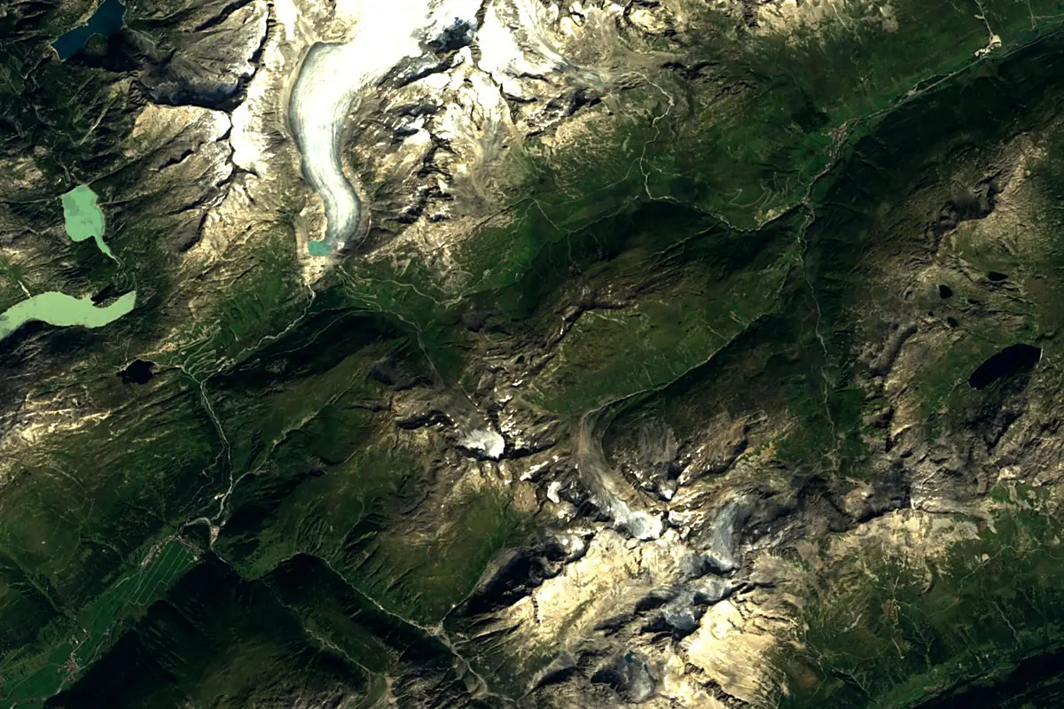
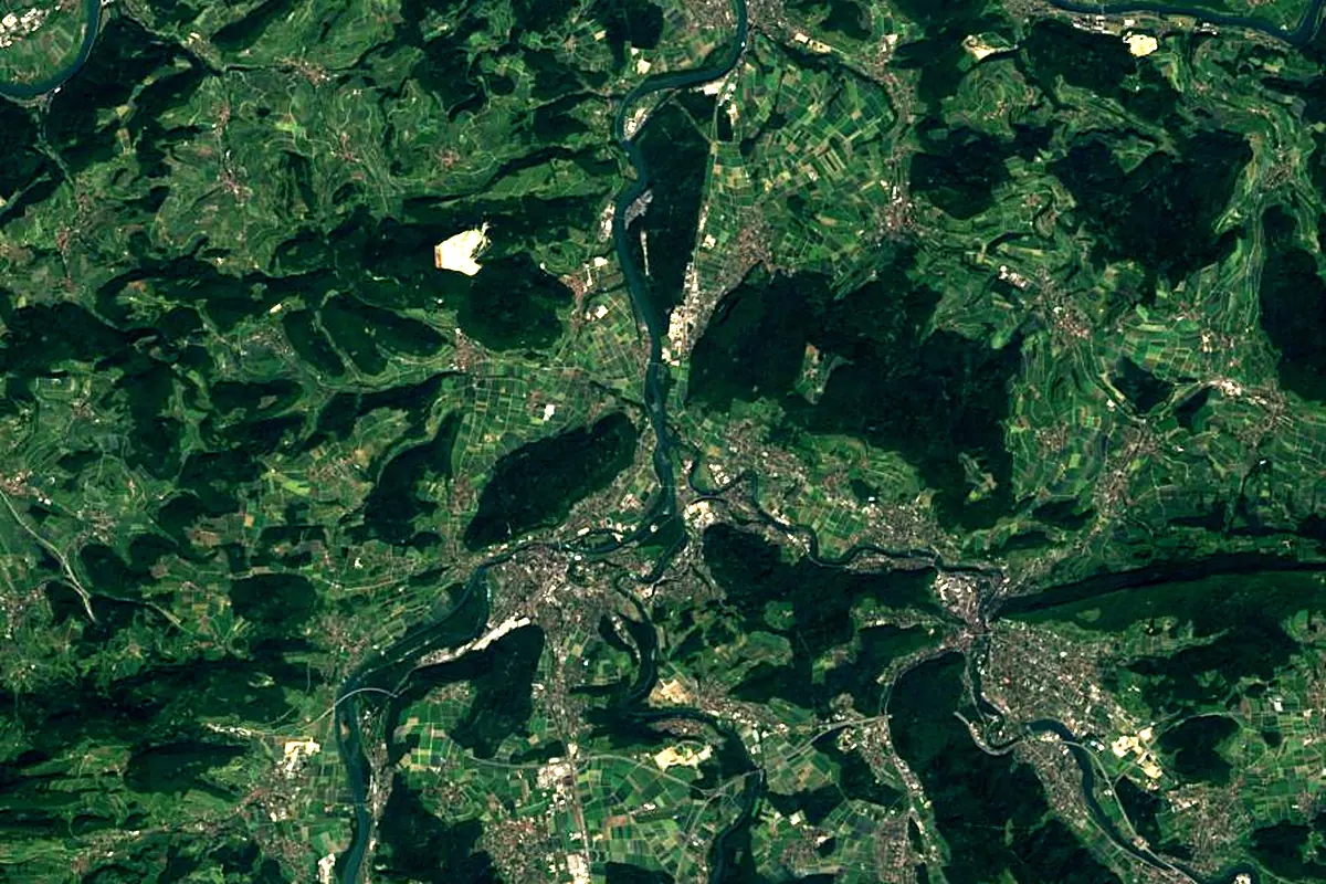
Sentinel-2 cloudless 2016 by EOX IT Services GmbH (contains modified Copernicus Sentinel data 2016), CC BY 4.0. The glowing line is the river as drawn by RiverATLAS.
Photos
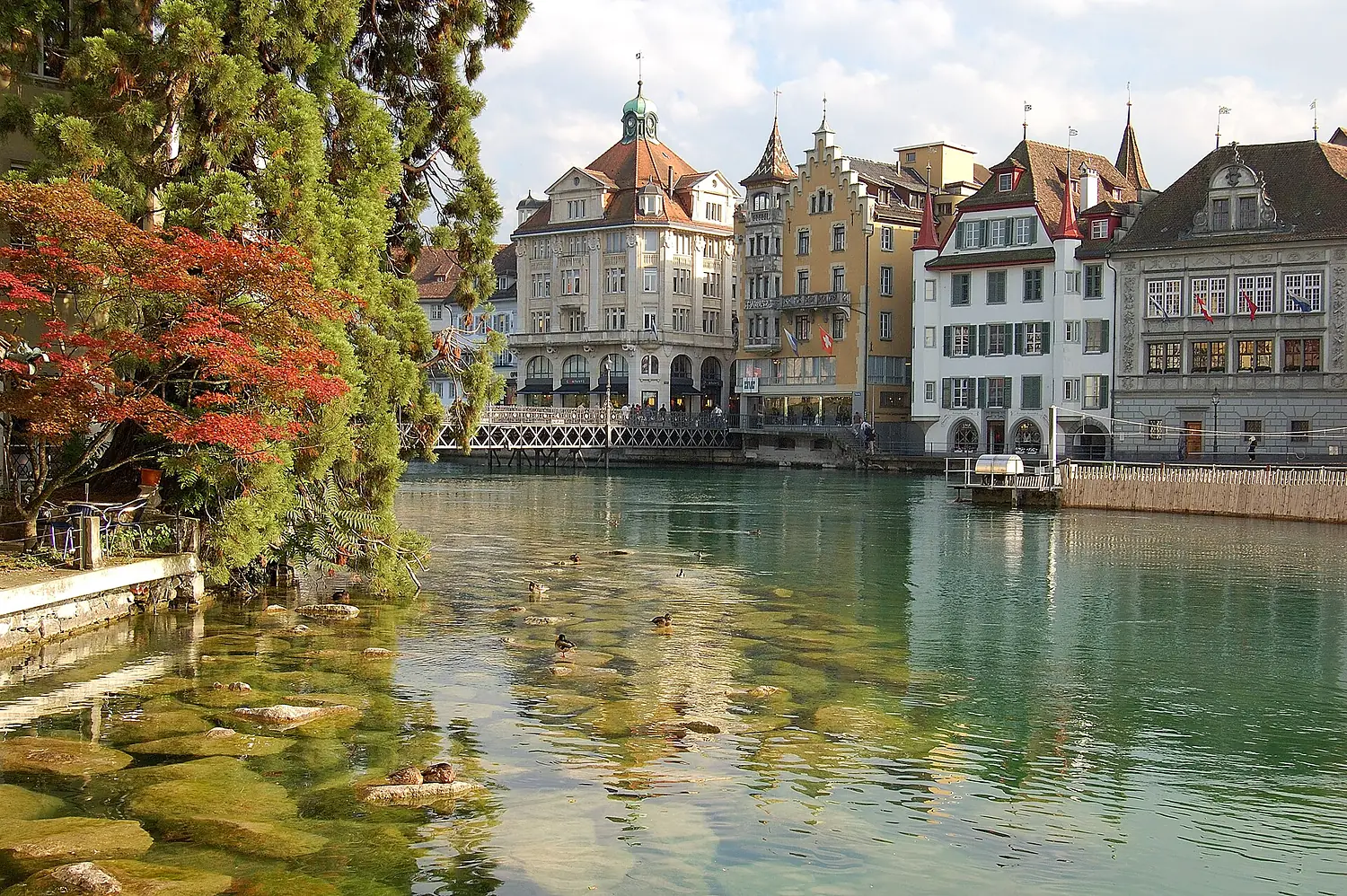
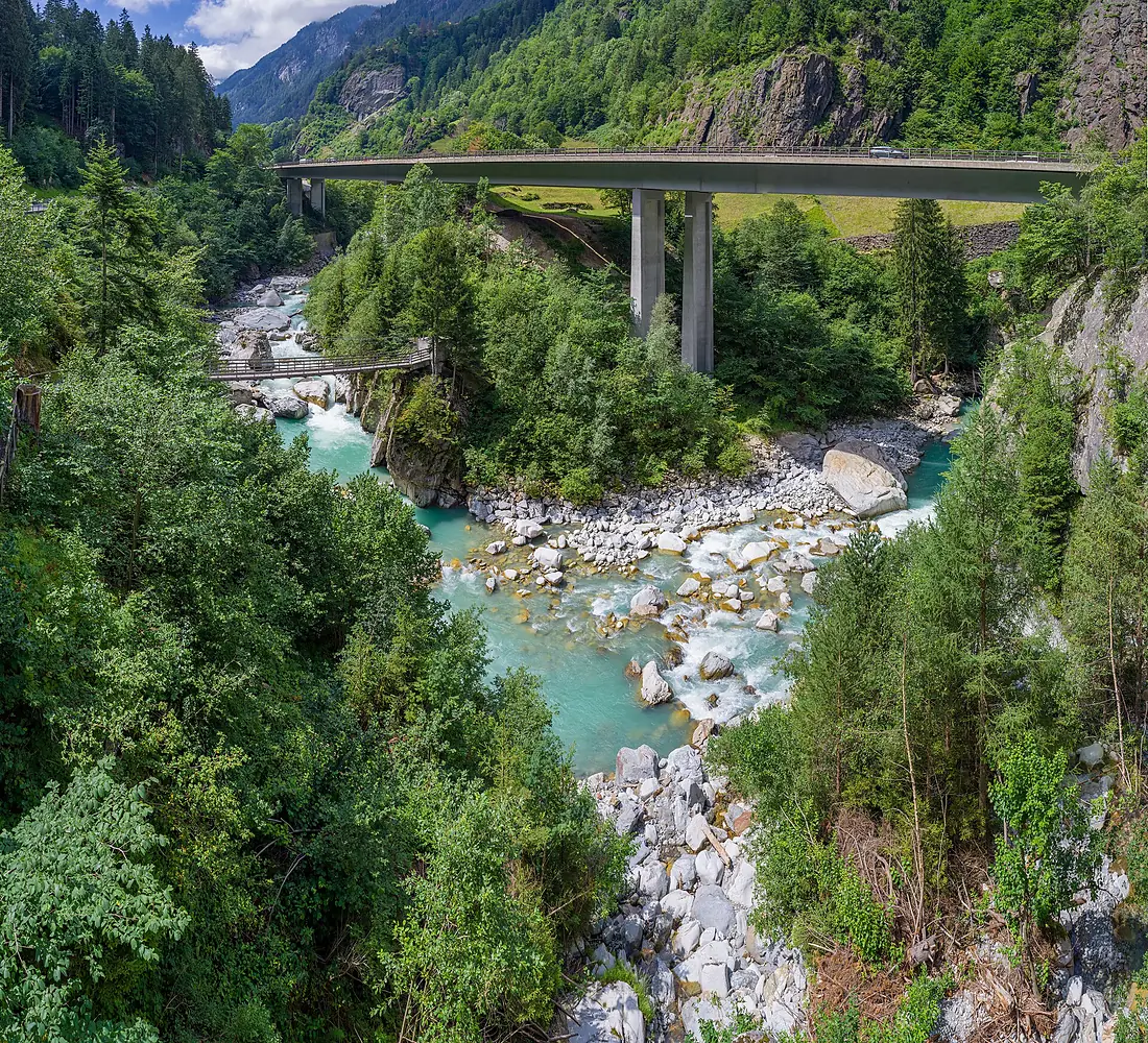
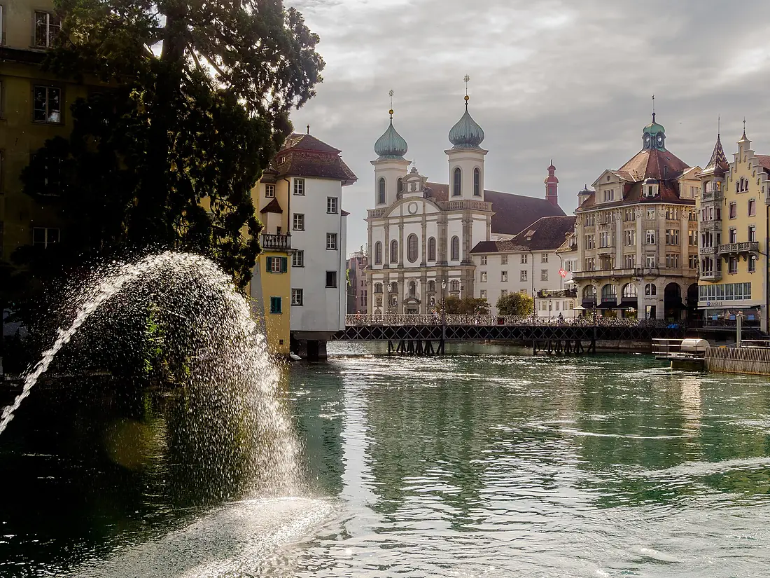
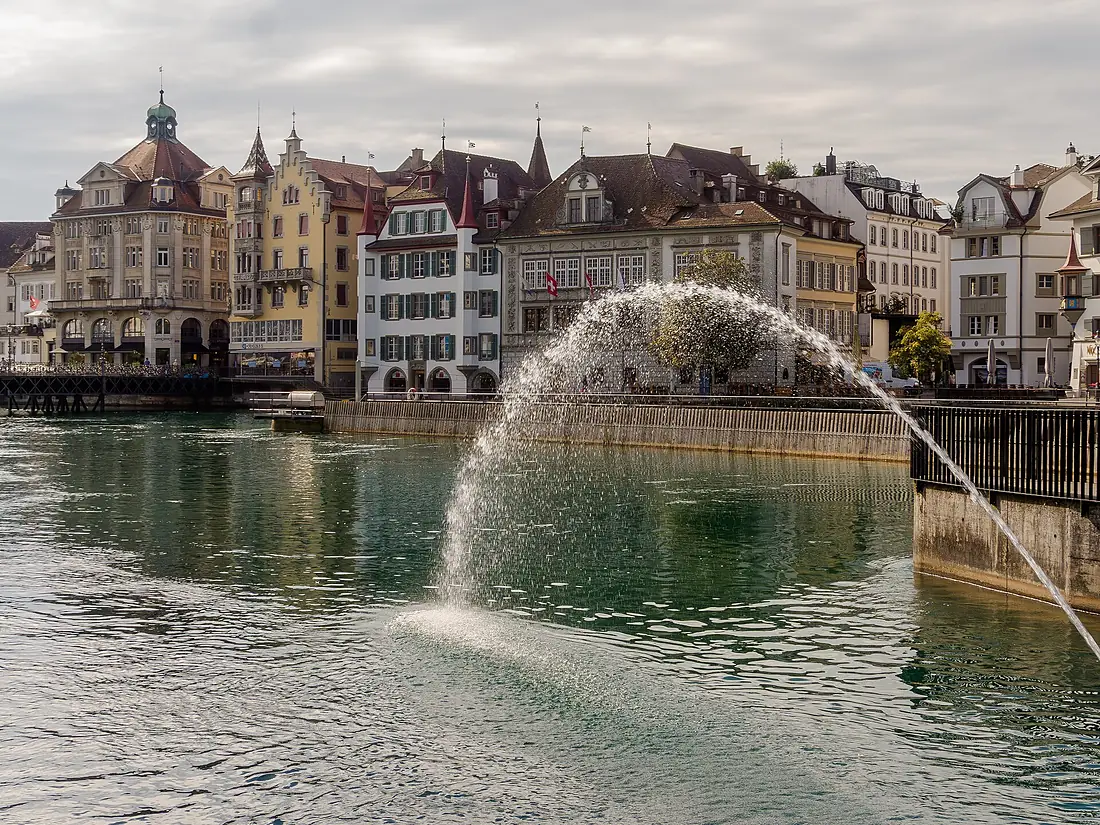
Reuss in pictures
Tributaries
Where it flows, and what flows into it
Tributaries (13)
Also: Lorze, Kleine Emme, Furkareuss, Göschener Reuss, Meienreuss, Schächen, Jonenbach, Chärstelenbach, Unteralpreuss, Gotthardreuss, Hellbühler Rotbach, Gornerbach, Torfmoosbach
 The Netherlands
Nearby
Rivers nearby
Switzerland295 km560 m³/s13 km awayLimmatSwitzerland140 km100 m³/s0 km awayThurSwitzerland135 km47 m³/s29 km awayBreg Germany49 km9.7 m³/s54 km awayLinthSwitzerland37 km55 m³/s60 km awaySaane/SarineSwitzerland126 km54 m³/s90 km awayIll
 Austria72 km210 m³/s103 km awayIll
 France217 km54 m³/s136 km away
Where these numbers come from
| Name, length, places | Wikidata (Q4015) · CC0 |
|---|---|
| Course, profile, basin | RiverATLAS v1.0 (HydroATLAS, Linke et al. 2019) · CC BY 4.0 — followed from the source to the mouth given by Wikidata |
| Flow | WaterGAP (RiverATLAS), 1971–2000 · CC BY 4.0 |
| Climate along the river | WorldClim (RiverATLAS), 1970–2000 · CC BY 4.0 |
| Towns, bridges, dams | Wikidata · CC0; GeoNames · CC BY 4.0 |
| Along the river | © OpenStreetMap contributors · ODbL |
| Images | EOX Sentinel-2 cloudless 2016 · CC BY 4.0; Wikimedia Commons |
| Our other atlases | Lakeyas, Peakyas — Wikidata · CC0; © OpenStreetMap contributors · ODbL; GeoNames · CC BY 4.0; HydroLAKES · CC BY 4.0; NOAA OISST |
Every source and licence is on the data sources page.
The family
Do you prefer beaches, lakes, mountains, waterfalls, islands, rivers or canyons?
Same idea, other landscapes: field atlases built on open data, month by month, in seven languages.
 beaches
 Find your beach: sea temperature, sun and swimming month by month.Visit lakes
 Every lake on Earth: water temperature, ice, depth and the shore.Coming soonVisit mountains
 Every summit in 3D: summit weather, the 0 °C line, huts and trails.Visit
  waterfalls
 Every waterfall: height, flow month by month and when it roars.Coming soonVisit
  islands
 Every island from the sea up: size, sea temperature, ferries and 3D.Coming soonVisit
  rivers
 Every river from source to sea: the journey, the flow and the basin in numbers.You are here
 canyons
 Every canyon cut to scale: depth to the floor, rim and floor temperatures, trails and viewpoints.Coming soonVisit