River
Saane/Sarine
126 km from source to mouth · Switzerland.
 SwitzerlandFlows into Aare5th longest in Switzerland
In numbers
Length
126km
Average flow
54m³/s
Basin
1,892km²
Drop
591m
from 1,040 m to 449 m
Country
1
The journey
From source to mouth
126 km of river and 68 stops on the way: 35 towns and cities on its banks, dams, bridges and the tributaries that feed it.
- 0 kmSourceat 1,040 m
- 0 kmGsteig bei Gstaad987 people
- 0 kmpipeline bridge near Gsteig (1)
- 0 kmpipeline bridge near Gsteig (2)
- 4 kmGstaad9,200 people
- 6 kmSaanen6,817 people
- 7 kmpipeline bridge near Saanen (1)
- 11 kmpipeline bridge near Saanen (2)
- 13 kmRougemont882 people
- 22 kmChâteau-d'Oex3,034 people
- 24 kmChâteau-d’Oex3,459 people
- 27 kmRossinière546 people
- 30 kmPont de la Tine
- 34 kmHongrintributary
- 35 kmCovered bridge
- 38 kmHaut-Intyamon1,542 people
- 42 kmGrandvillard844 people
- 46 kmBas-Intyamon1,454 people
- 48 kmGruyères2,199 people
- 49 kmCovered bridge, called Pont-qui-Branle
- 51 kmBroc2,651 people
- 51 kmChâteau d'En-Bas
- 52 kmBulle22,709 people
- 52 kmLa Tour-de-Trême3,686 people
- 53 kmpipeline bridge between Morlon and Broc
- 56 kmMorlon615 people
- 65 kmLa Roche1,405 people
- 67 kmGibloux7,447 people
- 69 kmLac de la Gruyère6.3 km²
- 72 kmTreyvaux1,470 people
- 73 kmVers-les-Châteaux, abandoned village - Middle Ages
- 74 kmArconciel949 people
- 76 kmLa Souche, mesolithic shelter
- 76 kmFarm of Hauterive abbey
- 77 kmHauterive2,497 people
- 77 kmAuberge d'Hauterive
- 78 kmEpendes1,006 people
- 79 kmVillars-sur-Glâne12,092 people
- 79 kmpipeline bridge between Posieux and Marly
- 79 kmChâtillon-sur-Glâne, Iron Age settlement
- 82 kmPont de Pérolles
- 83 kmMarly8,193 people
- 83 kmPierrafortscha156 people
- 85 kmFribourg39,151 people
- 85 kmPont de la Motta
- 85 kmPont de Saint-Jean
- 85 kmPont du Milieu
- 86 kmForge of the Balme known as Mooses House
- 86 kmPont de Zaehringen
- 86 kmPont de Berne
- 87 kmPoya Bridge
- 96 kmDüdingen7,961 people
- 100 kmLac de Schiffenen3.0 km²
- 102 kmKleinbösingen693 people
- 104 kmKriechenwil428 people
- 105 kmLaupen3,138 people
- 105 kmBösingen3,408 people
- 106 kmSensetributary
- 111 kmRailroad viaduct BN over the Saane
- 111 kmRailroad viaduct BN over the Saane - Part Mühleberg
- 111 kmRailroad viaduct BN over the Saane - Part Ferenbalm
- 112 kmCovered wooden bridge over the Saane River
- 112 kmCovered wooden bridge over the Saane River - Part Ferenbalm
- 112 kmFerenbalm1,260 people
- 114 kmMühleberg2,985 people
- 117 kmLake Wohlen1.9 km²
- 124 kmKallnach1,918 people
- 126 kmAarberg3,911 people
- 126 kmRadelfingen1,218 people
- 126 kmAareat 449 m
Water level along the river (RiverATLAS; the height is exaggerated). Towns: GeoNames and Wikidata; bridges, dams and tributaries: Wikidata.
Left tributary of the Aare in Switzerland
At the mouth it carries 54 m³/s on average: an Olympic pool every 46 seconds. It drops from 1,040 m to 449 m, 4.7 m per kilometre on average. Its basin covers 1,892 km², about the size of GP. 748,000 people live in it. Highest water: February and April. Dams and reservoirs hold back a large share of its water (12% of a year's flow).
Where to start
- FribourgLargest city on its banks · 39,151 people
- Bern Airport (BRN)Nearest airport with scheduled flights, 29 km from the cityCar hire at BRN airport (Bern)Discover Cars · Affiliate link↗
- On the water21 ferry piers, marinas, boat rentals and boat ramps along the river (OpenStreetMap)
- Kayak and canoe4 put-ins and rapids mapped (OpenStreetMap)
- From June to SeptemberThe best months to visit
Saane/Sarine, month by month
Highest water: February and April
Best months to visit: from June to September.
From about 78 m³/s in the lowest month to 250 m³/s in the highest. An estimate: the monthly flow is modelled from the lowest and highest months of WaterGAP (RiverATLAS, 1971–2000) and the rain and snow along the river (WorldClim). Dams change the real rhythm. The chip is the average air temperature; below it, the month's rain.
Plan the trip
Plan the trip: boat trips, a bed by the river, a car
Some links above are affiliate links: if you book through them we may earn a commission, at no extra cost to you. It never changes what the data on this page says.
The basin
Saane/Sarine: the basin in numbers
5,097 km² of land send their water to this river. This is what lives on it.
- 748,000people live in the basin
- 150/km²people per km²
- 1,384maverage altitude of the basin
- 1,397mmof rain a year (basin average)
- 4.4°Caverage air temperature
- 8%protected areas
- 1.9%covered by lakes
- 4%glaciers
- 4%permafrost
- 0.6km³held in reservoirs
What covers the basin
- 59% Forest
- 6% Cropland
- 21% Pasture
- 7% Towns and cities
- 4% Ice
RiverATLAS (HydroATLAS v1.0, CC BY 4.0): land cover, people, protected areas, glaciers and dams over the whole basin upstream of the mouth.
Along the river
Saane/Sarine: what you find on the way
- 25Weirs
- 11WaterfallsCascade du Ramaclé, Cascades des Allières, Cascade de la Tâna and 8 more
- 4Canoe put-insSaanen, Pont de Perolles, Schiffenen and 1 more
- 16Boat rampsBoot-Transportanlage and 15 more
- 1Ferry piers
- 3Marinas
- 6River beachesMorlon Beach, Plage de Corbières, Plage de Gumefens and 3 more
From OpenStreetMap, within 1.6 km of the river. Not mapped is not the same as not there.
Cross-checked with our atlases
Saane/Sarine in our other atlases
What our sister atlases know about the waterfalls on this river, the lakes it flows through, the beaches at its mouth, the mountains where it rises and the islands off its mouth.
 3lakes on its wayLakeyas
 175mountains at the sourcePeakyas
Lakes and reservoirs (3)
Lakes it flows through, by Lakeyas
- Lac de la Gruyèrekm 55 · 75 m deep6.3km²
- Lac de Schiffenenkm 79 · 38 m deep3.0km²
- Lake Wohlenkm 921.9km²
Lakeyas is coming soonOpen Lakeyas ↗
Mountains at the source (175)
Within 15 km of the source, by Peakyas
- Diablerets6.6 km away3,216m
- Wildhorn7.7 km away · prominence 981 m3,250m
- Arpelistock4.0 km away · prominence 66 m3,036m
- Grand Muveran15 km away · prominence 1,013 m3,051m
- Oldenhorn3.4 km away · prominence 307 m3,123m
- Haut de Cry11 km away · prominence 515 m2,969m
- Les Diablerets summit6.6 km away3,216m
- Geltenhorn5.5 km away · prominence 308 m3,065m
167 more on PeakyasOpen Peakyas ↗
From space
The source and the mouth, seen from orbit
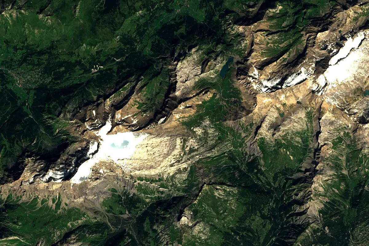
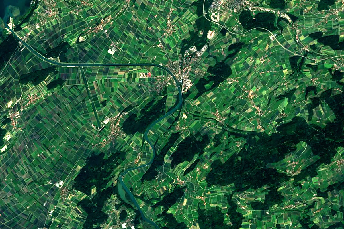
Sentinel-2 cloudless 2016 by EOX IT Services GmbH (contains modified Copernicus Sentinel data 2016), CC BY 4.0. The glowing line is the river as drawn by RiverATLAS.
Photos
Saane/Sarine in pictures
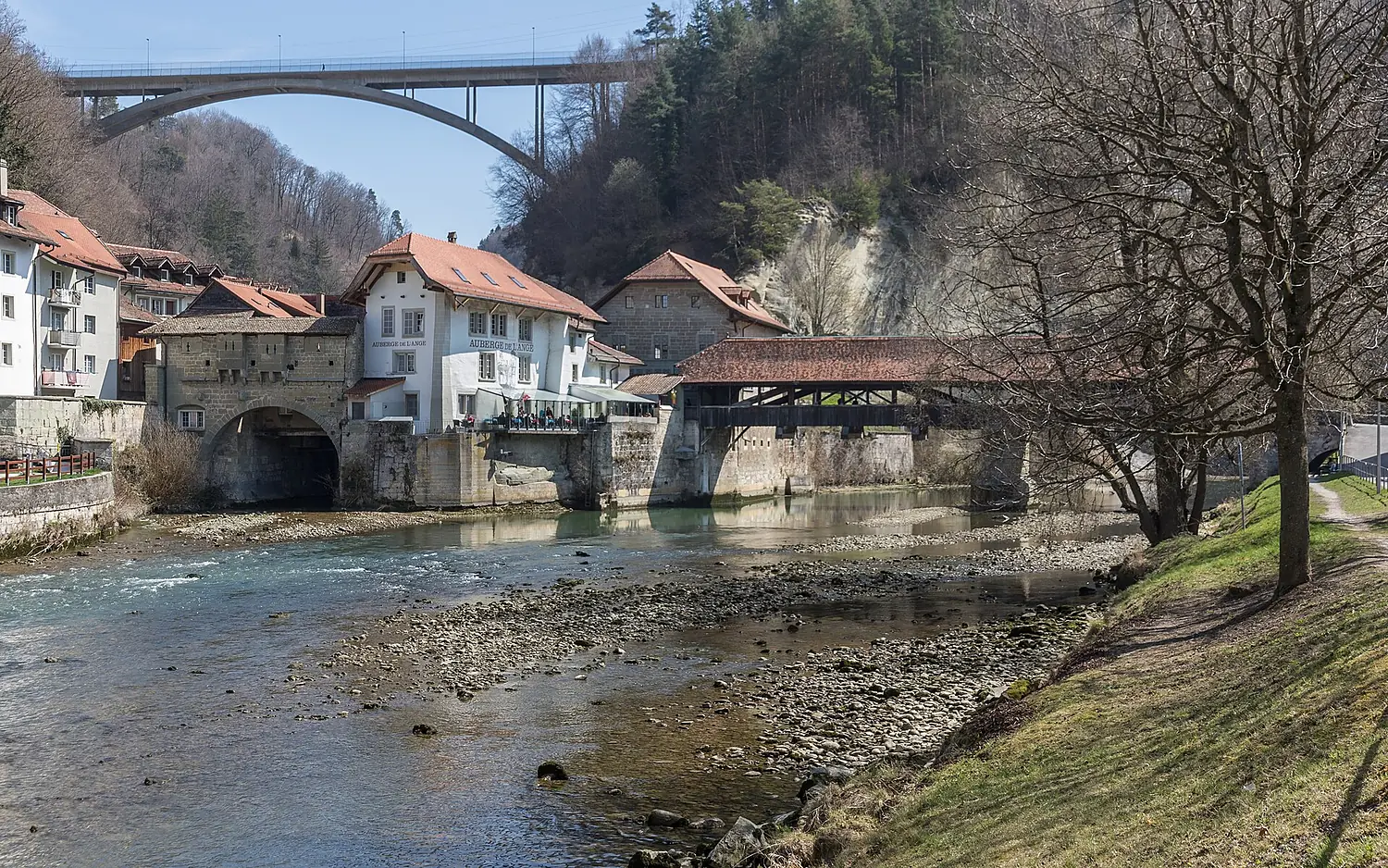
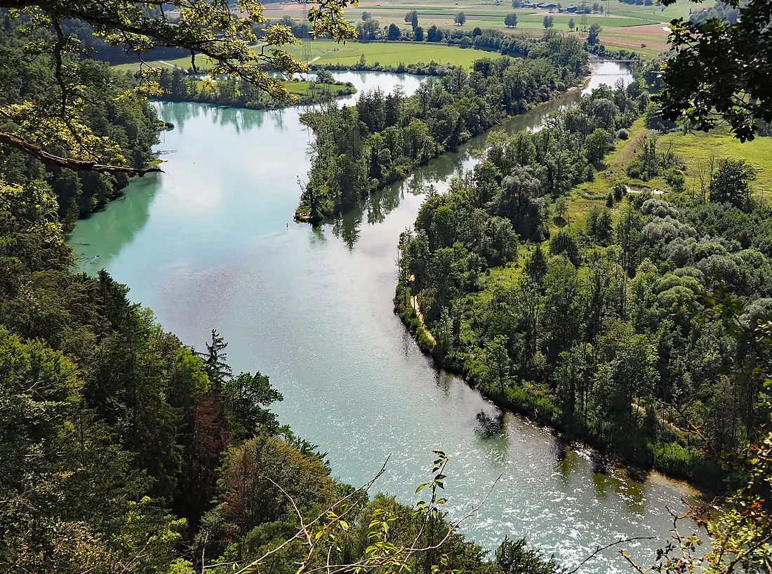
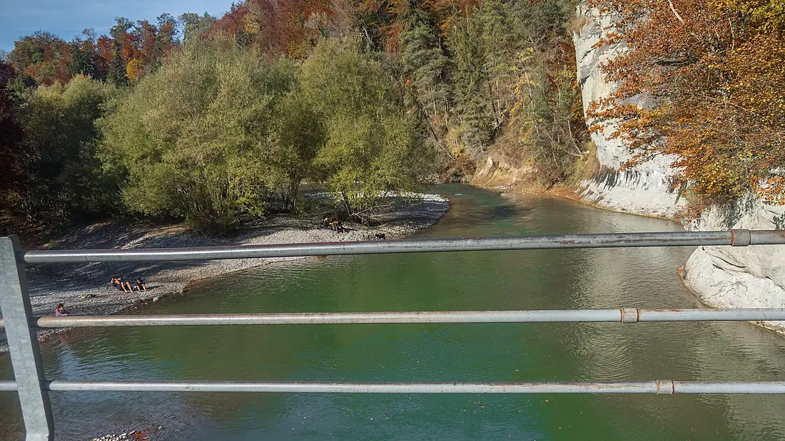
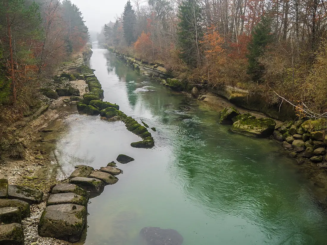
Tributaries
Where it flows, and what flows into it
It flows into
AareSwitzerland295 km560 m³/sTributaries (10)
Also: Sense, Glâne, Jogne, Gottéron, Hongrin, Trême, Sonnaz, Gérine/Ärgera, Torneresse, Sionge
 The Netherlands
Nearby
Rivers nearby
Switzerland159 km130 m³/s90 km awayLimmatSwitzerland140 km100 m³/s90 km awayThurSwitzerland135 km47 m³/s118 km awayArveSwitzerland108 km78 m³/s128 km awayLinthSwitzerland37 km55 m³/s127 km awayDoubs France453 km180 m³/s172 km awayBreg
 Germany49 km9.7 m³/s139 km awayOgnonFrance214 km35 m³/s140 km away
Where these numbers come from
| Name, length, places | Wikidata (Q14333) · CC0 |
|---|---|
| Course, profile, basin | RiverATLAS v1.0 (HydroATLAS, Linke et al. 2019) · CC BY 4.0 — followed from the source to the mouth given by Wikidata |
| Flow | WaterGAP (RiverATLAS), 1971–2000 · CC BY 4.0 |
| Climate along the river | WorldClim (RiverATLAS), 1970–2000 · CC BY 4.0 |
| Towns, bridges, dams | Wikidata · CC0; GeoNames · CC BY 4.0 |
| Along the river | © OpenStreetMap contributors · ODbL |
| Images | EOX Sentinel-2 cloudless 2016 · CC BY 4.0; Wikimedia Commons |
| Our other atlases | Lakeyas, Peakyas — Wikidata · CC0; © OpenStreetMap contributors · ODbL; GeoNames · CC BY 4.0; HydroLAKES · CC BY 4.0; NOAA OISST |
Every source and licence is on the data sources page.
The family
Do you prefer beaches, lakes, mountains, waterfalls, islands, rivers or canyons?
Same idea, other landscapes: field atlases built on open data, month by month, in seven languages.
 beaches
 Find your beach: sea temperature, sun and swimming month by month.Visit lakes
 Every lake on Earth: water temperature, ice, depth and the shore.Coming soonVisit mountains
 Every summit in 3D: summit weather, the 0 °C line, huts and trails.Visit
  waterfalls
 Every waterfall: height, flow month by month and when it roars.Coming soonVisit
  islands
 Every island from the sea up: size, sea temperature, ferries and 3D.Coming soonVisit
  rivers
 Every river from source to sea: the journey, the flow and the basin in numbers.You are here
 canyons
 Every canyon cut to scale: depth to the floor, rim and floor temperatures, trails and viewpoints.Coming soonVisit