River
Moselle
544 km from source to mouth · Germany, France and Luxembourg.


 Germany, France and LuxembourgFlows into Rhine1st longest in Germany
In numbers
Length
544km
Average flow
320m³/s
Basin
28,286km²
Drop
359m
from 419 m to 60 m
Countries
3
The journey
From source to mouth
544 km of river and 68 stops on the way: 43 towns and cities on its banks, dams, bridges and the tributaries that feed it.
- 0 kmMoselle River Sourceat 419 m
- 24 kmcascade de Miraumont
- 26 kmMoselottetributary
- 27 kmRemiremont7,388 people
- 42 kmVolognetributary
- 42 kmNichetributary
- 57 kmÉpinal32,251 people
- 60 kmGolbey8,832 people
- 81 kmAvièretributary
- 87 kmCharmes4,484 people
- 128 kmNeuves-Maisons6,524 people
- 130 kmChaligny2,729 people
- 133 kmMadontributary
- 148 kmBouvadestributary
- 150 kmDommartin-lès-Toul2,013 people
- 151 kmToul15,768 people
- 169 kmLiverdun5,580 people
- 176 kmFrouard6,444 people
- 176 kmPompey4,780 people
- 179 kmCustines3,089 people
- 179 kmMeurthetributary
- 189 kmDieulouard4,581 people
- 194 kmEschtributary
- 194 kmTreytributary
- 194 kmBlénod-lès-Pont-à-Mousson4,659 people
- 197 kmPont-à-Mousson14,190 people
- 211 kmRupt de Madtributary
- 214 kmCorny-sur-Moselle2,168 people
- 219 kmArs-sur-Moselle4,616 people
- 224 kmMoulins-lès-Metz5,265 people
- 226 kmMontigny-lès-Metz21,718 people
- 228 kmLe Ban-Saint-Martin4,684 people
- 229 kmMetz122,572 people
- 231 kmSeilletributary
- 232 kmSaint-Julien-lès-Metz3,554 people
- 240 kmArgancy1,381 people
- 245 kmTalange8,120 people
- 247 kmHagondange9,278 people
- 247 kmMondelange5,699 people
- 250 kmBousse3,236 people
- 252 kmOrnetributary
- 252 kmGuénange8,083 people
- 254 kmUckange7,021 people
- 259 kmFenschtributary
- 261 kmThionville42,658 people
- 262 kmYutz17,391 people
- 263 kmManom3,137 people
- 268 kmBasse-Ham2,349 people
- 270 kmCattenom2,580 people
- 284 kmGandertributary
- 287 kmPerl9,405 people
- 296 kmRemich4,156 people
- 324 kmSyretributary
- 325 kmSauertributary
- 330 kmSaartributary
- 331 kmKonz18,099 people
- 339 kmTrier105,054 people
- 346 kmOlewiger Bachtributary
- 346 kmRuwertributary
- 348 kmKylltributary
- 354 kmSchweich7,663 people
- 376 kmSalmtributary
- 400 kmDhrontributary
- 400 kmLiesertributary
- 406 kmBernkastel-Kues6,682 people
- 430 kmTraben-Trarbach5,399 people
- 473 kmCochem4,897 people
- 491 kmBrohlbach (Moselle)tributary
- 526 kmKoblenz113,020 people
- 544 kmRhineat 60 m
Water level along the river (RiverATLAS; the height is exaggerated). Towns: GeoNames and Wikidata; bridges, dams and tributaries: Wikidata.
River in Western Europe
At the mouth it carries 315 m³/s on average: an Olympic pool every 7.9 seconds. It drops from 419 m to 60 m, 0.7 m per kilometre on average. Its basin covers 28,286 km², about the size of SB. 33.0 million people live in it. Highest water: from December to March. Its dams hold back little of its water (3.0% of a year's flow).
Where to start
- MetzLargest city on its banks · 122,572 people
- Metz-Nancy-Lorraine Airport (ETZ)Nearest airport with scheduled flights, 16 km from the cityCar hire at ETZ airport (Goin)Discover Cars · Affiliate link↗
- On the water239 ferry piers, marinas, boat rentals and boat ramps along the river (OpenStreetMap)
- From June to SeptemberThe best months to visit
Moselle, month by month
Highest water: from December to March
Best months to visit: from June to September.
From about 1,300 m³/s in the lowest month to 3,100 m³/s in the highest. An estimate: the monthly flow is modelled from the lowest and highest months of WaterGAP (RiverATLAS, 1971–2000) and the rain and snow along the river (WorldClim). Dams change the real rhythm. The chip is the average air temperature; below it, the month's rain.
Plan the trip
Plan the trip: boat trips, a bed by the river, a car
Some links above are affiliate links: if you book through them we may earn a commission, at no extra cost to you. It never changes what the data on this page says.
The basin
Moselle: the basin in numbers
137,689 km² of land send their water to this river. This is what lives on it.
- 33.0millionpeople live in the basin
- 242/km²people per km²
- 532maverage altitude of the basin
- 880mmof rain a year (basin average)
- 8.1°Caverage air temperature
- 23%protected areas
- 1.0%covered by lakes
- 2.0km³held in reservoirs
What covers the basin
- 45% Forest
- 23% Cropland
- 17% Pasture
- 14% Towns and cities
RiverATLAS (HydroATLAS v1.0, CC BY 4.0): land cover, people, protected areas, glaciers and dams over the whole basin upstream of the mouth.
Along the river
Moselle: what you find on the way
- 132WeirsBarrage des Graviers, Barrage de Mainqueyon, Barrage Usine Zainvillers and 129 more
- 266LocksCanal des Vosges and 265 more
- 22WaterfallsCascade des Graviers, Saut de la Cuve, Cascade de Miraumont and 19 more
- 124Boat rampsSlipanlage Nennig, Alte Fährrampe Igel, Alte Fährrampe Reinig and 121 more
- 40Ferry piersMoulins-lès-Metz, Scy-Chazelles, Longeville Centre and 37 more
- 66MarinasPort de Plaisance d'Épinal, Halte fluviale de la cote Olie, Halte Nautique de Thaon les Vosges and 63 more
- 4River beachesMainqueyon, Woippy Plage, Plage du club de voile and 1 more
From OpenStreetMap, within 2.5 km of the river. Not mapped is not the same as not there.
Cross-checked with our atlases
Moselle in our other atlases
What our sister atlases know about the waterfalls on this river, the lakes it flows through, the beaches at its mouth, the mountains where it rises and the islands off its mouth.
 1waterfall on the riverCascadyas
 86mountains at the sourcePeakyas
Waterfalls (1)
On the river, by Cascadyas
- cascade de Miraumontkm 22
Cascadyas is coming soonOpen Cascadyas ↗
Mountains at the source (86)
Within 15 km of the source, by Peakyas
- Ballon d'Alsace8.2 km away · prominence 520 m1,247m
- Storkenkopf14 km away · prominence 133 m1,366m
- Rainkopf15 km away1,305m
- Rothenbachkopf14 km away1,315m
- Klintzkopf14 km away1,330m
- Batteriekopf13 km away1,311m
- Le Lauchenkopf13 km away1,314m
- Trehkopf10 km away1,266m
78 more on PeakyasOpen Peakyas ↗
From space
The source and the mouth, seen from orbit
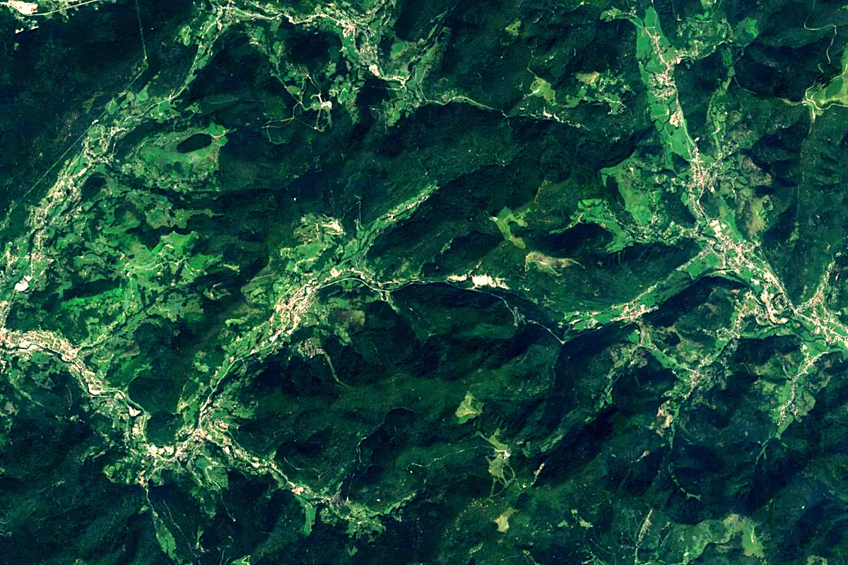
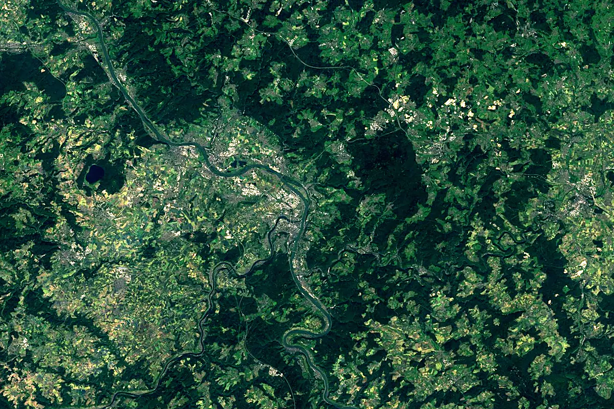
Sentinel-2 cloudless 2016 by EOX IT Services GmbH (contains modified Copernicus Sentinel data 2016), CC BY 4.0. The glowing line is the river as drawn by RiverATLAS.
Photos
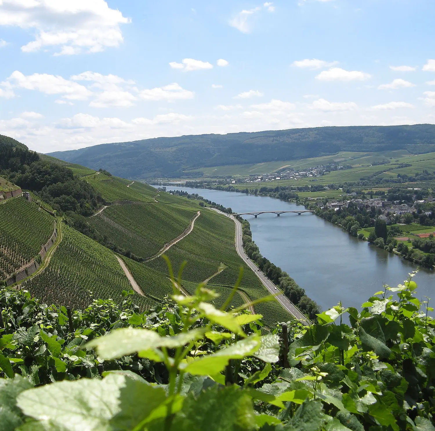
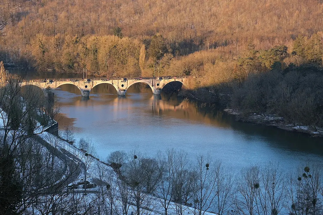
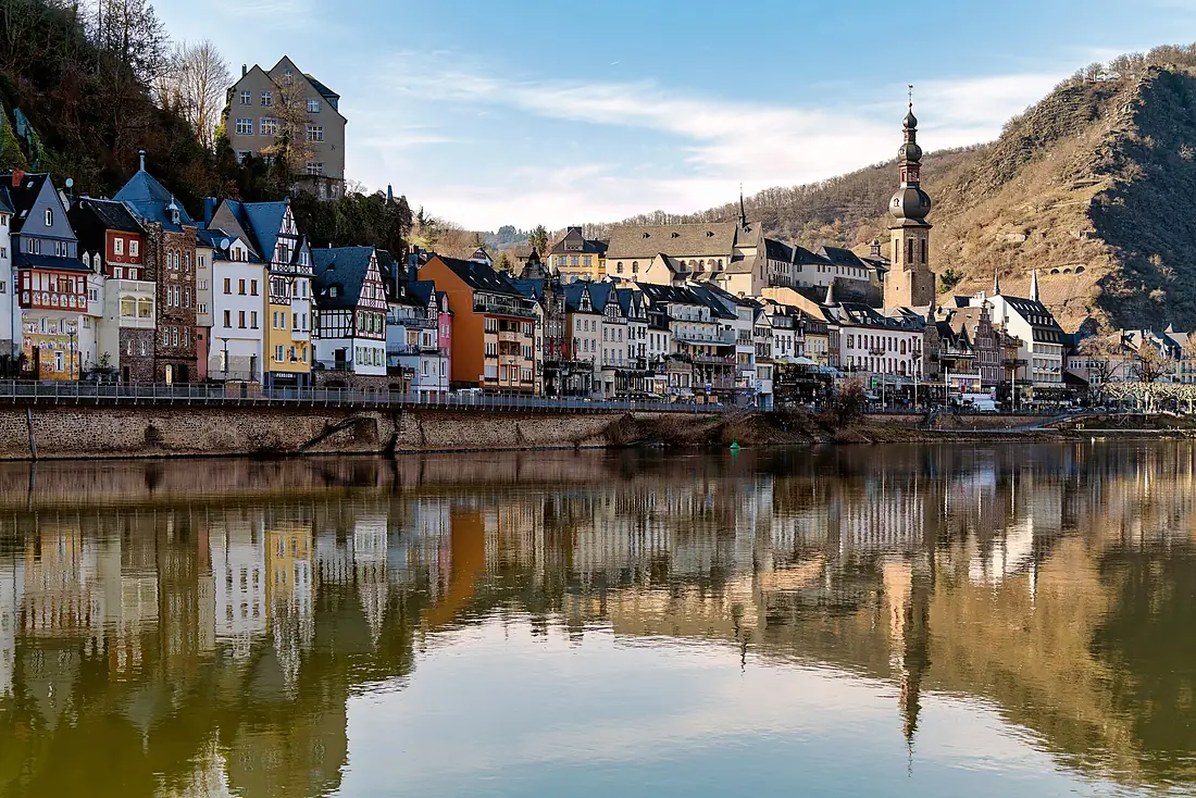
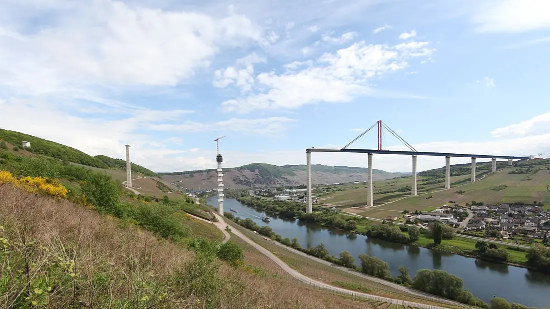
Moselle in pictures
Tributaries
Where it flows, and what flows into it
It flows into
Rhine The Netherlands1,233 km2,200 m³/s
Tributaries (83)
Germany246 km78 m³/sjoins at km 305SauerGermany173 km220 m³/sjoins at km 301MeurtheFrance161 km41 m³/sjoins at km 165SeilleFrance138 km9.8 m³/sjoins at km 214Also: Kyll, Ruwer, Vologne, Syre, Madon, Elzbach, Rupt de Mad, Salm, Alf, Moselotte, Orne, Lieser, Gander, Fensch, Feller Bach, Avière, Brohlbach (Moselle), Durbion, Canner, Donwerbaach, Aspeler Bach, Föhrenbach (Mosel), Dhron, Niche
 Switzerland
Nearby
Rivers nearby
Where these numbers come from
| Name, length, places | Wikidata (Q1667) · CC0 |
|---|---|
| Course, profile, basin | RiverATLAS v1.0 (HydroATLAS, Linke et al. 2019) · CC BY 4.0 — followed from the source to the mouth given by Wikidata |
| Flow | WaterGAP (RiverATLAS), 1971–2000 · CC BY 4.0 |
| Climate along the river | WorldClim (RiverATLAS), 1970–2000 · CC BY 4.0 |
| Towns, bridges, dams | Wikidata · CC0; GeoNames · CC BY 4.0 |
| Along the river | © OpenStreetMap contributors · ODbL |
| Images | EOX Sentinel-2 cloudless 2016 · CC BY 4.0; Wikimedia Commons |
| Our other atlases | Cascadyas, Peakyas — Wikidata · CC0; © OpenStreetMap contributors · ODbL; GeoNames · CC BY 4.0; HydroLAKES · CC BY 4.0; NOAA OISST |
Every source and licence is on the data sources page.
The family
Do you prefer beaches, lakes, mountains, waterfalls, islands, rivers or canyons?
Same idea, other landscapes: field atlases built on open data, month by month, in seven languages.
 beaches
 Find your beach: sea temperature, sun and swimming month by month.Visit
  lakes
lakes Every lake on Earth: water temperature, ice, depth and the shore.Coming soonVisit mountains
 Every summit in 3D: summit weather, the 0 °C line, huts and trails.Visit waterfalls
 Every waterfall: height, flow month by month and when it roars.Coming soonVisit
  islands
 Every island from the sea up: size, sea temperature, ferries and 3D.Coming soonVisit
  rivers
 Every river from source to sea: the journey, the flow and the basin in numbers.You are here
 canyons
 Every canyon cut to scale: depth to the floor, rim and floor temperatures, trails and viewpoints.Coming soonVisit